Southeast Michigan to see first snowfall of the season Friday. Here's what to expect

The colder season is on the way, as we've officially made it to our first lake-effect snow chance in Southeast Michigan.
Rain showers Thursday will cool as temperatures plummet near freezing. The wind direction will also shift to mainly out of the north-northeast, increasing lake-effect chances.
The biggest boost is the cool air and the fact that our lake water is still warm.
Lake-effect snow showers begin well before sunrise on Friday, with scattered snow showers continuing through the morning.
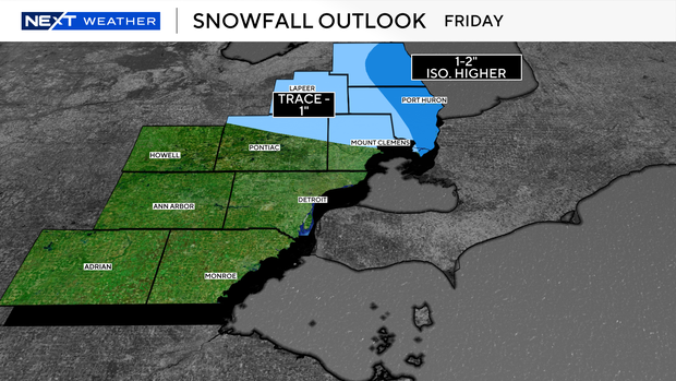
By midday Friday, the warmer air will put a halt to the chances of snow, with the lake-effect bands moving offshore.
Snow amounts are fickle in these scenarios this early in the season; however, we have a good estimate of what to expect.
Along the lakeshore and inland in Sanilac and St. Clair counties, accumulations appear to be near 1-2 inches of slushy snow.
The rest of the area north of M-59 could see a dusting in spots, but more often than not, some scattered non-accumulating snow showers.
Flurries or brief snow showers are possible for the rest of southeast Michigan as the lake-effect bands fizzle out.
Stay with the CBS News Detroit NEXT Weather team for updates as cooler air continues into the weekend.