Thunderstorm chances increase Saturday in Colorado as active monsoon pattern continues

Warmer temperatures will continue across Colorado on Saturday, along with an increased chance for showers and thunderstorms during the afternoon and evening.
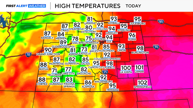
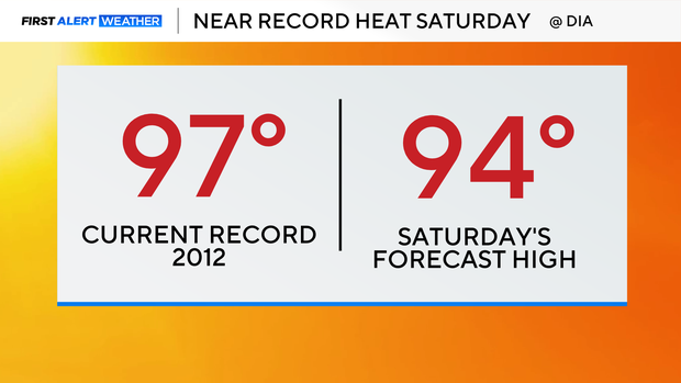
Denver should fall just shy of the record high. The current record is 97 degrees, set in 2012, while the forecast high is 94 degrees.
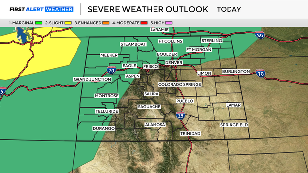
Scattered showers and thunderstorms are expected to develop by early Saturday afternoon and could continue into the evening and early overnight hours. Some storms could produce gusty outflow winds, especially across the Front Range and plains.
The active monsoon pattern will continue into Sunday, although the greatest storm coverage is expected over the mountains and high country during the afternoon. Storm chances will increase again Monday as another disturbance moves through the region.
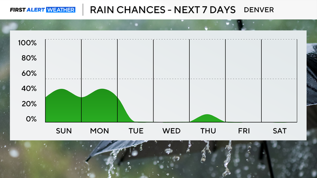
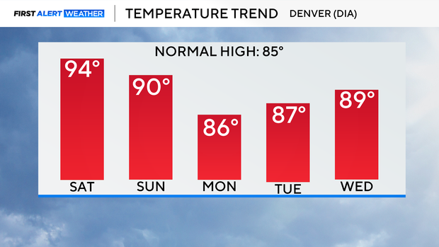
By Tuesday, moisture is expected to decrease, bringing a return to a warmer and drier weather pattern for much of next week. High temperatures across the plains are expected to approach 90 degrees on most days, with a gradual warming trend possible by next weekend.