Winter storm coming to Colorado mountains, more questions come into play for possible snow in lower elevations

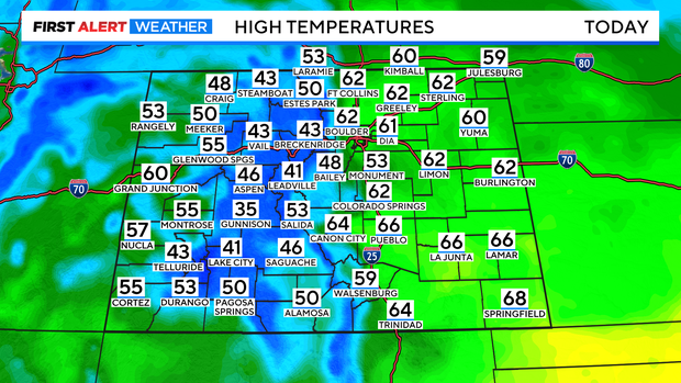
High temperatures on Thursday in Denver will climb into the low 60s, for what could be the fifth day in a row! Sky will remain mostly sunny throughout the afternoon, but by the evening cloud cover will increase ahead of this advancing storm system.
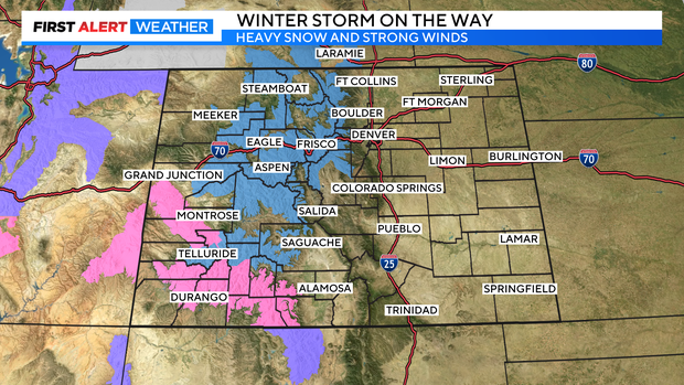
Winter Storm Watches and Warnings are in place for the high country as confidence remains high the mountains will receive heavy snow, and travel will likely be impacted. A large portion of the mountains can expect to receive roughly 10 to 20 inches of snow Friday through Sunday.
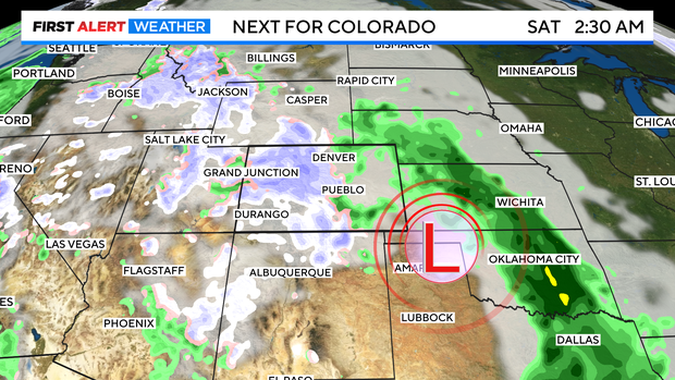
More questions come into play the lower the elevation, which includes the Denver metro area, Front Range, and Plains. This moisture-laden system will bring the precipitation to the high country first, beginning Friday morning. By late day Friday, the Front Range and Plains will likely start to see some light rain.
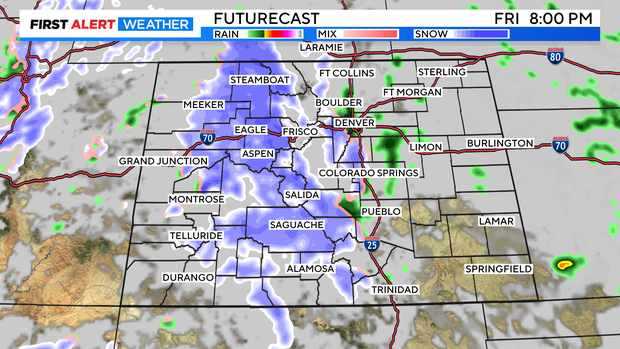
Overnight, if temperatures can dip low enough, that rain will likely transition to a rain/snow mix. What happens on Saturday into Sunday remains rather uncertain. Several factors will determine the ability to pick up measurable snow. First, how much moisture are we able to pull in from the Gulf of Mexico, and will there be a dry slot within this system that would result in less moisture in some areas? If there is a dry slot, where will it occur?
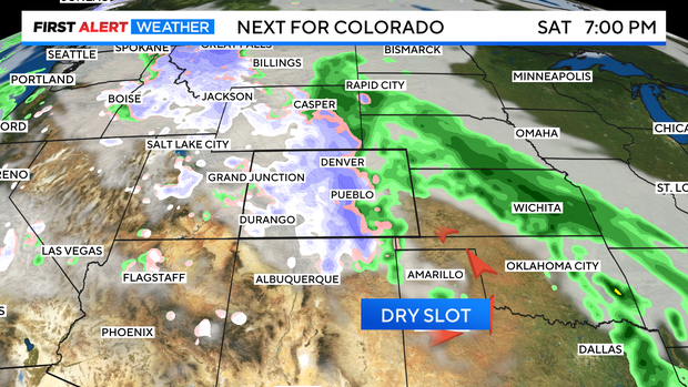
There is also the potential to see some heavier snow banding in this system if temperatures drop low enough, and there is sufficient moisture. This could result in significantly higher totals. The potential is still there for a heavier snow event if enough moisture is pulled in from the Gulf of Mexico, and if temperatures can drop low enough to support that turning into snow.
Snow totals will likely be higher above 6,000 ft. The foothills and the Palmer Divide can expect to see more accumulating snowfall through the weekend. Right now, the plains look to remain on the rain side of this storm system, with totals in the Denver metro and along the 125 Corridor coming into question. As of Thursday morning, it appears roughly 3-5" are possible into the metro and Front Range through the weekend, with most of that falling Saturday night into Sunday morning, if temperatures are cold enough. But this is all subject to change.
This will be a forecast to watch as the weekend approaches, and as it unfolds with several scenarios possible.


