Heavy snow possible in Colorado's mountains, things could get slick for Friday afternoon's commute
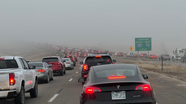
Dense fog developed overnight for parts of the Denver metro area and Colorado's Front Range, resulting in low visibility Thursday morning. A Dense Fog Advisory was in place until 10 a.m. for the Denver metro area and parts of Northern Colorado.
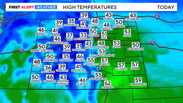
Partly cloudy skies took over after that as high temperatures are set to climb into the low 50s for the final time this work week.
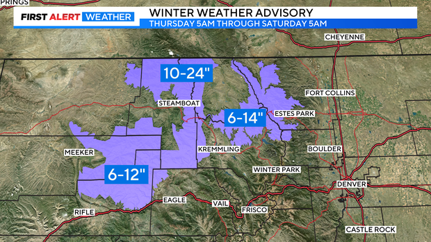
Snow will build into the high country throughout the day Thursday as Winter Weather Advisories go into place, and remain in effect through early Saturday morning. Some mountain areas could receive 6-12" of snow during this time, with Rabbit Ears Pass possibly receiving up to as much as 2 ft. On top of the heavy snow possible, the wind speeds will also pick up, gusting around 55 mph through this evening.
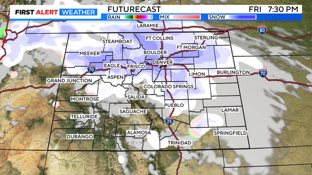
An advancing cold front will begin to make its presence known Friday afternoon, as high temperatures only climb into the upper 30s, and low 40s. Along with colder temperatures more snow is expected Friday afternoon into the mountains, expanding to the lower elevations by Friday late day. While this system won't pack quite the punch the last weekend storms have, there is a chance for some slick road conditions for the Friday evening commute.
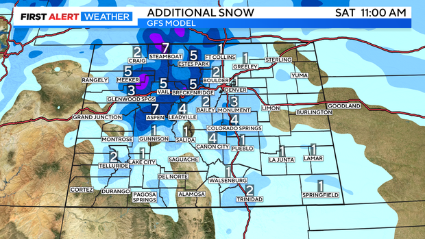
Snow will continue to fall overnight, before gradually clearing early Saturday morning. The Denver metro and Front Range will likely see a trace to 1" of snow Friday into Saturday, with more expected into the Foothills, and near the Palmer Divide.
By Saturday afternoon the sun will come back out, and seasonable temperatures return, kicking off the beginning of a warming trend into next week.