Snow tapers off Friday, but cold air settles in across Colorado

Friday is a First Alert Weather Day, with cold temperatures and slick road conditions likely to impact travel across the Front Range.
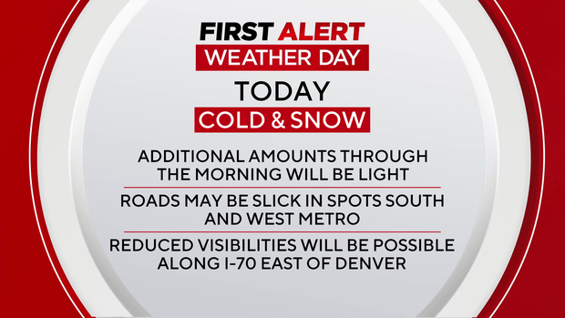
Snow showers will gradually taper off from north to south. Despite improving conditions later Friday, the cold will be slow to leave.
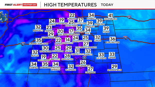
Afternoon temperatures will remain slightly below seasonal averages, and wind chills will stay in the low to mid-20s through the day. The coldest air arrives Friday night, with lows dropping into the low teens across the plains and urban corridor, and even colder readings expected in the foothills and mountain valleys.
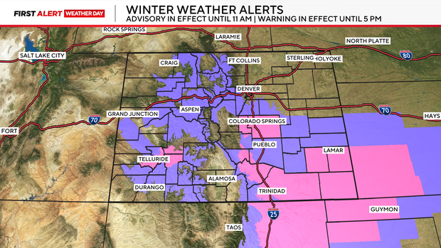
Winter Weather Advisories remain in effect through 11 a.m. for portions of the southern foothills, Palmer Divide, and eastern plains. Gusty northerly winds are also causing areas of patchy blowing snow, especially along and east of I-70, which may briefly reduce visibility. A Winter Storm Warning is in effect through this evening for the Wet Mountains, where they could pick up an additional 2-4 inches of snow.
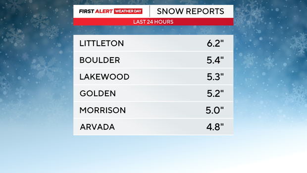
Here's a look at estimated snowfall totals across Colorado from this system:
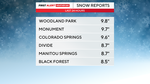
Communities in and around Colorado Springs were among the hardest hit, with higher snowfall totals along the Palmer Divide.
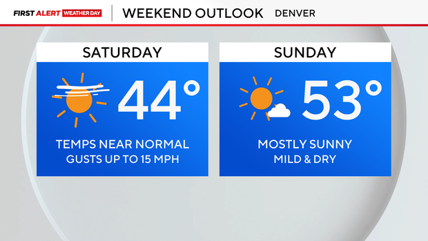
Sunshine returns for the weekend, and temperatures will rebound quickly. Highs climb back toward average Saturday, helping melt much of the fresh snowfall. By Sunday, highs in the 50s are expected across the plains, with some areas potentially reaching the 60s early next week.