Denver Weather: Get Ready For Wind Thursday. A Lot Of Wind!
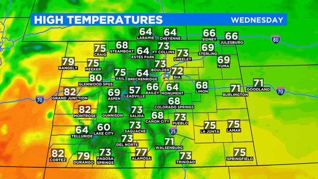
DENVER (CBS4) - Wednesday will be a very pleasant day across most of Colorado. Denver and the Front Range will experience mostly sunny skies, light winds, and highs in the 70s. The weather is set to change on Thursday as a cold front brings very gusty northerly winds.

The front was over Idaho Wednesday morning and it will take about 24 hours before reaching Colorado's urban corridor Thursday morning. Before the front arrives, temperatures will be above normal across the state and in most cases, at least a couple degrees warmer than it was on Tuesday.
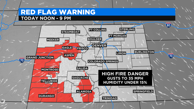
The Western Slope will experience highs in the 80s which will help raise the fire danger. A Red Flag Warning is in effect from Noon until 9 p.m. on Wednesday for cities such as Vail, Glenwood Springs, Grand Junction, Durango, and Alamosa.
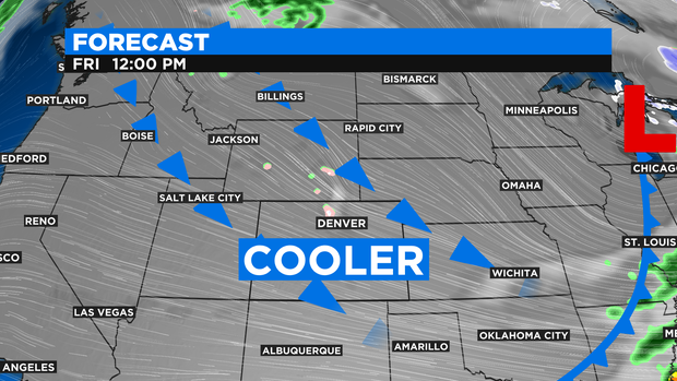
Once the cold front passes Thursday morning, northerly winds will gust to at least 40 mph in the Denver metro area for much of the day. The front will also bring cooler weather with highs in the 60s around Denver, Boulder, and Fort Collins.
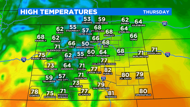
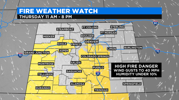
The temperature map for Thursday is a bit deceiving because although temperatures should climb through the 60s in the afternoon, the northerly wind will make it feel cooler. The wind will also help to increase the fire danger especially for areas along the Palmer Divide. Most of Douglas County, Elbert County, and the higher terrain of Jefferson County are under a Fire Weather Watch for Thursday from 11 a.m. until 8 p.m.
Then as cooler air behind the front continue to invade Colorado into Thursday night, temperatures will become quite chilly with the possibility of freezing temperatures across most of the metro area. A hard freeze (28 degrees or colder) is not expected.
For the weekend, the weather turns mainly quiet with highs in the 60s both Saturday and Sunday. It could be breezy at times for Mother's Day on Sunday.