Storm system targets Colorado Thursday with rain on the plains, snow in the mountains

A busy stretch of November weather is setting up across Colorado, bringing a mix of rain, mountain snow and cooler temperatures as we head toward Thanksgiving.
Front Range Mountains & Foothills:
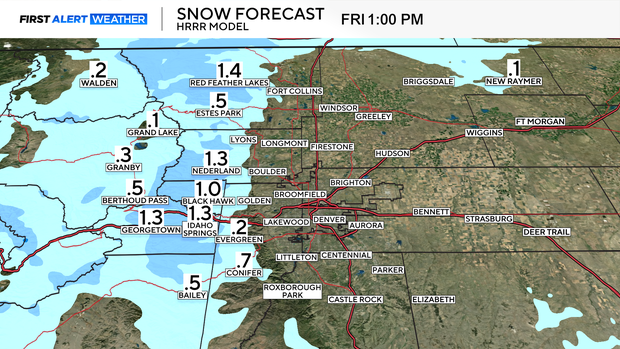
Light accumulating snow is likely Thursday into early Friday, with of 1–6 inches of accumulation expected across the Front Range Mountains.
Denver Metro & Eastern Plains:
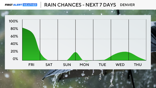
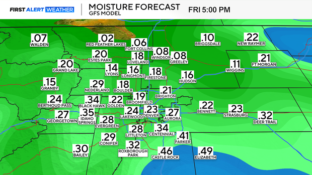
Rain will be the bigger story east of I-25. Widespread showers develop late Thursday and continue through early Friday. Some locations in far eastern and northeastern Colorado could pick up up to an inch of rainfall, depending on how the storm system strengthens as it moves across the region.
Snowfall is possible above 6,500 feet with portions of the foothills and Palmer Divide seeing light accumulation.
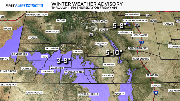
The heaviest snow is expected across the San Juan, Sangre de Cristo Mountains, La Sal, and Abajo Mountains where a Winter Weather Advisory is in place. Expect slick travel conditions Thursday night and Friday morning. The Winter Weather Advisory also includes Pikes Peak where 5 to 8 inches of accumulation is expected through early Friday morning.
Another Round of Rain and Mountain Snow Sunday
Once Friday's storm exits, brief clearing arrives Friday night through early Sunday. But another cut-off low pressure center is expected to move into the region late Sunday, bringing a second chance for rain on the plains and light snow in the mountains and foothills.
Thanksgiving Week: Cooler With Light Snow Chances
A cooling trend is on the way for Thanksgiving week as northwesterly flow develops. Temperatures will fall below normal, and there are several chances for very light snow during the latter half of the week.