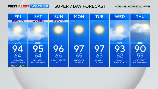
Hot thru the weekend with a few welcome t-storms
Here comes the weekend and here comes more heat! Our August heatwave is not going anywhere, anytime soon. There is on change for Friday. The monsoon flow is shifting a few 100 miles east. This will bring in a better chance for thunderstorms and rain over the mountains and eastern plains.
Lets start with temperatures and take you thru the weekend. Friday's highs will be in the 90s over the Denver metro area.
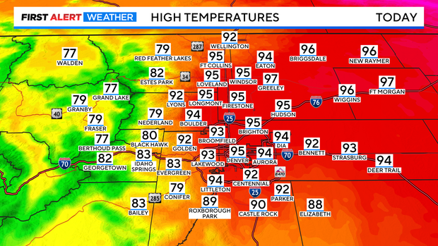
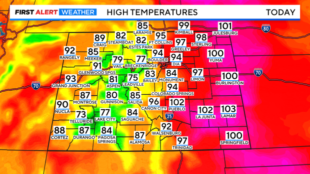
Further east and south into the plains the 90s will be mixed with a few 100 degree highs! Places like Julesburg, Burlington, Pueblo, La Junta, Lamar down into the southeastern Colorado corner.
High pressure has shifted into Texas opening the door for a little more monsoon moisture into the central Rockies. As a result we will see scattered thunderstorms in the mountains by early afternoon.
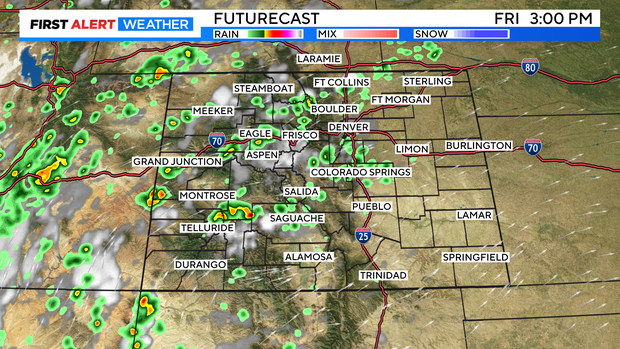
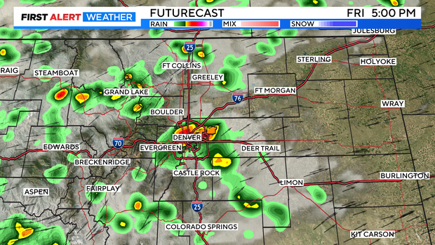
Over Denver and the Front Range the storms should fire up between 3pm and 4pm. This storms will have lots of water with them. Some of the rain showers that develop could be heavy. I am not expecting severe weather with hail but, the pockets of heavy rain definitely may slow down the afternoon drive.
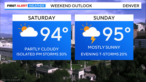
Over the weekend the heat remains along with a chance for isolated storms on Saturday afternoon and a drier day on Sunday with a slight chance for an evening shower.
Next week should start off dry and super high with highs in the upper 90s for Monday and Tuesday.