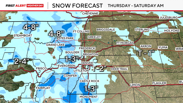
Heavy high country snow in Colorado's mountains with lighter totals moving into Denver Friday evening

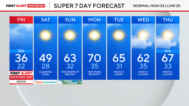
A big warm-up is on the way across Colorado, but before that, more snow will move across the state to end the work week.
A burst of snow was falling after dark on Friday from Highlands Ranch down to Castle Rock. Douglas County was on accident alert as a result of the snowy road conditions.
The First Alert Weather Team called a First Alert Weather Day for Friday because of the heavy snow in the high country and the lighter totals expected in the Denver metro area.
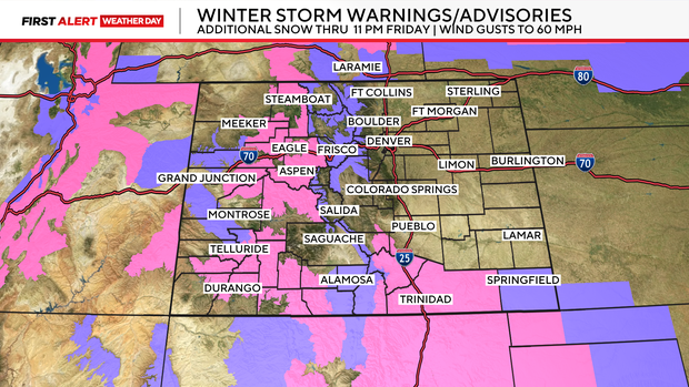
Winter Weather Advisories and Winter Storm Warnings will remain in place for the mountains through 11 p.m. on Friday as more snow and wind are expected. There are also Avalanche Warnings in place for some mountain areas. With the onset of heavy snow, avalanche danger will remain high.
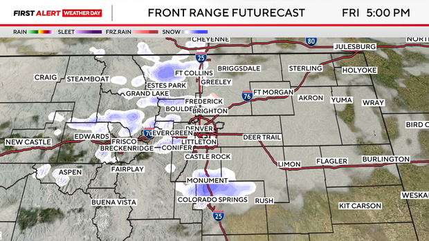
Steady snow will continue in the high country, while lighter flakes fall for the lower elevations. There may be a few off-and-on flurries throughout the day, but by the evening commute time, there is a better chance for the Denver metro area to see some accumulation. Totals for most of the metro will be light, with slightly higher totals expected closer to the foothills and Palmer Divide.
The snow will clear out overnight, and by Saturday a warming trend kicks in. Temperatures throughout the weekend will build, peaking with possible 70s by Monday afternoon.