Colorado Weather: Much cooler and eventually quite wet on Wednesday
Expect clouds and noticeably cooler temperatures Wednesday with rain arriving late in the day for the Front Range. The dramatic change compared to the sunny and hot weather on Monday and Tuesday has prompted a First Alert Weather Day for Colorado.
Rain will initially be across the Western Slope and in the mountains by early Wednesday afternoon. Some of the rain could be heavy at times.
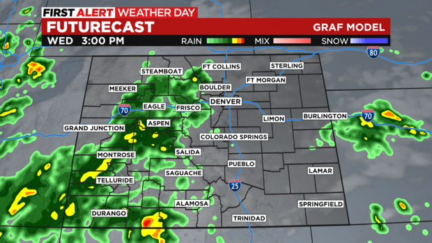
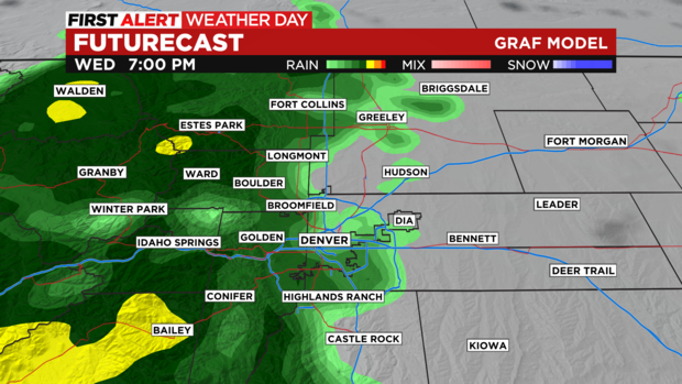
The moisture should then reach Denver and much of the Front Range mostly after 5pm and the chance for rain will reach near 100% during the late evening hours.
With the heaviest and most prolonged rainfall staying in the mountains, the Flood Watch in Colorado is limited to areas along and west of the Continental Divide. Minor street flooding is possible in the Denver metro area Wednesday night but no significant or widespread flooding is expected in town.
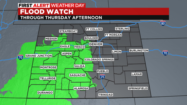
Excessive runoff may result in flooding of rivers, creeks, streams, and other low-lying and flood-prone locations. Burn scars will be especially susceptible to flash flooding including the Williams Fork, Weston Pass, and Grizzly Creek burn areas.
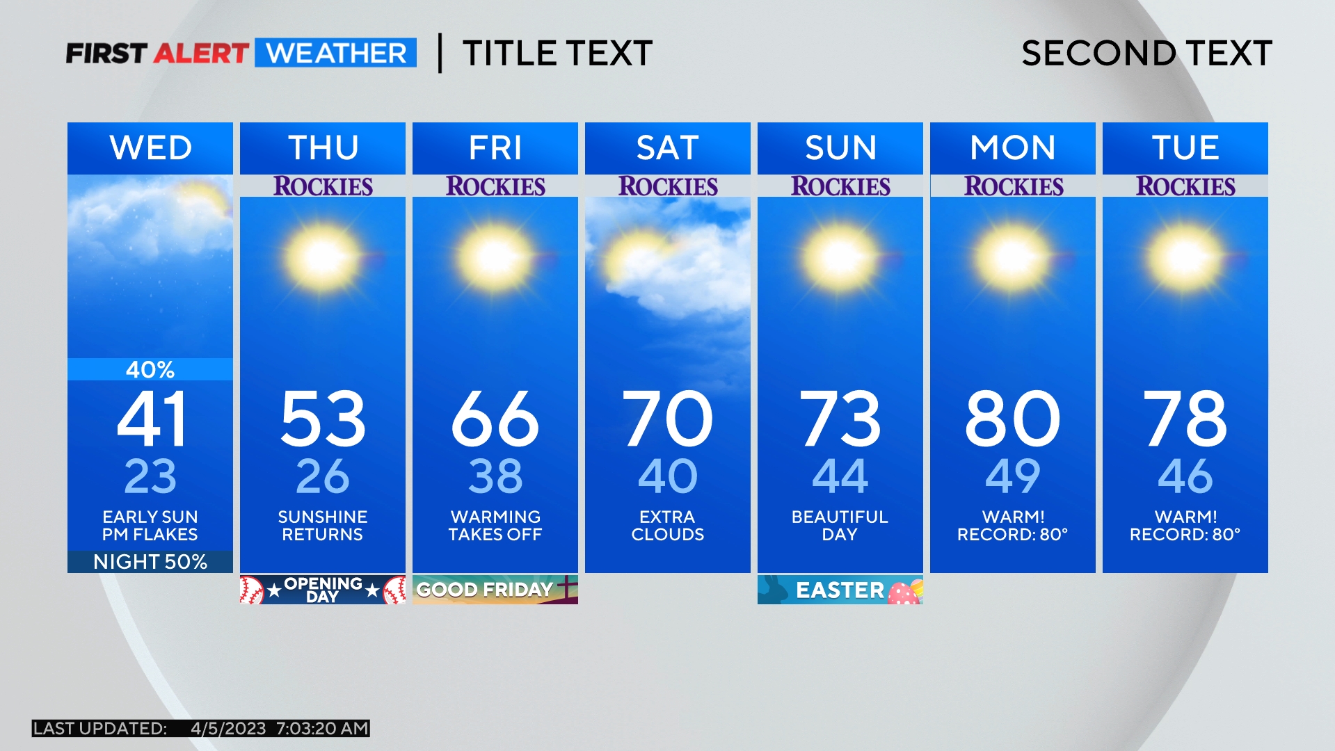
Rain will gradually end across the state on Thursday and the forecast calls for sunny, dry, and warmer weather statewide for Friday and weekend.