Denver's average last freeze is less than two weeks away
A hard freeze is in the forecast for the Front Range Wednesday night and Thursday night but the chance for additional hard freezes will become less likely in coming weeks.
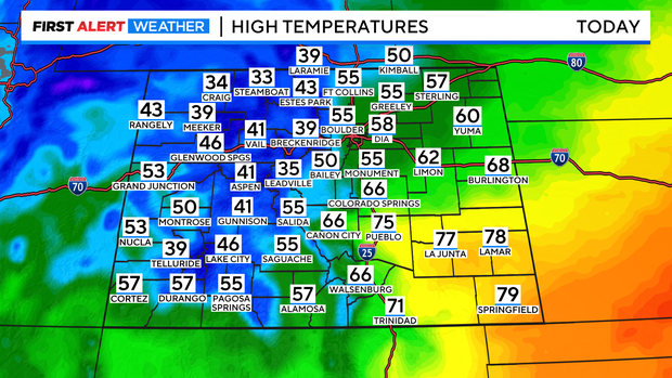
A cold front that raced across Colorado Tuesday night will keep temperatures about 20 degrees cooler on Wednesday compared to Tuesday when Denver reached 78 degrees. It will remain much warmer in southern Colorado where fire weather concerns continue.
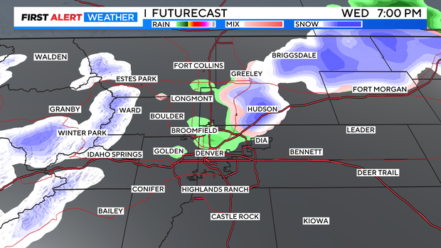
Snow in the mountains on Wednesday will eventually translate into a chance for rain and then snow in the Denver metro area during the evening. Any accumulation at lower elevations will be under 1 inch on the grass.
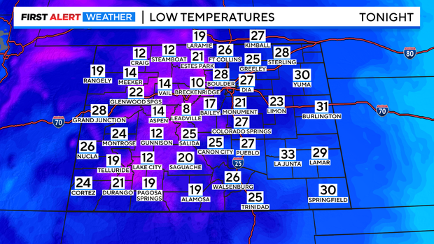
Then attention will shift to unseasonably cold temperatures for Thursday morning. Overnight lows will dip into the single digits for some higher mountain areas like Leadville. Mid and upper 20s are expected around Denver, Boulder, and Fort Collins. A hard freeze in Colorado is defined as 28 degrees or lower which seems likely.
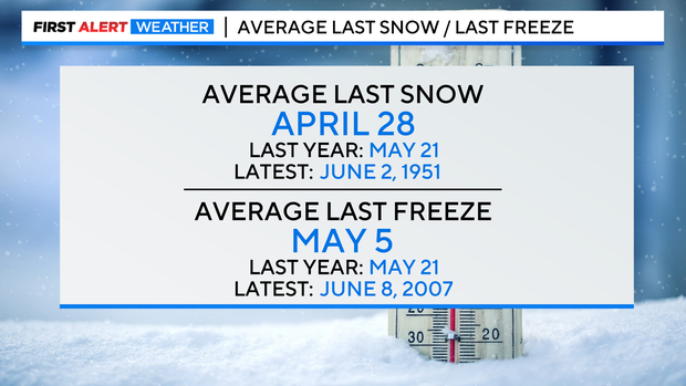
Freezing temperatures along the urban corridor in the second half of April are no uncommon. In fact the average last freeze in Denver is still over a week away on April 28. The final freeze last year was much later on May 21, 2022. The final snow was also on the date last year which is about two weeks later than the average day of May 5.
So while it's not possible to know exactly when the final freeze and final snow will happen this season, the likelihood of either occurring will gradually decrease in the coming weeks. After another hard freeze in the Denver metro area Friday morning, no additional freezing temperatures are in the forecast for at least 7 days.