Denver Weather: Severe Storms Possible East Of I-25 Monday Afternoon
DENVER (CBS4) - Another round of afternoon and early evening thunderstorms are possible on Monday. Similar to Sunday, most storms will not be severe and some neighborhoods will stay dry all day.
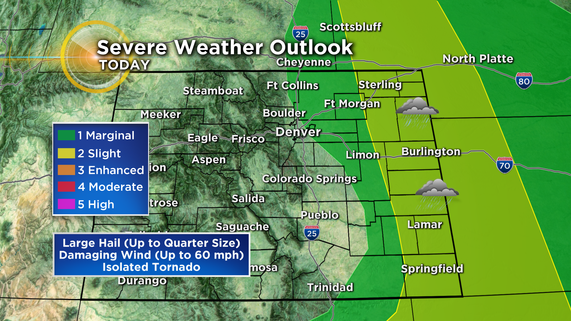
The best chance for thunderstorms around Denver, Boulder, and Fort Collins will be after 1 p.m. and prior to 5 p.m. After this time most of the storms will be on the Eastern Plains of Colorado where they have a better chance of being severe with large hail and/or damaging wind.
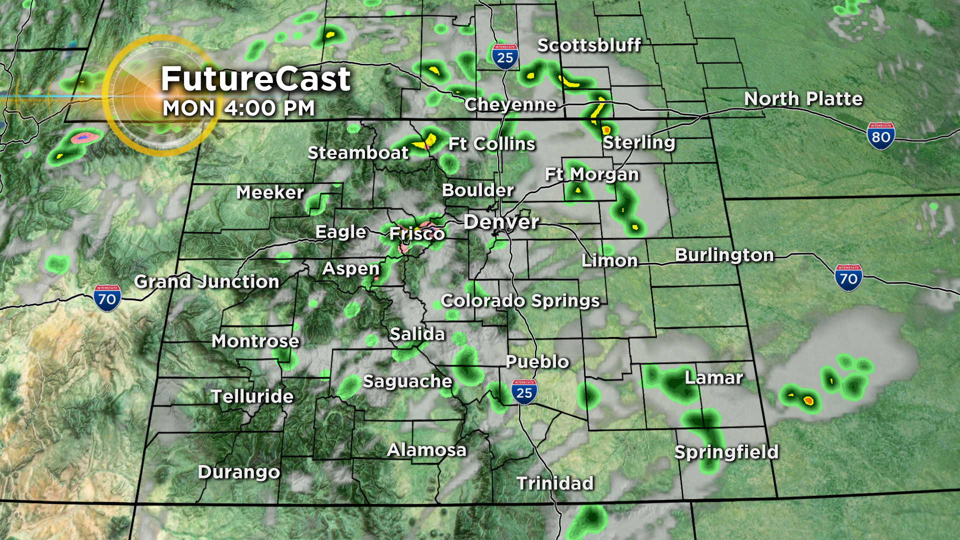
Severe weather is not impossible in the metro area on Monday but the chance is quite small. Any hail from thunderstorms along and west of the I-25 corridor should not be large enough to do significant damage.
Officially the eastern half of the Denver metro area as well as the Fort Collins, Greeley and Fort Morgan areas are under a "marginal" threat for severe weather is level 1 on a scale of 1 to 5. Locations farther east including Sterling, Burlington, and Lamar are under a "slight" risk which is level 2.
In addition to the thunderstorm threat, Monday will be warmer than normal for the first week in June. High temperatures in the Denver area will be in the lower 80s.
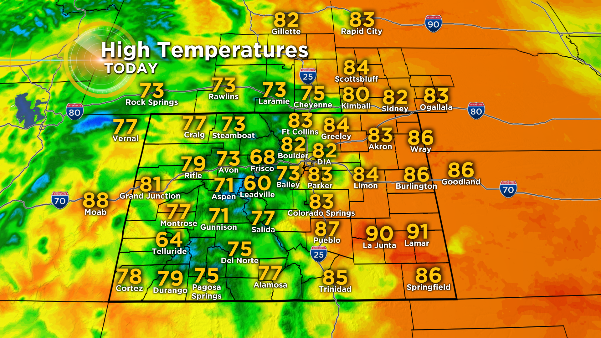
Each day this week should reach the 70s or 80s with the best chance for rain arriving in the afternoon on Wednesday.

PHOTO GALLERY: Severe Weather On June 3