Denver Weather: Incoming Heavy Downpours Prompts First Alert Weather Day
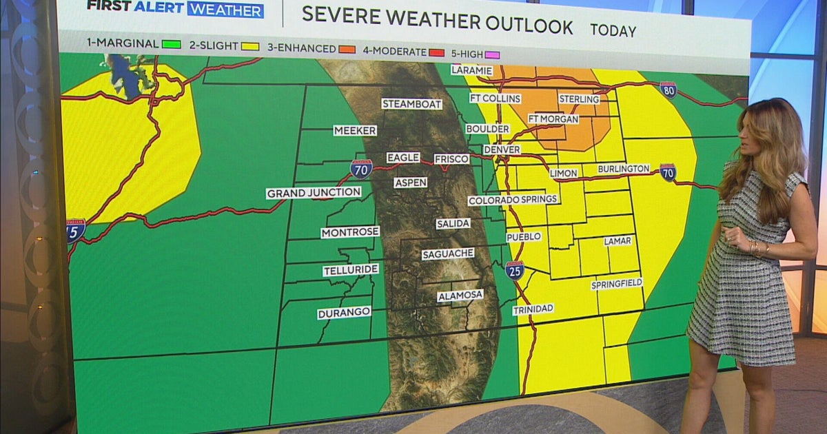
Slow moving thunderstorms will bring the potential for heavy rain and localized flooding to southwest Colorado on Wednesday followed by Denver and the Front Range on Thursday.
The Denver, Boulder, and Fort Collins areas will experience an unusual summer day on Wednesday with showers and thunderstorms generally waiting until after 9pm instead of arriving in the afternoon. Overnight thunder is uncommon in the metro area but it will be possible Wednesday night.
Prior to the rain eventually reaching the urban corridor, southwest Colorado will get hit with heavy downpours during the day on Wednesday. There is a Flood Watch in effect from noon until midnight for cities like Cortez, Durango, Telluride, Lake City, Ouray, and Silverton. Flooding caused by excessive rainfall is possible, especially on fire burn scars and areas with already saturated ground.

The expectation for Thursday is the flood watch will be expanded north into the central and northern mountains of Colorado including the fire burn scars closer to Denver like East Troublesome and Cameron Peak. These scars have at least an "elevated" threat for flash flooding on both Thursday and Friday.

The best chance for rain along the Front Range on Thursday will be the afternoon and evening. Some of the heavy will be heavy at times and street flooding could occur in some areas. Then another good chance for rain will redevelop on Friday followed by smaller chances for showers and thunderstorms on Saturday and Sunday.
Temperatures will also be be significantly cooler almost statewide on Thursday and Friday. Denver will stay in the 70s for the first time since late June. Warmer weather will return for the weekend.