Denver Weather: Cold With Occasional Light Snow Possible Through Tuesday
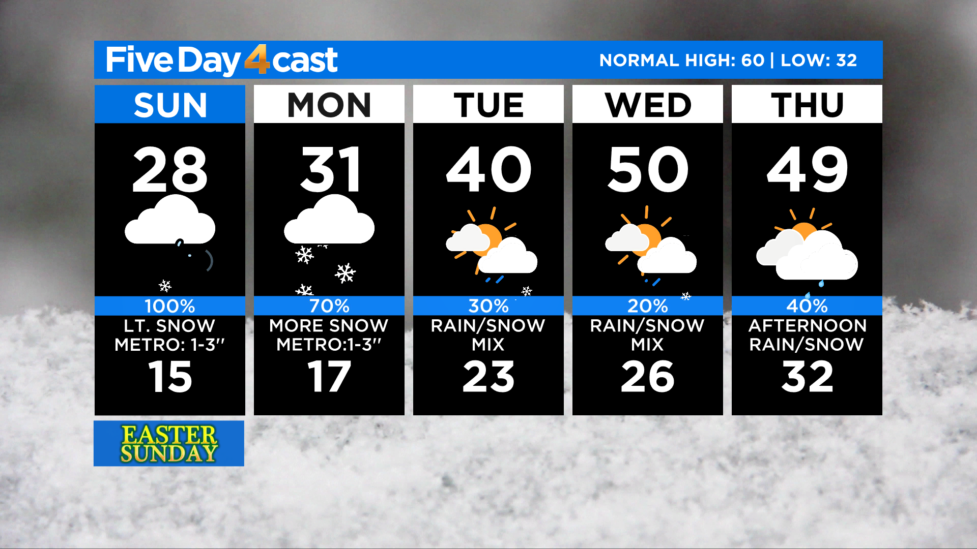
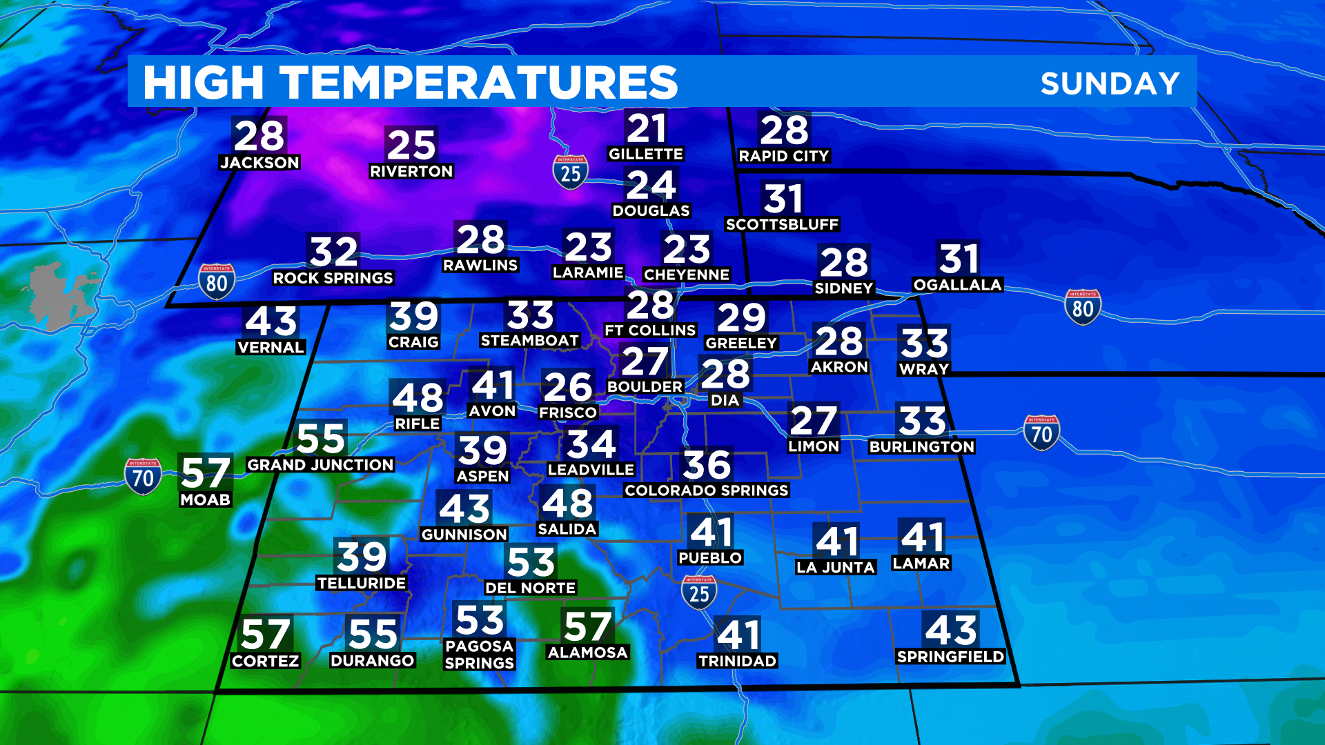
DENVER (CBS4) - After a high of 70 degrees at the airport in Denver on Saturday we'll struggle to hit the mid and upper 20s today. A cold front brought an arctic air mass into the region last night.
The arctic air will moderate over the next few days but we anticipate below normal temperatures to stick around for most of the week ahead. The only part of the state not really feeling this cold air is our far west and southwest counties.
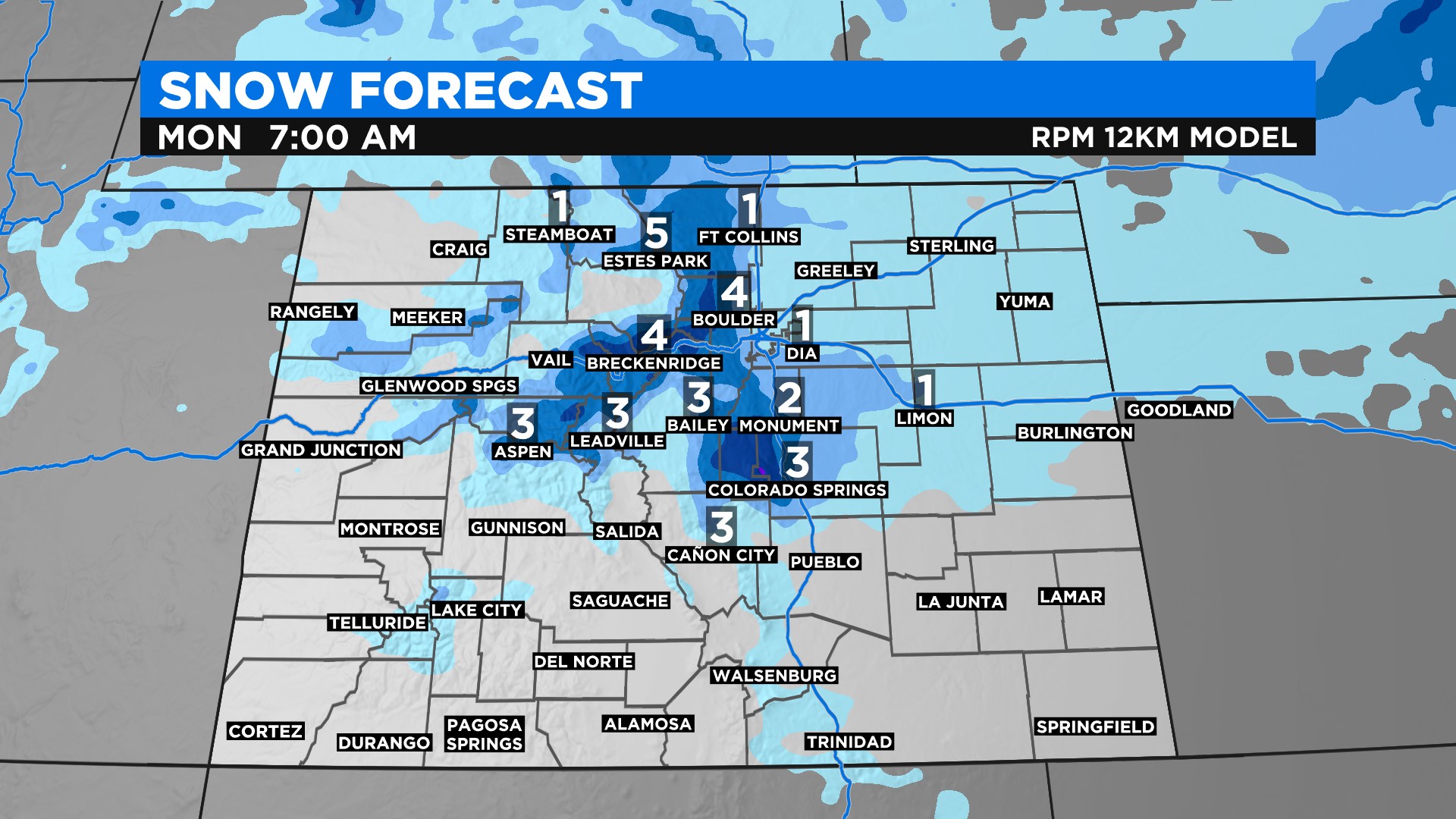
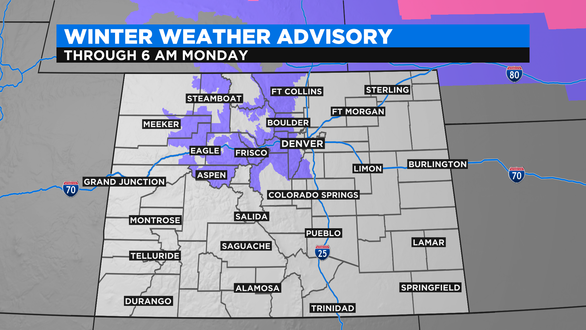
The cold front kicked up a round of snow overnight and early this morning. It should taper off for many areas by this afternoon before another round of snow develops tonight and early tomorrow. Some places in the northern mountains and foothills could stay socked in all day today, which is where we expect to see the highest snow totals.
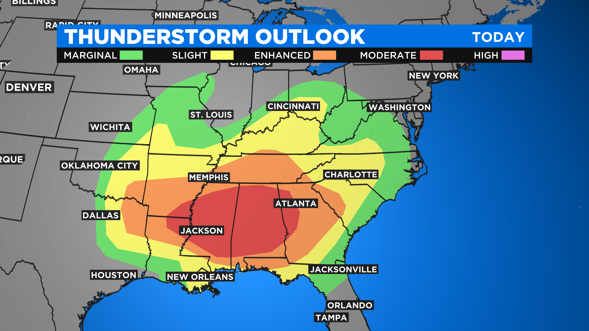
We are on the cold side of this spring storm. On the warm side Easter Sunday could see an outbreak of severe thunderstorms with large hail, damaging wind and even tornadoes. The threat extends from Texas to North Carolina. If you have friends or family in that part of the country you may want to give them a reminder to stay alert to changing conditions.
Looking ahead to Monday afternoon and night it looks like yet another round of snow will move through the region. Some computer models indicate the potential to see a small window of moderate to heavy snow somewhere in or around the Denver metro area. The snow would last into the early part of Tuesday if it materializes.
We are looking at a very unsettled week ahead with below normal temperatures and even more chances for rain and snow as we progress through the week. Warmer weather looks like it will move back into the state for the upcoming weekend and early next week.