Denver Weather: Cold front set to arrive Wednesday evening causing limited snow and intense wind chills
A cold front will reach the Front Range Wednesday evening causing a brief burst of snow and wind gusts up to 40 mph in the metro area. For many areas there will be more wind than snow.
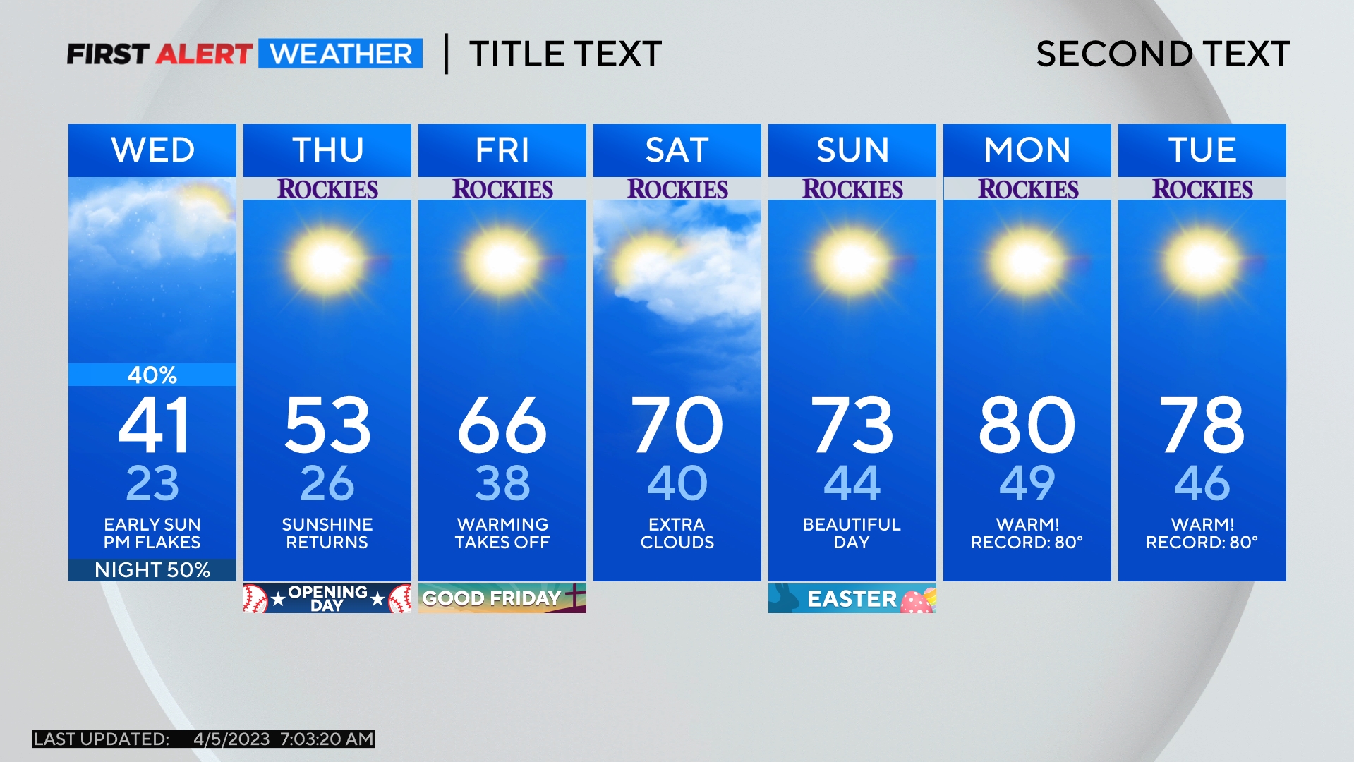
The cold front was in Idaho early Wednesday morning and should move across the Denver, Boulder, and Fort Collins areas between 4-6 p.m. Once the front arrives, chilly northwest winds will quickly develop. Prior to the front, temperatures will be relatively mild with lower 50s along most of the urban corridor. It will be the warmest afternoon of the week in Denver followed by a very chilly evening just a few hours later.
Snow in the metro area will be limited overall but a few bursts of moderate and even heavy snow will be possible mainly between 7-9 p.m. Any accumulation will be under 1 inch in most areas but a few spots along the Palmer Divide in Douglas and Elbert Counties could get up to 2 inches before midnight.
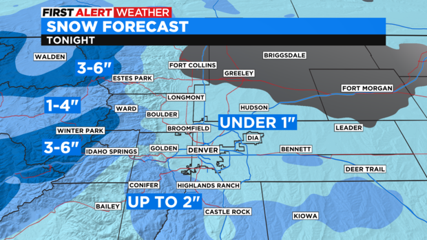
Confidence regarding snow in the mountains is much higher. Most ski areas in Colorado will get 3-6 inches of snow mostly Wednesday night although some additional snow is possible on Thursday. Mountain valley locations like Silverthorne, Frisco, and Dillon will get 1-4 inches.
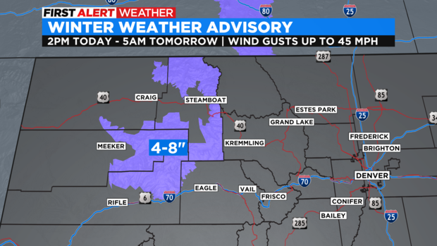
Somewhat higher snow amounts are possible over Colorado's northwest mountains where a Winter Weather Advisory has been posted from 2 p.m. Wednesday until 5 a.m. Thursday for 4-8 inches of snow and wind gusts up to 45 mph. The advisory includes Rabbit Ears Pass, The Flat Tops, the Steamboat Springs area, and the Park Range.
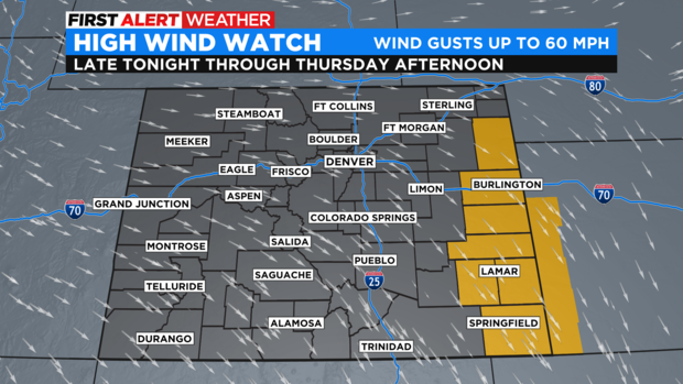
Across the Eastern Plains, it will be mainly dry but very windy. There is a High Wind Watch for late Wednesday night through Thursday afternoon for areas near Kansas and Nebraska. Northwest winds could gust up to 60 mph around Yuma, Burlington, Cheyenne Wells, Lamar, and Springfield.
For Denver and the Front Range, wind gusts up to 40 mph Wednesday night and through the day on Thursday will make wind chill very relevant. Wind chill temperatures in the metro area could easily drop below zero Thursday morning and air temperatures will struggle to reach freezing Thursday afternoon.
Then gradually warmer weather will develop for Friday and Saturday with high temperatures reaching the 40s and 50s for lower elevations.