Denver Weather: Three Cold Rainy Days Ahead, Possibly Turning To Snow Monday Night
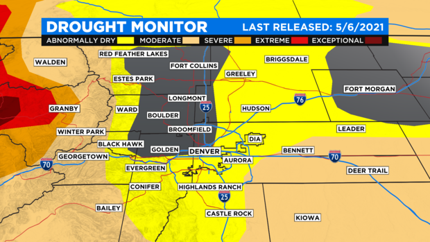
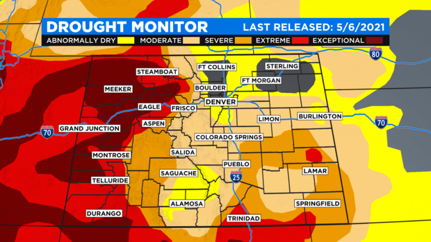
DENVER (CBS4) - After several weeks in a row with cool, soggy storm systems hitting the Front Range we have yet another storm on our hands. This pattern makes it tough to get outside and enjoy the spring season but when it comes to drought it's a beautiful thing.
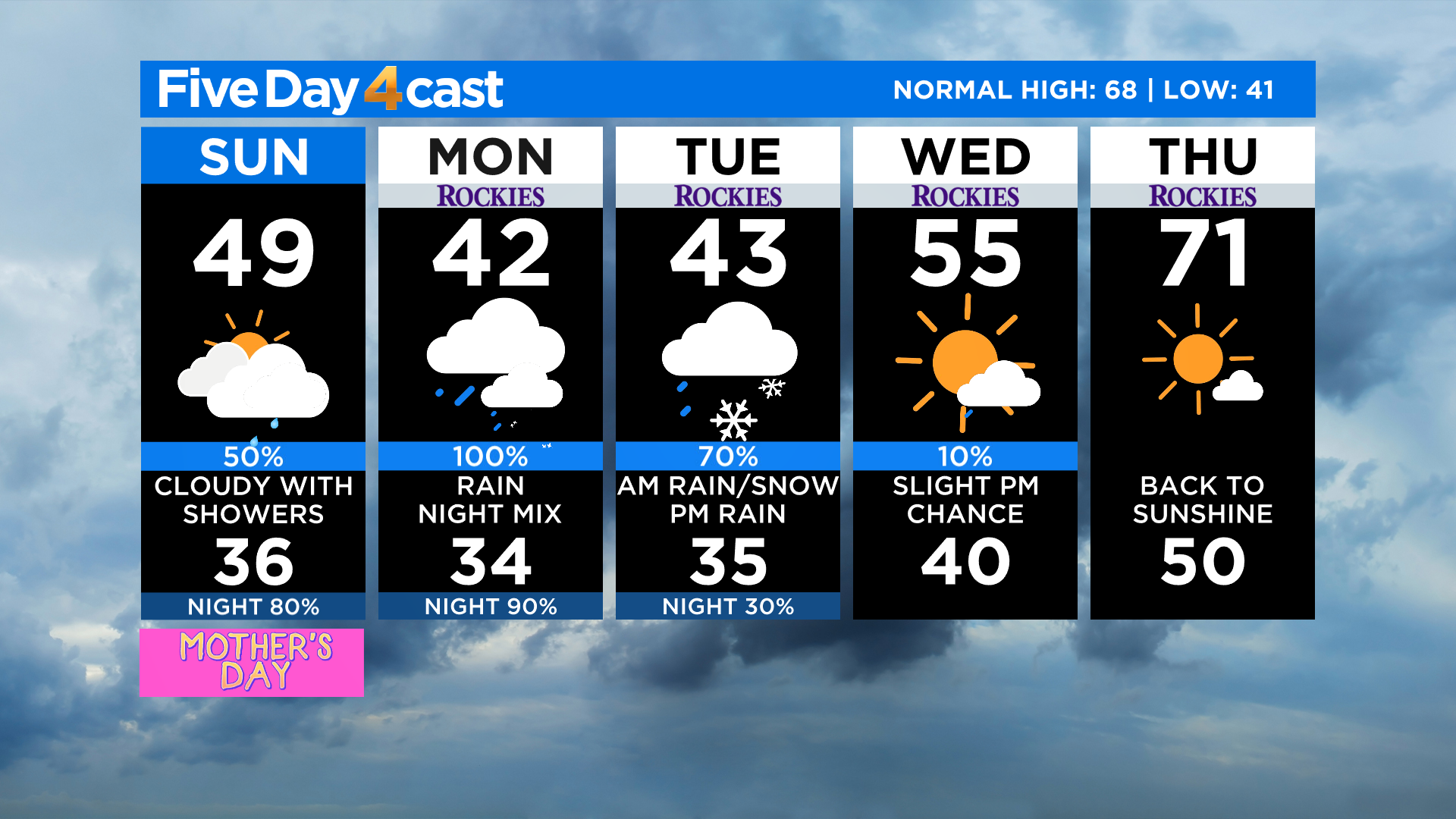
In Denver we're calling for occasional rain with extensive cloud cover for the next three days. Temperatures will be running several degrees below normal for this time of year with daily highs only in the 40s.
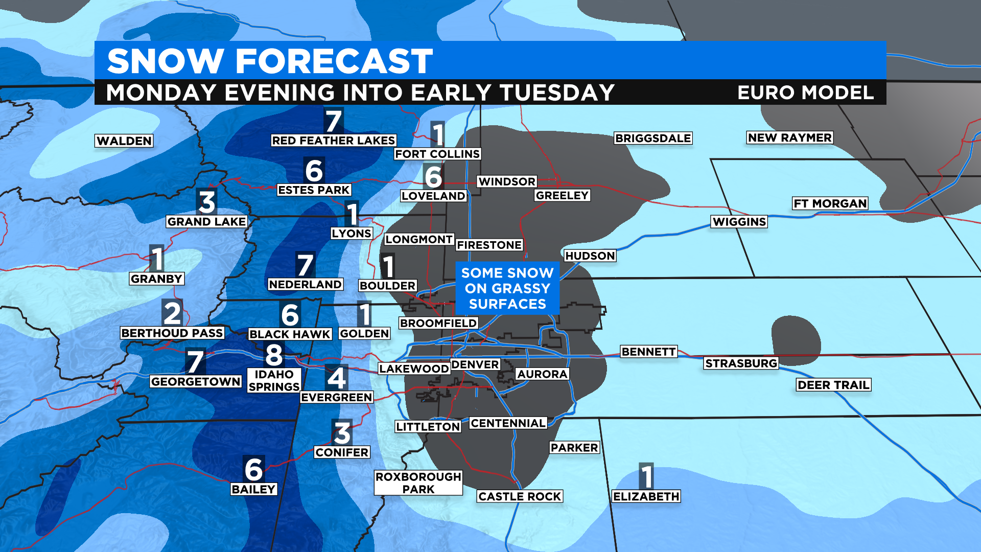
The coldest air associated with this storm system will move into Colorado during the day on Monday with snow levels dropping in the foothills west of Denver by Monday night. There is even potential to see a rain-snow mix or all snow in Denver, along Interstate 25 and on the adjacent plains.

As of this posting at 9 a.m. on Sunday morning we are calling for the potential to see some light snow accumulations for elevations between 4,500 and 7,000 feet Monday night into Tuesday morning. If this happens it will mostly be confined to grassy areas. We do not anticipate any widespread travel issues across the lower elevations but there will be a lot of water on the roads and that means plenty of splashback.
A lot can change with this forecast so we encourage you to watch Meteorologist Dave Aguilera at 5 p.m. and 10 p.m. Sunday for any updates. Meteorologist Ashton Altieri will have additional updates Monday between 4:30 a.m. and 7 a.m. on CBS4 This Morning.
Looking ahead to the middle of the new week a warming and drying trend will take over Colorado's weather pattern starting Wednesday. Temperatures should be back to seasonal levels by the upcoming weekend.