Denver was more humid than Dallas on Tuesday. Find out why the city and other parts of Colorado were so muggy.
Denver and the Front Range definitely felt muggy and humid all day Tuesday. The reason? Increased monsoon flow from the south and a humid cold front from the north teaming up across the Eastern Plains of Colorado.
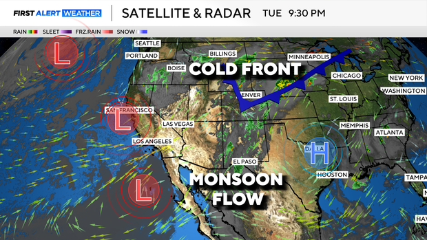
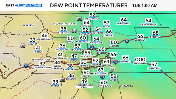
When the cold front pushed in with cooler air and moisture filled air fog formed from Denver International Airport and in many low lying areas. In fact, with the Tuesday morning fog Denver's airport measured 100% relative humidity.
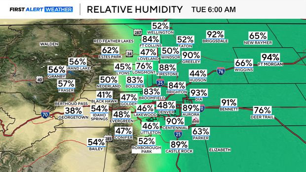
With the cooler temps and moisture in the air, dew point temperatures early in the morning rose to 66 degrees. Dew point is the temperature the air must be cooled to for complete saturation. For Colorado dew point temperatures over 40 degrees are considered high.
At one point on Tuesday morning Denver was more humid than Dallas, Nashville, Chicago, and Oklahoma City because of the higher dew point.
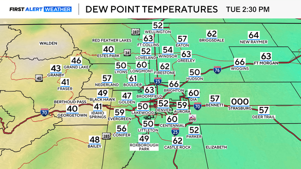
Tuesday the dew point readings were in the upper 50s to low 60s which is extremely high for Colorado and prime moisture for showers and thunderstorms.
The heavy thunderstorms of Tuesday however did not come together over the Denver metro area because one missing ingredient. We had the moisture, we had some lift with cold front but, we didn't get the unstable air from the heating of the day. The solid cloud cover kept Denver's high in the low 80s. Not enough heat to lift storms to severe levels over the Mile High City.
Wednesday's weather ingredients look more promising with more sunshine expected.