Denver Weather: Not as warm on Wednesday but still critical fire danger due to wind
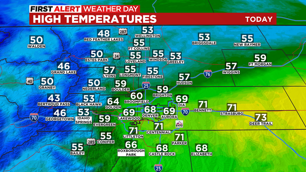
Wednesday will not be as warm as it was on Tuesday but gusty afternoon winds will still drive up the fire danger for most areas east of the mountains including Denver.
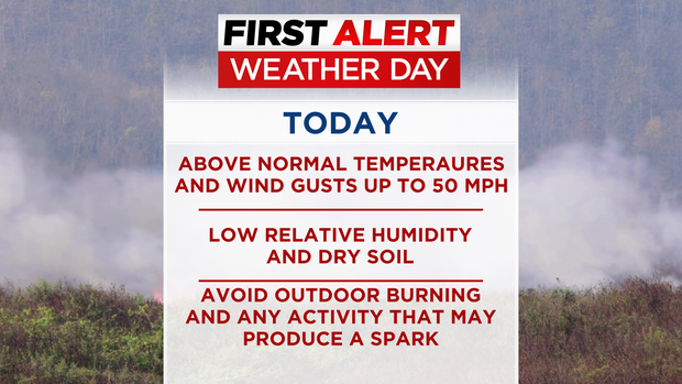
A First Alert Weather Day has been declared through 7 p.m. because of the critical fire danger. The combination of above normal temperatures, wind gusts up to 50 mph, low relative humidity and dry soil means a wildfire could start and spread rapidly.
Outdoor burning is strongly discouraged on Wednesday and any activity that may produce a spark should be avoided.
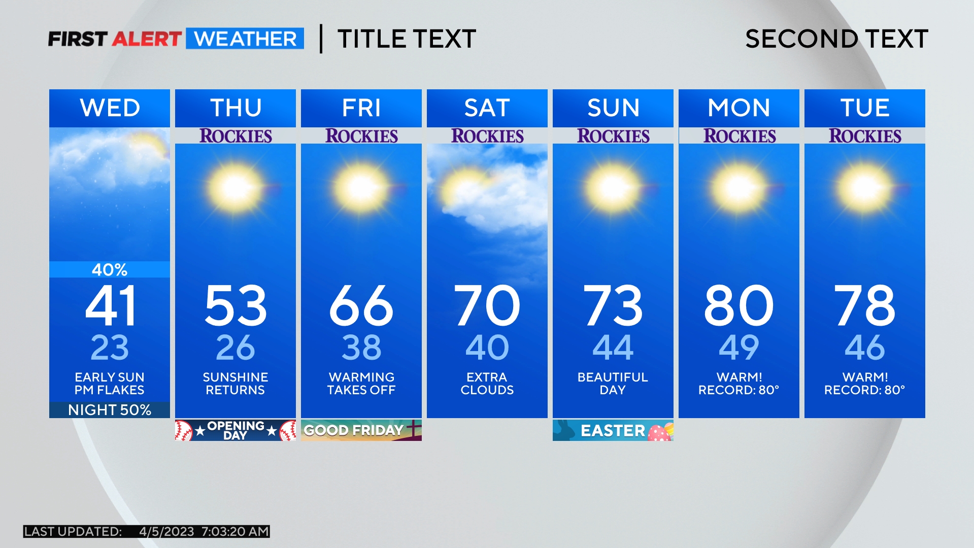
Fire danger is not as high farther north around Boulder, Fort Collins, Loveland, and Greeley where winds should be less and temperatures will be cooler. In fact, most of Boulder, Larimer, and Weld Counties will be at least 10 degrees cooler than Denver Wednesday afternoon.
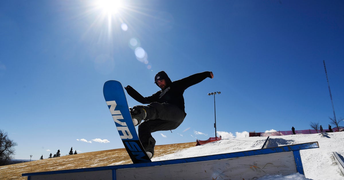
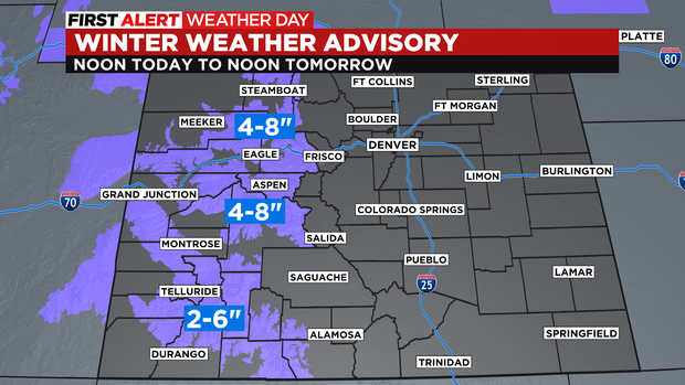
Fire danger also won't be an issue in the mountains where snow will slowly spread from west to east in the afternoon and evening. It could be after 6 p.m. by the time the snow reaches Summit County and accumulation east of Vail Pass should be limited to 1-4 inches.
Farther west, snow totals will be higher around Steamboat Springs, Vail, Aspen, Crested Butte, and Telluride. These areas are under a Winter Weather Advisory until 12 p.m. Thursday for 4-8 inches of snow. The San Juan Mountains will likely get slightly less.
Meanwhile, a strong cold front will pass over Denver and the Front Range Wenesday night but no moisutre is expected. Not even a flurry!
Much cooler weather will settle in on Thursday and below normal temperatures are expected to continue each day for a week or more.