First Alert Weather Day: Tuesday Could Be The Coldest Feb. 22 On Record
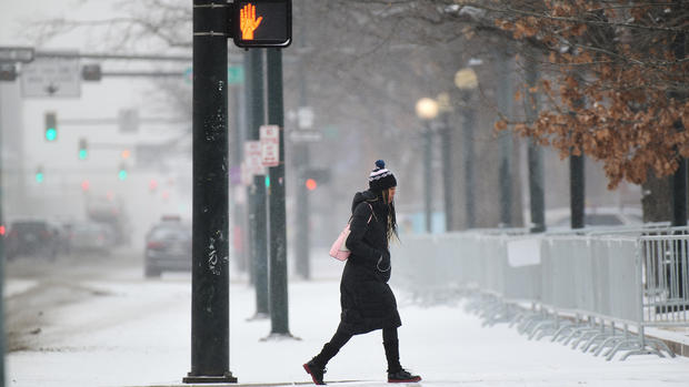
DENVER (CBS4) - The eastern half of Colorado is experiencing weather whiplash this week after temperatures climbed into the 60s and 70s on Sunday and fell below zero early Tuesday morning.
Denver's official weather station recorded a 66 degree drop in 39 hours which tied last place on the list of largest 2-day temperature swings since 1872.
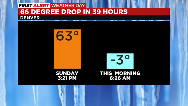
Denver's largest 2-day temperature swing was 76 degrees in 2008 when temperatures fell from 58 degrees on December 12 to -18 degrees on December 14. The following is a list of other 66 degrees swings on record. The date listed is the ending date of the temperature swing.
Jan. 21, 1888 - High 62, Low -4
Jan. 3, 1950 - High 54, Low -12
Jan. 16, 1972 - High 59, Low -7
Jan. 5, 2015 - High 56, Low -10
Feb. 19, 2018 - High 69, Low 3
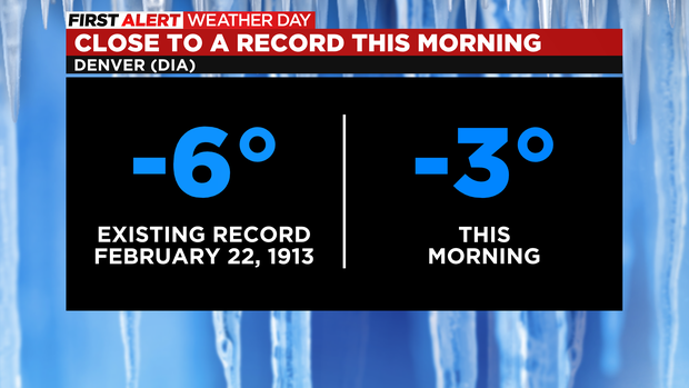
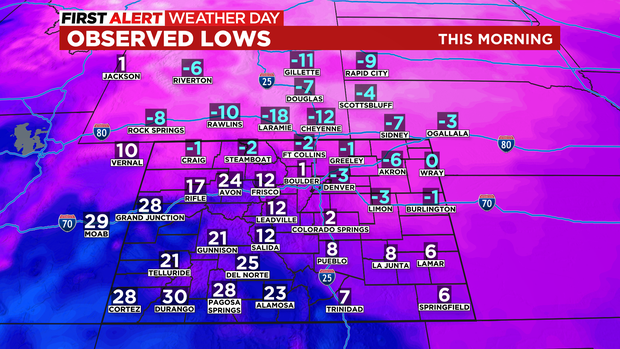
Although the morning temperature in Denver was about 25 degrees colder than normal, it was not cold enough to tie the record low for February 22 which is -6 degrees from 1913.
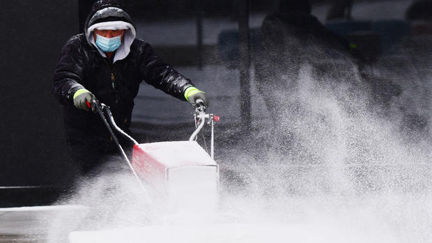
It was even colder on the Eastern Plains Tuesday morning with -6 degrees in Akron for example. And neighborhoods in southeast Wyoming experienced some of the coldest weather in the county. At one point Laramie was -18 degrees.
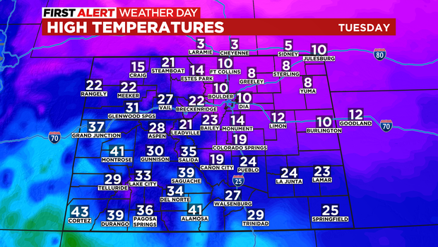
After the frigid start to the day, temperatures will struggle to reach higher than about 10 degrees around Denver, Boulder, and Fort Collins. It will stay even colder on the Eastern Plains with only 8 degrees in Sterling.
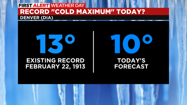
If Denver stays below 13 degrees on Tuesday, the city will break the record for the "coldest maximum" temperature ever recorded on February 22. In other words, it's likely Denver has never stayed so cold on the date.
Looking ahead to Wednesday, it will stay cold enough to justify the CBS4 Weather Team issuing another First Alert Weather Day due to extreme temperatures together with occasional light snow showers.
The most likely time for additional accumulating snow in Denver will be during the Tuesday evening commute. Some areas along the urban corridor could see 1 inch between 4pm-10pm Tuesday. Then more snow is possible on Wednesday and Wednesday night but any additional accumulation should be minor.
It's a different story in the mountains where a Winter Storm Warning continues west of Vail Pass through 11 a.m. Thursday.
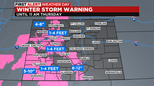
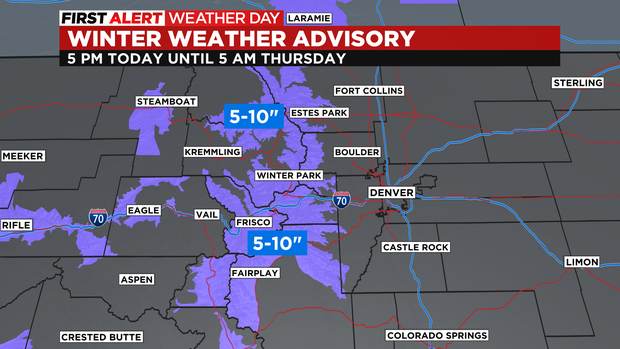
Closer to Denver, there is a Winter Weather Advisory for the mountains of Summit County, the Winter Park area, the Rocky Mountain National Park region, and the I-70 mountain corridor between Georgetown and Copper Mountain for 5 to 10 inches of snow. The heaviest snow in these areas will fall from Tuesday night through Wednesday night.
The final chance for snow in the Denver metro area will be early Thursday morning when flurries will remain possible. Then dry weather will dominate through early next week with a slow warming trend. Denver should finally reach above freezing for the first time in five days on Saturday.