Colorado Weather: Winter Blast Is One Day Away
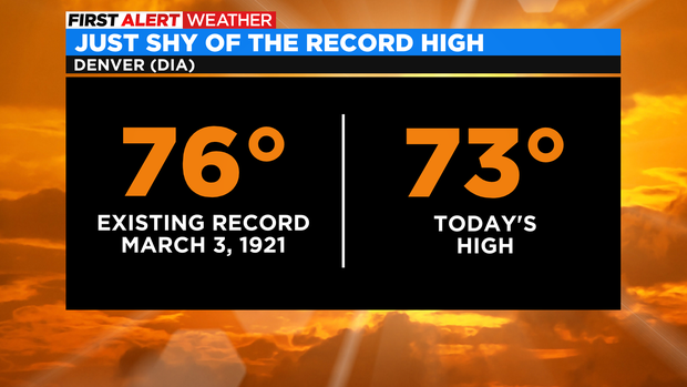
DENVER(CBS)- Our unseasonably warm start to March is still underway! Thursday's high temperature zoomed up to 73 degrees. Very warm for this time of year but, just shy of the record high by 3 degrees.
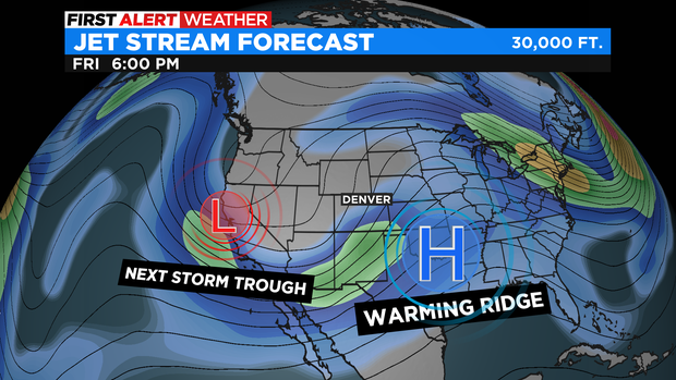
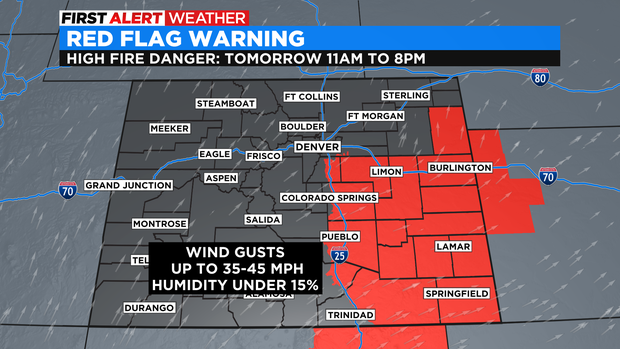
Our warming ridge of high pressure is slowly drifting east of the Rockies. This will allow gusty winds to kick up on Friday keeping mild temperatures locked in for one more day but also, kicking up the Fire Danger for a large part of eastern Colorado on Friday.
With a Red Flag Warning in place including Castle Rock and Parker areas.
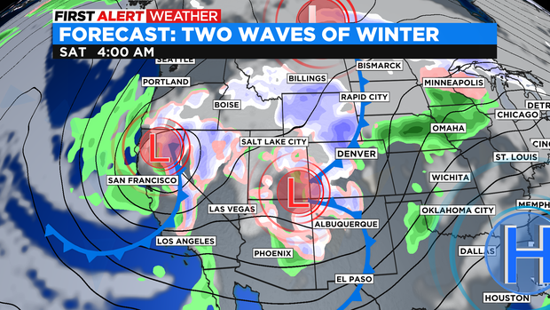
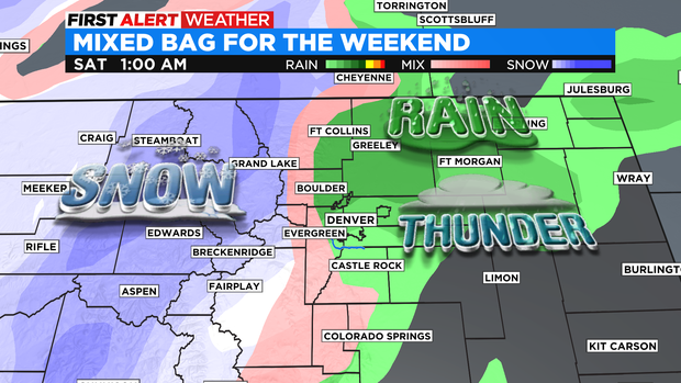
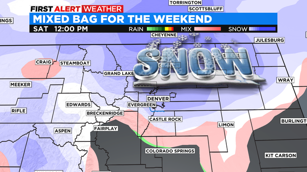
Then we turn our attention to the double storm wave expected over the weekend. The pattern change will bring in snow to the mountains on Friday with rain and snow on the plains overnight Friday into Saturday.
There also, may be a few isolated overnight thunderstorms with the first cold front coming thru before Saturday morning.
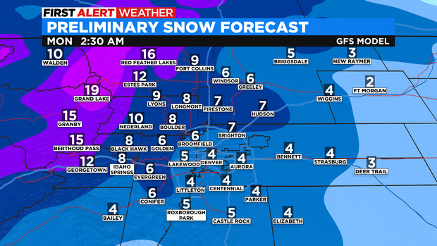
Sunday will be a much colder and moisture packed system and it does look like that will be when more accumulating snow will build up.
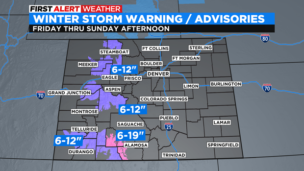
There are already Winter Weather Advisories and Winter Storm Warnings posted for the western mountains where some spots may see a foot-plus of snowfall.
For the Denver metro area Saturday will be very wet with lots of melting with amounts around a trace to 2 inches. Then the second Sunday storm moves in with colder temps and more snow. Getting the metro area up to 2 to 6 total inches by Sunday night and 4 to 8 inches in and near the foothills.