Colorado Weather: More unsettled weather on Monday including high snow in the mountains
Colorado's higher peaks and mountain passes had some snow over the weekend and more is expected on Monday. Meanwhile Denver and the Front Range will experience mostly cloudy skies and a chance for showers and a few rumbles of thunder.
Scattered showers and isolated thunderstorms could develop as early as 1 p.m. and the urban corridor. Most areas will experience nothing more than light rain but the stronger thunderstorms could produce wind gusts up to 40 mph, brief heavy rain, and possibly some small soft hail.
The best chance for rain in the Denver metro area is 4-8 p.m. meaning roads could be wet for the Monday evening commute.
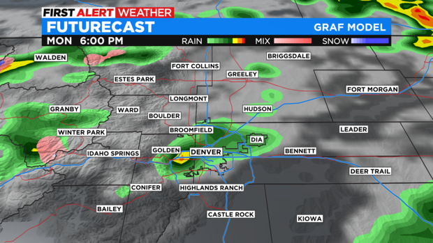
Mountain snow should stay above 10,000 feet and is most likely above 12,000 feet meaning the snow should stay above mountain towns. Slushy accumulation is possible over passes like Loveland, Berthoud, and Vail Pass. The east and west approaches to the Eisenhower Tunnel on I-70 could also become slushy (above Silverthorne and above Silver Plume).
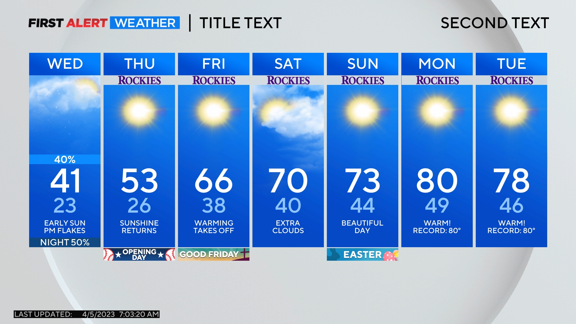
Monday should be the most unsettled day of weather this week although a stronger colder is expected to arrive Thursday night into Friday. Any moisture should be limited but cooler weather will settle in for Friday.