Colorado Weather: Storm system delivers small hail, welcome rain with April thunderstorms
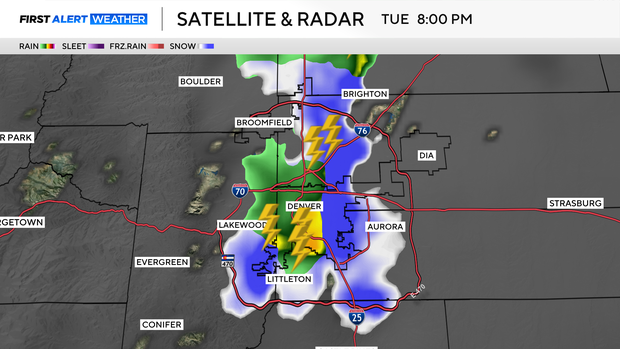
Fast moving showers and thunderstorms helped to lead a second surge of moisture across the state on Tuesday evening. The storms were strong enough to produce small hail over parts of the Denver metro area along with measurable rainfall.
There will be another surge of moisture with colder air overnight that could give some of our metro areas a little dusting of snow on grassy surfaces. With little to no accumulation expected for most. There may be some areas of slick roads over the south Denver metro area down into Castle Rock and over into Aurora for the Wednesday morning commute.
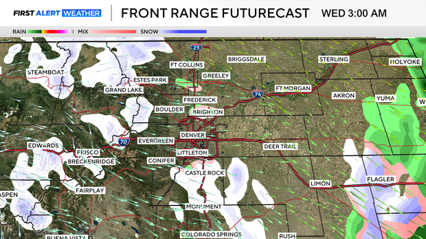
Wednesday will quickly go partly cloudy while we wait for more unsettled weather on Thursday through Saturday.
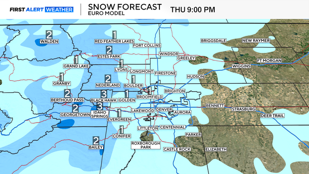
Thursday is a First Alert Weather Day for the chance of snow late in the day into Friday morning. Amounts of this round will be small. With a half inch to an inch expected.
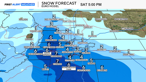
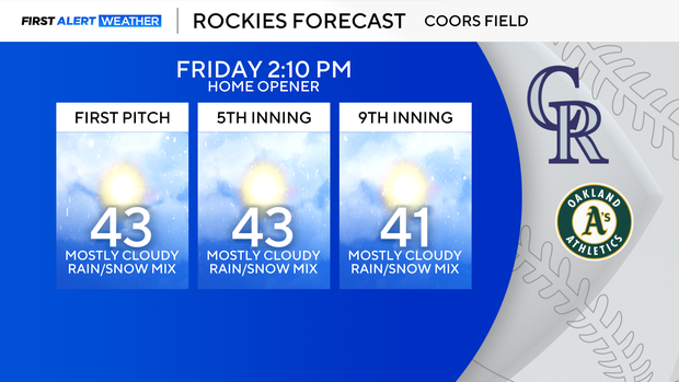
Friday is also a First Alert Weather Day for the Rockies Home opener there will be a chance for rain in the afternoon and significant snowfall developing Friday night into Saturday morning.
Saturday will be snowy and colder. This storm surge is still several days out and specific amounts are likely to change, but, this will give you some idea what to expect in your neighborhood. At this point snow models are indicating the potential for 3 to 6 inches of heavy wet snow in the Denver metro area and higher amounts in and near the foothills.