Colorado Weather: Snow Bogs Down Afternoon Commute And Will Effect Morning Drive
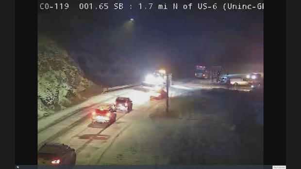
DENVER(CBS)- Wednesday afternoon's blast of snow made for a tough commute for many as roads iced over just before and after sunset.
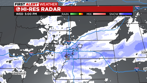
Bands of snow intensified over the Front Range and Palmer Divide with upslope flow from 4pm on into the better part of the evening.
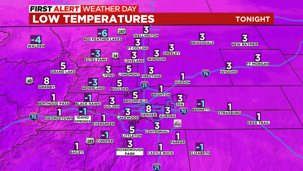
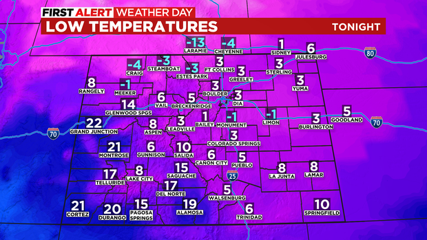
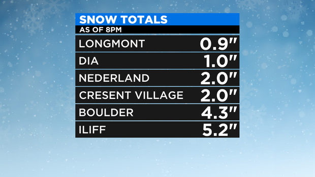
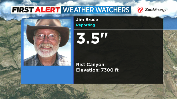
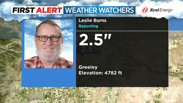
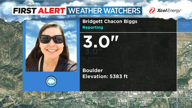
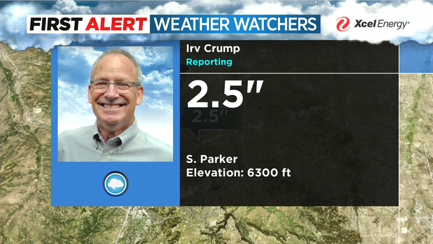
Here are a few of our weather watcher snow measurements as of 8pm Wednesday night. You may have more or less depending upon your location.
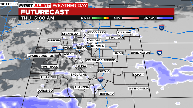
Intensity of snow should weaken after midnight into Thursday. The morning drive will still be a slow one with icy and slick spots holding on along with a few leftover flurries. So the morning drive will need caution with conditions improving by afternoon.
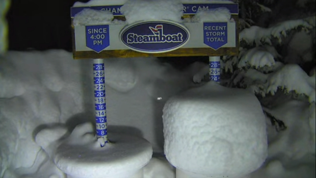
The big kahuna out of this whole storm is the mountains in and around Steamboat Springs coming in with one to almost two feet of snow!
The morning commute for the Denver metro area may be icy and slick along with a few flurries. And while the morning drive will be slow the afternoon rush will be much easier to manage.

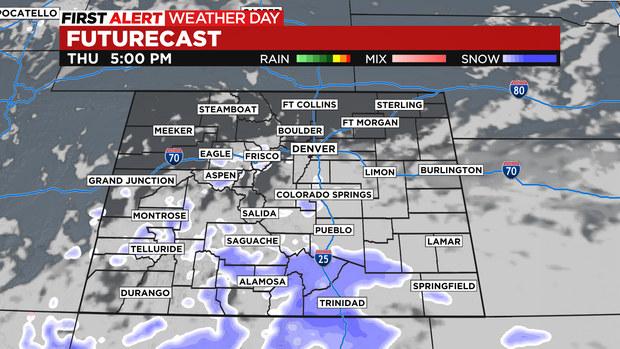
Additional snowfall on top of what has already fallen includes another 1 to 2 inches for the Denver metro area with higher amounts in the mountains and southern Colorado.
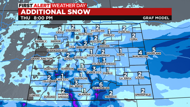
Mountains will have light snow continuing on Thursday off and on before moving out late Thursday.
Along the Front Range clearing should start around noon and gradually begin clearing as the afternoon goes on. The Sangre De Cristo mountains will see a surge of snow late on Thursday with more accumulation occurring.
The other big issue for Thursday morning will be the cold temperatures. Most areas will be in the single digits with below zero wind chills thru the early part of the day.