First Alert Weather Day: Snow And Cold Making A Big Return
DENVER(CBS)- We have two First Alert Weather Days coming our way for Wednesday and Thursday this week. Another strong arctic cold front will work its way into Colorado by Wednesday morning. At the same time a Utah low will help to push moisture from out west into the cold front helping to get the snow machine really going in the Colorado mountains.
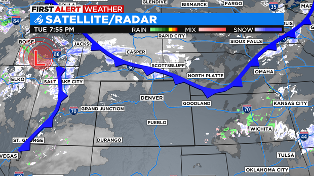
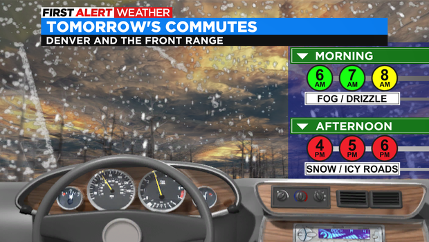
Snow will ramp up in the mountains overnight Tuesday into Wednesday. For the Front Range the Wednesday morning may start with patchy fog and spots of drizzle as the cold front moves in.
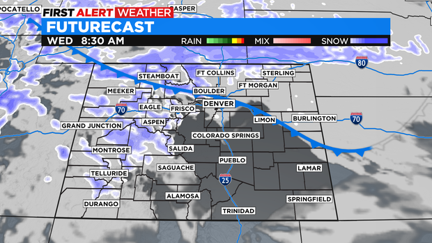
By late morning snow will develop over the Front Range and northeastern plains and intensify by afternoon. The heaviest snow for the Denver metro area will be late afternoon thru Wednesday night.
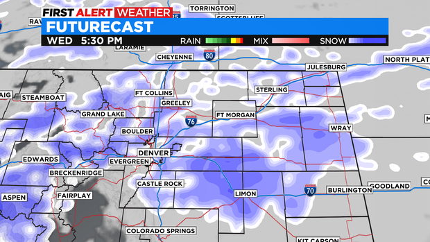
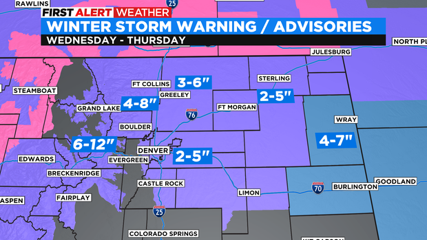
There is a Winter Weather Advisory posted for the Front Range, Denver metro and northeastern plains from 5am Wednesday thru 5am Thursday. Right now it looks like 2 to 5 inches in the Denver metro with more in and near the foothills.
Wednesday morning's commute may have some patchy fog and drizzle. The afternoon commute will be the rough one! With snow sticking to the roads and icy conditions forming up. With the worst conditions close to and after sunset.
Most mountains of the state will be in the neighborhood of 6 to 12 inches of snow. With a lot more in the northwest mountains. Around Rabbit Ears Pass into the Flattops, Elkhead and Park mountains there could be 10 to 24 inches of snow!
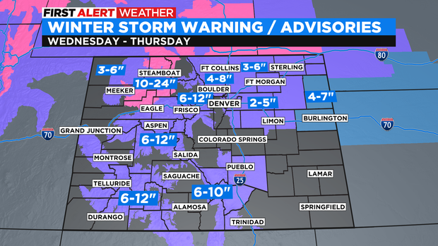
Snow should clear over northern Colorado by Thursday afternoon with more snow at that point falling in the Sangre De Cristo mountains.