Colorado Weather: One Last Round Of Snow Thursday For Central And Southern Colorado
DENVER (CBS4) - We are nearing the end of a very cold March storm system, but not before one last piece of energy crosses the central and southern mountains. It will produce areas of light to moderate snow, mostly during the afternoon and early evening hours on Thursday, which could create some localized travel troubles to the south of Denver. The National Weather Service has issued some winter weather alerts for portions of southern Colorado on Thursday.

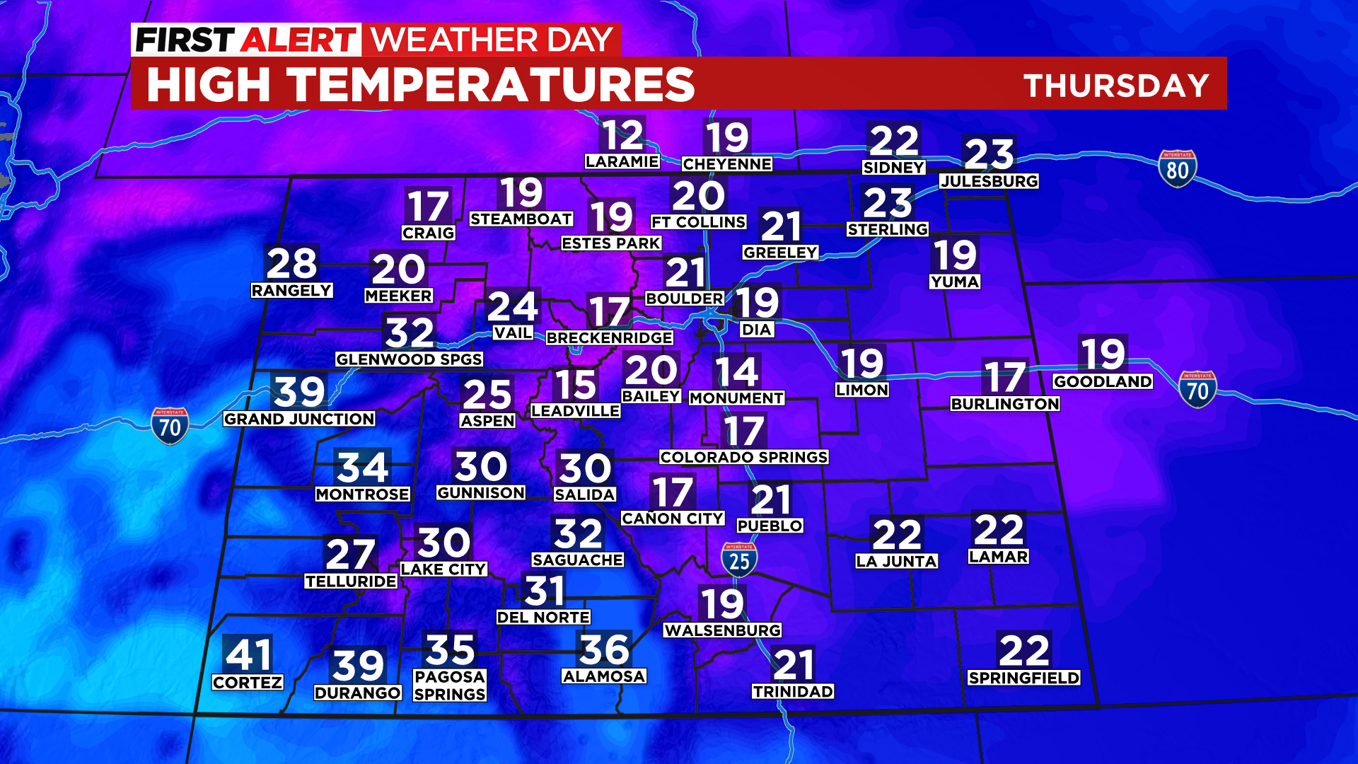
Denver and the Front Range will be on the far northern edge of this weather and therefore it will remain partly to mostly cloudy for the majority of the day. While we can't rule out some occasional flurries or even a few snow showers, most (if not all) of the precipitation should stay south of the city. The best chance to see a little more light snow in the Denver area would be in the foothills west of the city and across the Palmer Divide to the south.
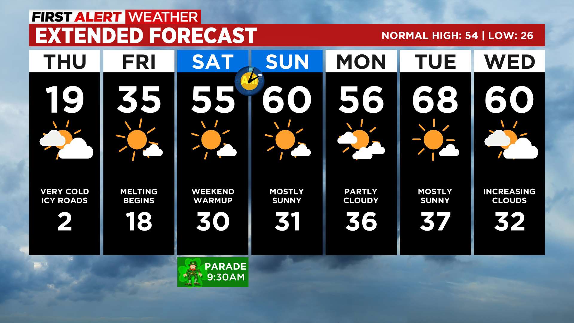
The arctic air mass in place will keep most of Colorado below freezing on Thursday with highs in the teens and 20s. We will see a few 30s and lower 40s in far western and southwest Colorado. Denver should top off somewhere around 20 degrees.
Skies will be mostly sunny by Friday as this storm moves away from the state. Temperatures will rebound with most places climbing back to or above freezing. In Denver we expect a high in the middle 30s.
It will be even warmer over the weekend as 50s and 60s return to Denver and the lower elevations. We'll see 30s and 40s over the weekend in the mountains. Some record highs are possible in a few areas by next Tuesday.