Colorado Weather: Mild temps before final storm of 2022

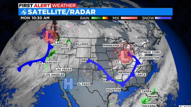
DENVER(CBS)- As we start the week we have lots of high clouds drifting across the Rockies in westerly flow as a high pressure ridge drifts into the area. We are between storm systems with another snow maker getting its act together on the west coast.
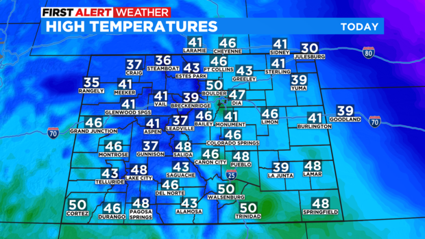
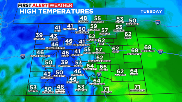
Most of Colorado will be experiencing a mix of clouds and sunshine as Monday goes on. Temperatures over the eastern plains will be above normal for this time of year with the 30s and 40s holding in the mountains and west.
Tuesday will also have have high clouds for the east with snow developing in the mountains with the next storm system. Westerly winds will be strong from the mountains to the plains.
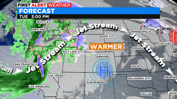
It will be a warming, downslope wind for the Denver metro area boosting temperatures into the low 60s for many in and around the Mile High City.
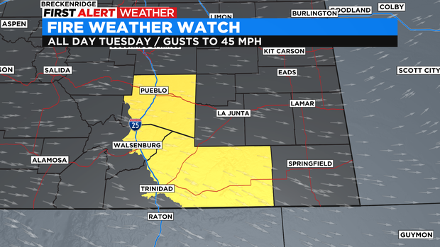
There is a Fire Weather Watch in place for parts of southern Colorado from Pueblo down to Trinidad and out over Las Animas county all day Tuesday. Gusts of wind could get to 45 mph along with 10 to 15 % relative humidity levels.
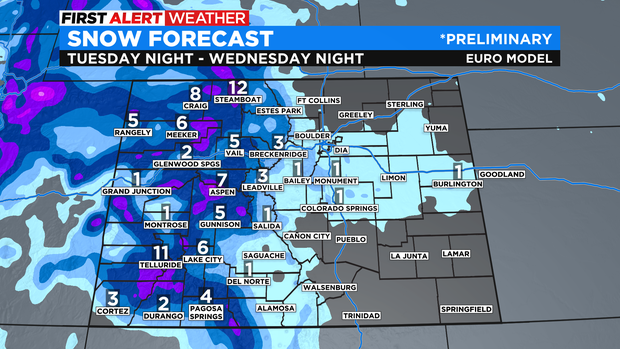
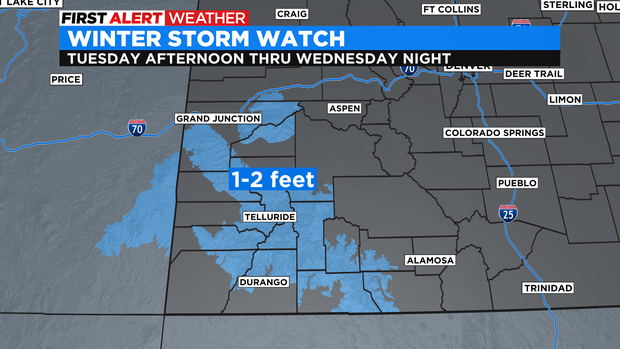
In the mountains snow will increase Tuesday afternoon into Wednesday. A Winter Storm Watch has already been posted for the Grand Mesa and San Juan mountains for the possibility of 1 to 2 feet in some areas!
There will be significant snow in the northern and central mountains as well before the New Year with lighter amounts in and around the Denver metro area.