Colorado Weather: Meltwater From Summer-Like Heat Raising Avalanche Danger
DENVER (CBS4) - As the Denver area soars well into the 80s on Thursday and Friday, many mountain towns will reach the lower 70s and the highest peaks will stay above freezing at night. It will be near record heat in many parts of the state and will cause a rapid increase in melting mountain snow.
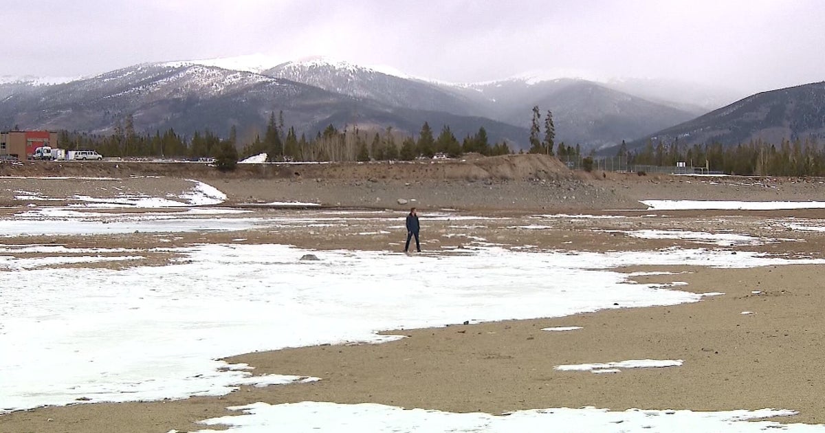
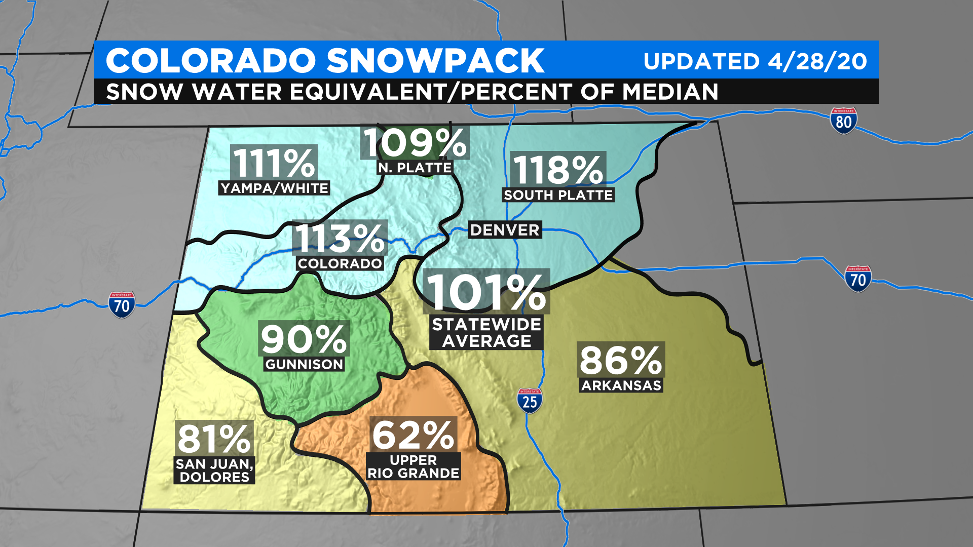
Snowpack remains at or above normal for about half the river basins in Colorado. As of Tuesday afternoon, the statewide average with snowpack was 101% but the South Platte basin which includes the entire Denver metro area was 118% of normal.
As the snow melts in the coming days, rivers like the Colorado and Arkansas will start running higher and faster. And as meltwater infiltrates the snowpack, the threat for avalanches will remain elevated. According to the Colorado Avalanche Information Center, "considerable" danger is expected to continue through at least Friday.
Fortunately, thanks to both limited travel because of the coronavirus pandemic and the fewer people in the backcountry because of the soggy snow, the danger will be somewhat mitigated.
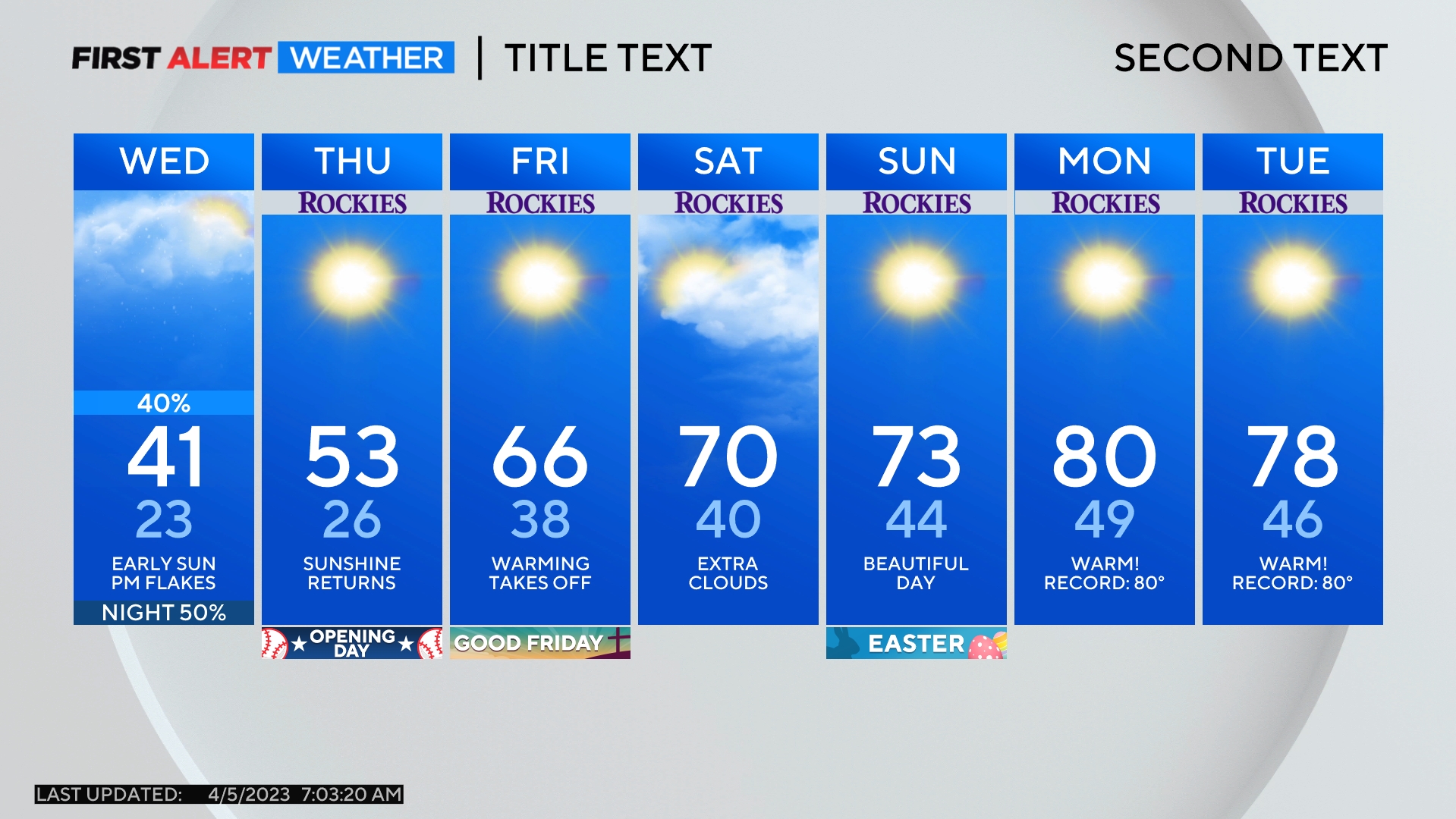
The warmest (or hottest!) weather will be on Thursday afternoon when the Denver, Boulder, and Fort Collins areas should reach the upper 80s. The record in Denver is 90 degrees set on April 30, 1992. For now that record appears safe.
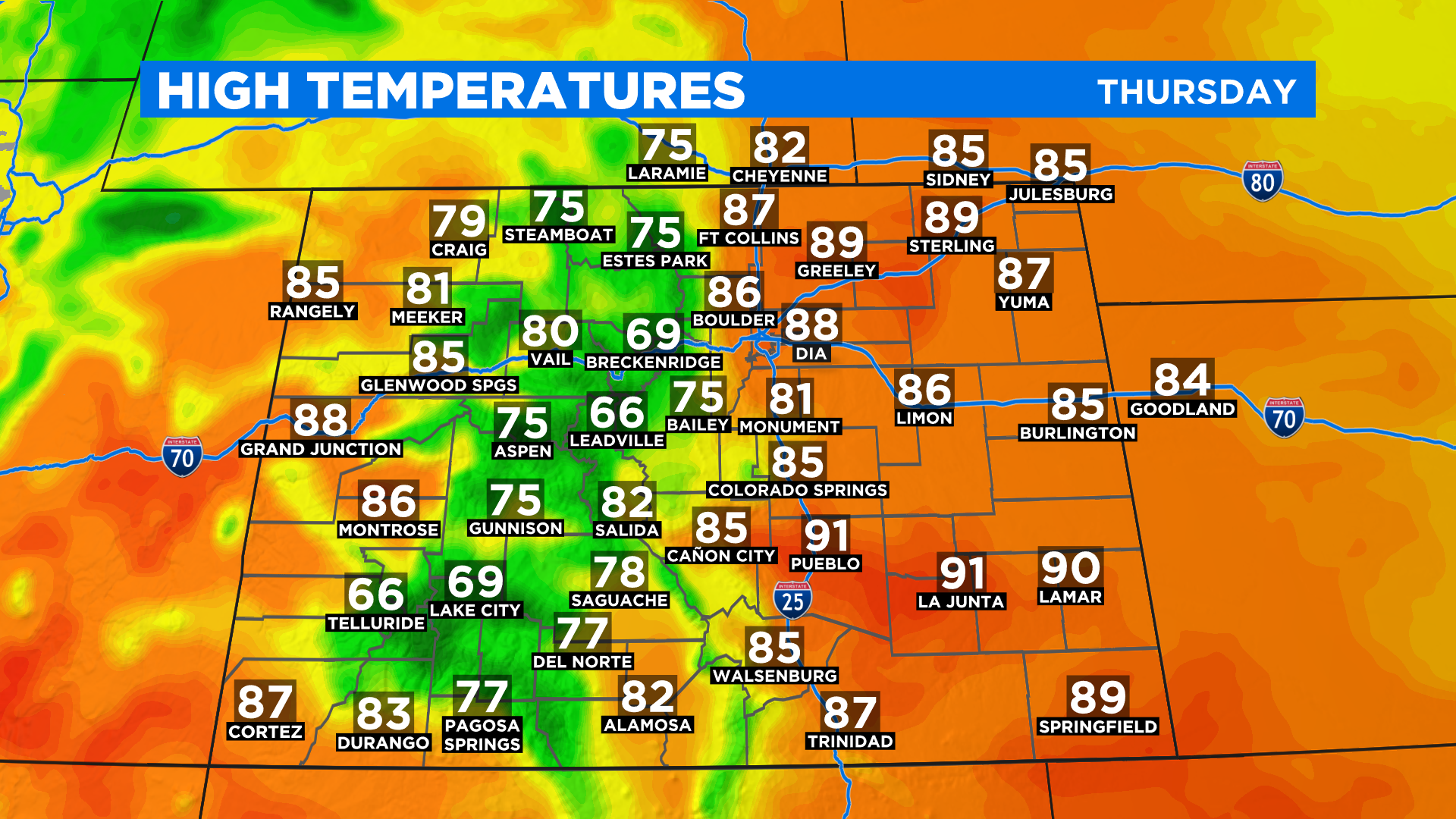
Temperatures drop slightly on Friday but remain far above normal with highs in the mid 80s. That's about two months ahead of schedule. The normal high in Denver doesn't reach the 80s until the middle of June.