Colorado Weather: Highest Wind Gust List Includes 103 MPH Atop Peak 8 At Breckenridge
DENVER (CBS4) - A powerful jet stream roaring over Colorado late Monday and early Tuesday produced powerful wind gusts in the northern mountains and foothills overnight. There have been some reports of damage including trees blown down at Winter Park.
RELATED: 100+ MPH Winds Reportedly Knock Down Trees At Winter Park
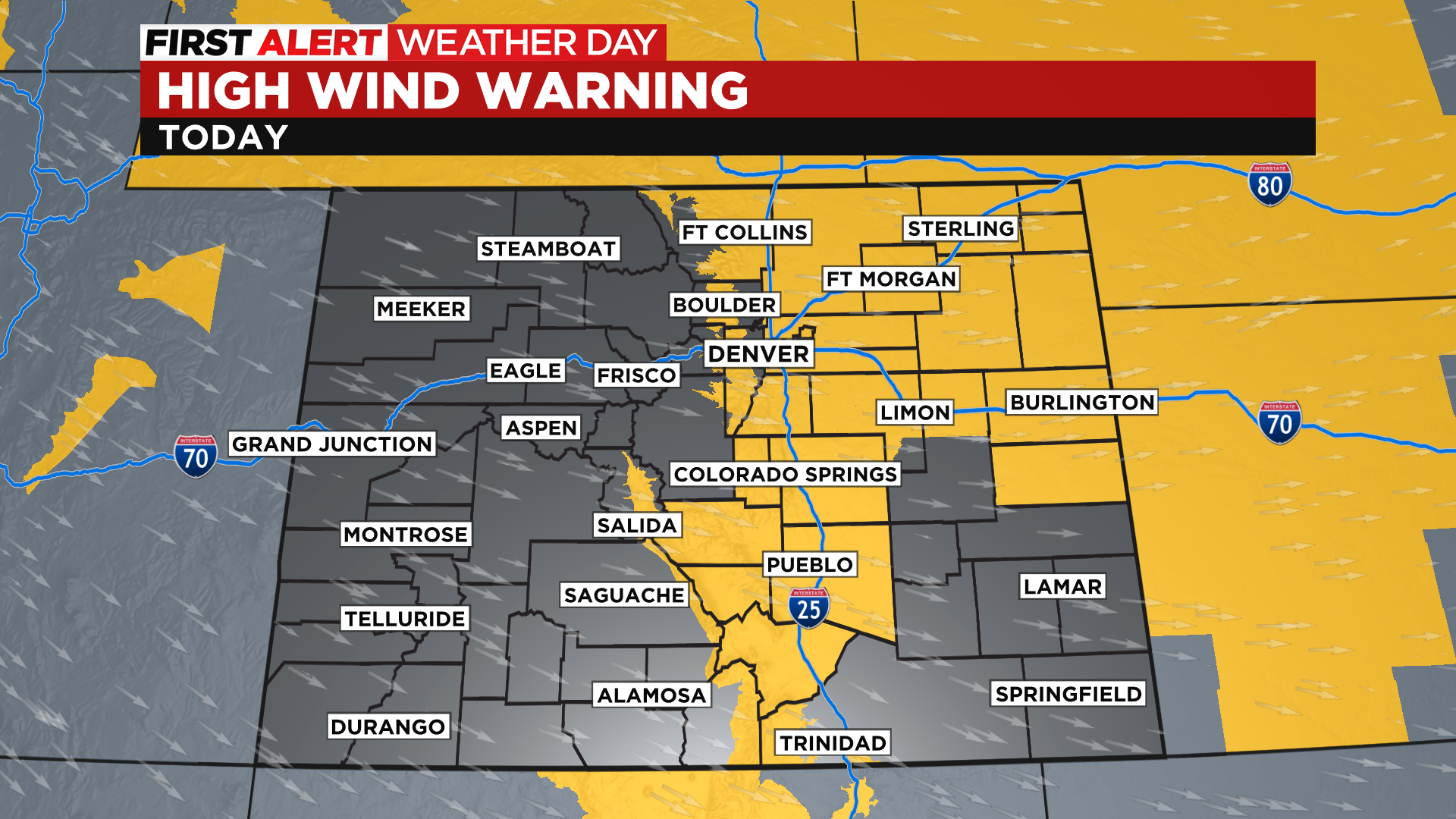
Here's a list of wind gusts reported to the National Weather Service as of 9 a.m. on Tuesday. We could see even more high gusts through the day with many areas under a high wind warning through Tuesday evening. Fire weather is also a big concern for many areas along and east of the foothills.
103 MPH - 7 miles SSW of Frisco (atop Peak 8 at Breckenridge)
91 MPH - 1 mile ENE of Berthoud Pass
80 MPH - 1 mile NW of Loveland Pass (11,890 feet)
79 MPH - 4 miles ENE of Poncha Pass
76 MPH - Wondervu
76 MPH - NCAR Mesa Lab in SW Boulder
76 MPH - Westcliffe
76 MPH - Manitou Springs
75 MPH - 6 miles SSW of Colorado Springs
72 MPH - Nederland
72 MPH - Crisman
72 MPH - Sunshine Canyon (foothills near Boulder)
71 MPH - Floyd Hill and Interstate 70
70 MPH - Livermore
70 MPH - Tabernash
68 MPH - Buckeye
67 MPH - Dakota Hill (Gilpin County)
67 MPH - Red Cliff Pass
67 MPH - Interstate 25 and Buckeye Road
65 MPH - along Interstate 70 in Frisco
64 MPH - Georgetown Lake
64 MPH - Cheesman Reservoir
64 MPH - 3 miles SW of Swissvale
62 MPH - Aspen Springs
62 MPH - Jefferson
62 MPH - northwest Boulder
62 MPH - Interstate 25 and the Wyoming state line
61 MPH - near Marshall (Boulder)
61 MPH - Coal Creek Canyon
60 MPH - Genesee
59 MPH - Black Hawk
59 MPH - Salida
58 MPH - Highway 93 and 72 north of Golden
55 MPH - Meeker
49 MPH - Sunlight
46 MPH - Craig


