Colorado Weather: High fire danger returns for Denver Metro
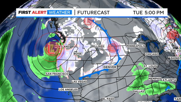
We are looking out for a big push of westerly winds across the state on Sunday. There is a another deep trough of low pressure off the west coast and on the east side of that trough a strong jet stream in the upper levels of the atmosphere along with a cold front that will be pushing across the central Rockies.
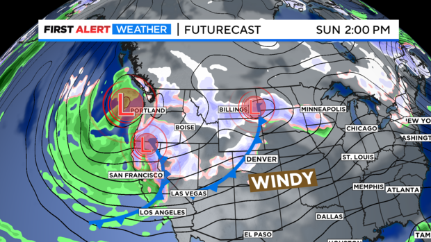
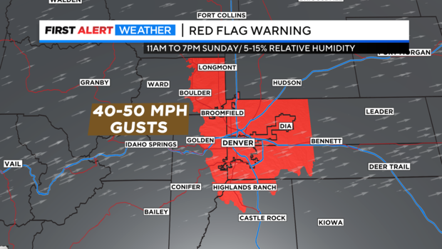
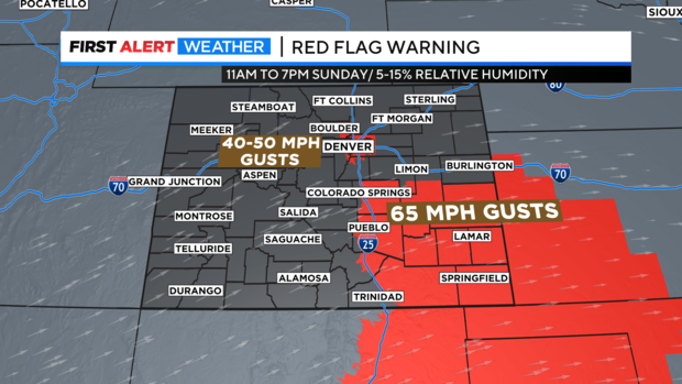
Ahead of the cold front that will swing thru Denver Sunday night. Wind gusts will be strong from the Front Range Foothills down into the Denver metro area. These will be warming and drying chinook winds. With some gusts expected to reach 40 to 50 mph as the day goes on. This has prompted a Red Flag Warning to be posted for the entire Denver metro area from 11am to 7pm on Sunday for high fire danger.
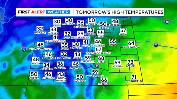
Temperatures will be unseasonably warm with the westerly winds over the eastern plains. Where many areas will be in the 50s and 60s. A few spots in in southeastern areas of the state may even get into the low 70s!
There is also, a Red Flag Warning in place for all of southeastern Colorado where gusts may reach 65 mph.
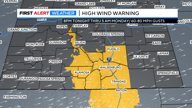
Beyond that area west into the southern I-25 corridor on into the Sangre De Christo mountains and San Luis Valley a High Wind Warning is in place for winds from 60 to 70 mph. Some more wind prone mountain and foothill areas may see isolated gusts to 80 mph.
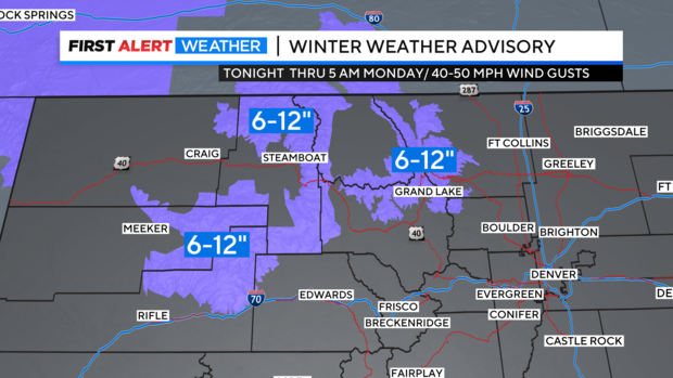
There is also, some mountain snow coming in with the western flow. The northern and central mountains could see snow combined with strong winds up to 40 mph. There are Winter Weather Advisories posted for the Park Range around Steamboat down to the Flat Tops over into Rocky Mountain National Park for 6 to 12 inches of snow thru Monday.
Monday will be a much cooler day. In fact, temperatures over northeastern Colorado will go from highs on Sunday in mostly in the 50s to only 40s behind the Sunday front. This will start a series of cold days with snow brought on by the stubborn west coast trough that will bring in a prolonged cold spell and several chances for snow for the majority of next week.