Colorado Weather: From fire danger to rain by Friday

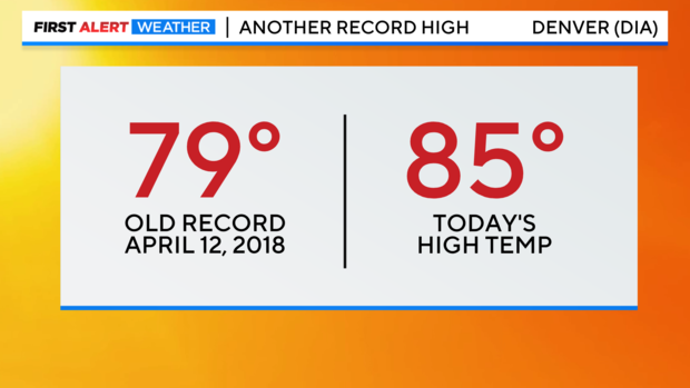
Another record high bites the dust! Wednesday delivered a high of 85 degrees at Denver International Airport. This broke a 5 year old record of 79 degrees set in.
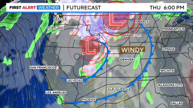
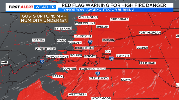
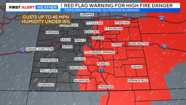
Along with the slightly cooler air there will be another day of gusty winds that come along with it. As a result, we have a First Alert Weather Day posted for Thursday for high fire danger with the wind, warmth and dryness teaming up again.
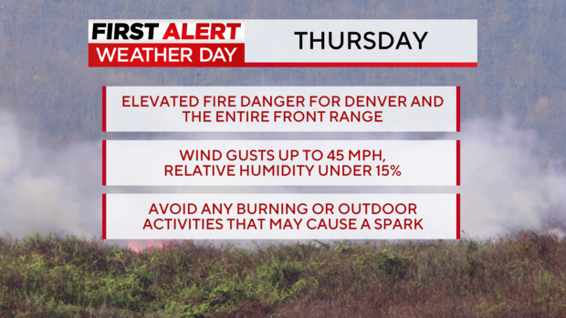
A dry overnight cold front will cool temperatures by about 5 to 10 degrees for most areas. The system may have a few clouds but, not enough moisture to produce rain or snow. Wind gusts across the eastern plains may get up around 40 to 45 mph during the day.
There is a Red Flag Warning in place for all of eastern Colorado from noon thru 8pm Thursday. This includes all of the Denver Metro Area and the Front Range foothills. Wind gusts could get up to 45 mph along with relative humidity levels below 10%.
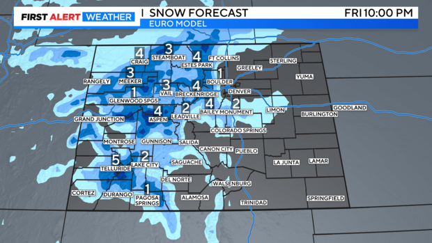
A second surge of cooler air is expected on Friday that will bring a chance of rain showers and a late day rain/snow mix to the Denver metro area. The mountains may see 2 to 5 inches of snow on Friday.