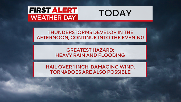
Colorado weather: First Alert Weather Day for afternoon & evening storms

Afternoon and evening thunderstorms on Friday will be capable of producing large hail, frequent lightning and heavy rain and the day has been declared a First Alert Weather Day.
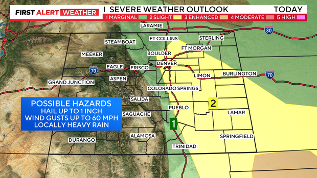
The threat for damaging wind or weak tornadoes is not zero, but it's relatively low today compared to other days in the recent weeks.
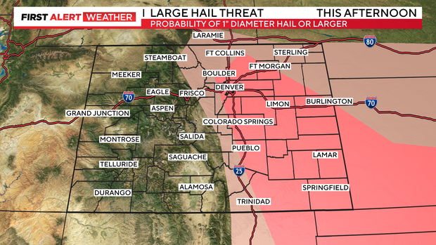
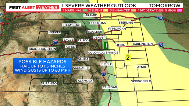
The Denver metro area is under a "slight risk" of severe weather. That is level 2 on a 5 level scale. The greatest threat will be south and east along the Palmer Divide and in southeastern Lincoln county.
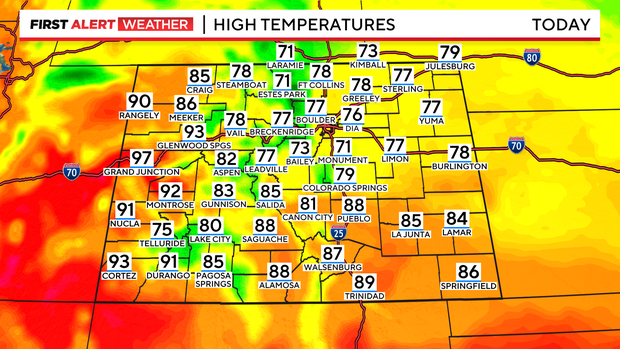
Daytime high temperatures will also be "cooler" today with highs in the mid to upper 70s which is about 10 degrees below normal for July 7.
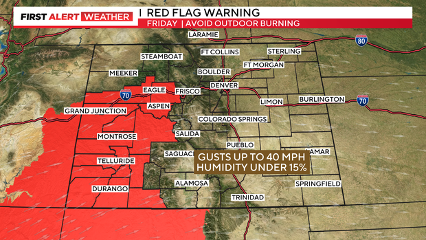
On the Western Slope, another Red Flag Warning has been posted today Noon through 9 p.m. tonight for high fire danger.
Saturday we will be back in the mid to upper 70s nearly 10 degrees below normal for this time of year.

Saturday afternoon we have another chance to see strong to severe storms to develop. These storms will be capable of producing hail up to an 1.5 inches and wind gusts up to 60 miles per hour in addition to hail.
By Sunday high pressure builds into the four corners and we will see high temperatures back in mid 80s with dry conditions.

The summer heat arrives next week with daytime highs in the 90s!


