Colorado Weather: Colder Temps With Areas Of Light Snow Expected On Friday
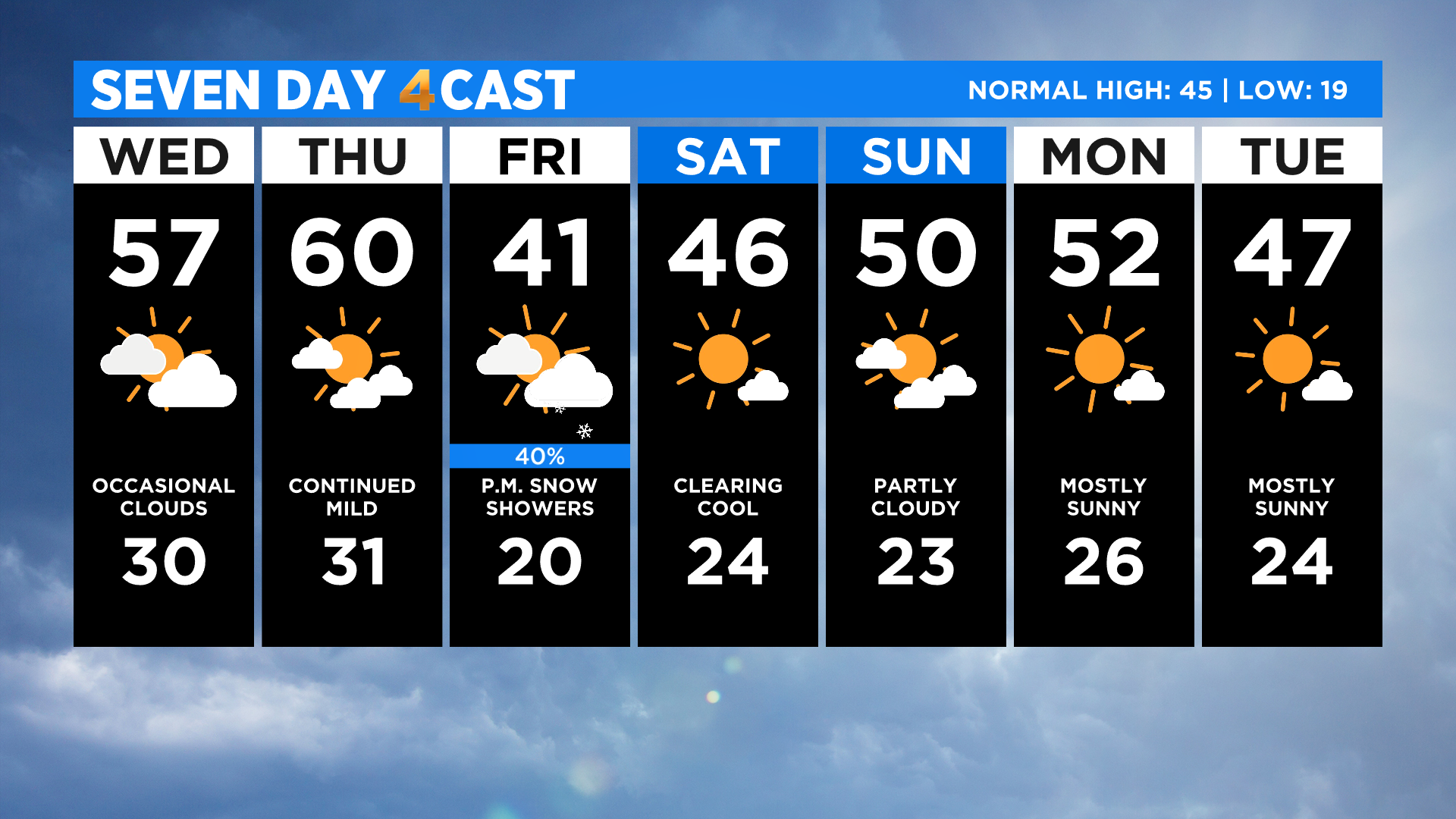
DENVER (CBS4) - Colorado will have two more days with mild and dry mid-January weather before an abrupt change arrives on Friday. Temperatures over the next two days will run anywhere from 5 to 15 degrees above normal.
We'll see occasional cloud cover today and tomorrow with westerly wind speeds averaging 5 to 15 mph. At times some places could gust as high as 30 mph.
By Friday morning the westerly winds will turn from the north, ushering in some much colder air and a little bit of moisture. Afternoon highs will be below normal for this time of year and we'll see a chance for areas of flurries or light snow throughout the day.
As it stands right now, the mountains will see a few inches of snow, mostly falling after sunrise on Friday. We could see a few pockets of snow with light accumulation develop in the Front Range, on the eastern plains and along the Interstate 25 urban corridor during the afternoon hours.
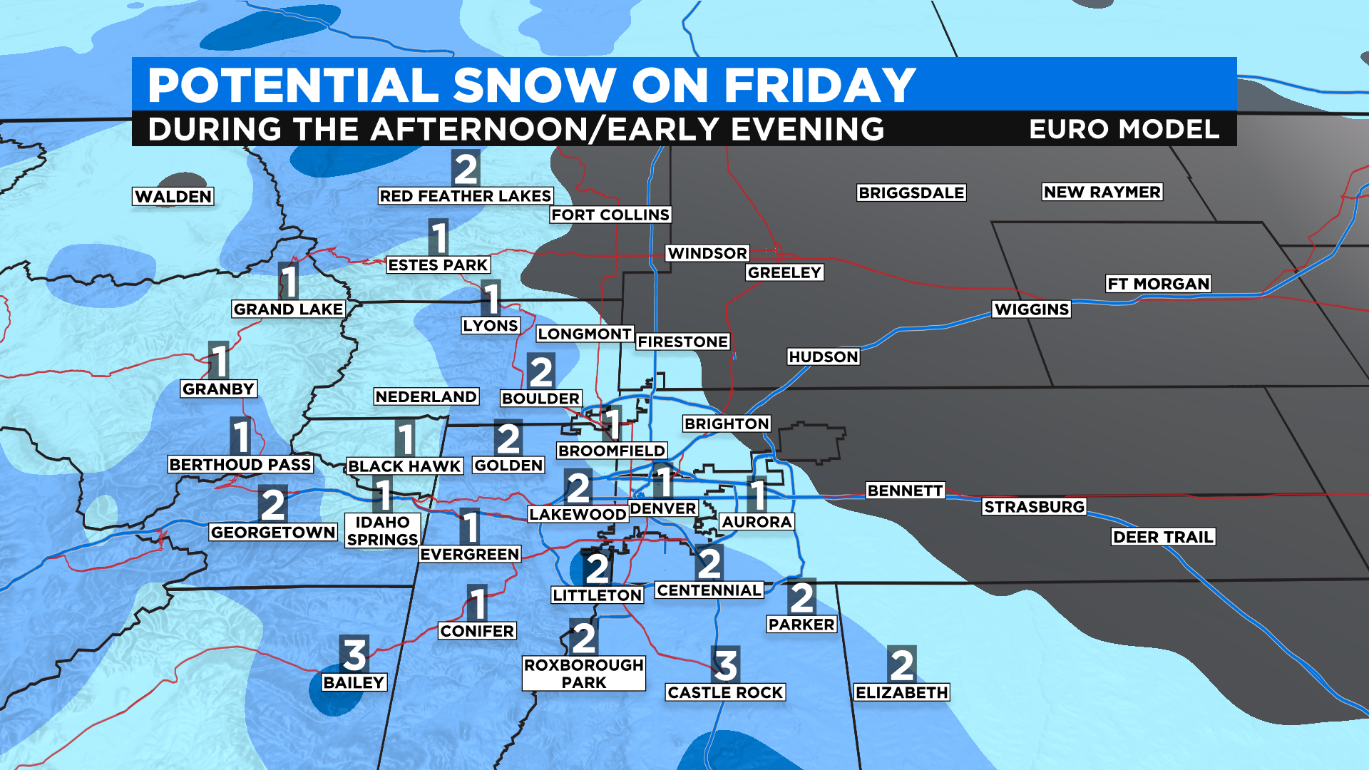
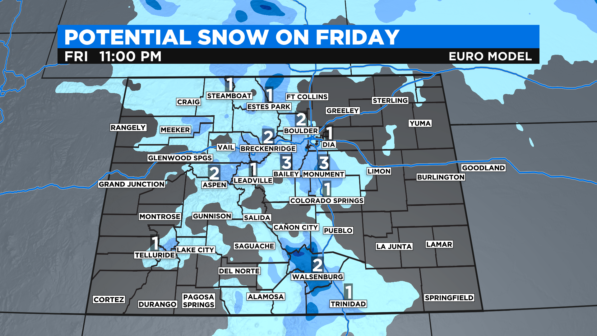
As always we ask that you stay tuned for any potential changes or tweaks to this forecast. Our confidence is high that we'll see a fast-moving storm arriving around sunrise on Friday. We're also confident that it won't produce a lot of snow because it is just moving too fast.
What could change is the specific amounts and places that get the snow on Friday. We'll have higher confidence on that once the storm moves on shore tomorrow and we get a better idea of the exact track it will take.