High humidity fuels storms across Colorado, flash flooding possible

Colorado feels more like Florida today, at least when it comes to the mugginess.
As of this writing, Denver is reporting a dewpoint of 63 degrees. For context, that's unusually high. Denver's semi-arid climate typically keeps midsummer dewpoints in the upper 40s to low 50s.
Enough of that ramble, this extra "juice" in the atmosphere is helping fuel storm development. Storms will stay scattered Tuesday evening, but the combination of weak upper-level flow and elevated instability will support slow-moving storms capable of dropping 1 to 2 inches of rain in a short amount of time.
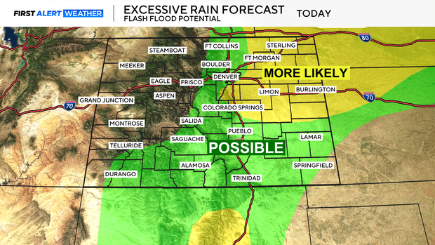
That brings a chance for localized flash flooding, especially in flood-prone areas.
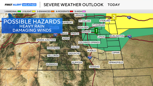
One or two stronger storms may also produce hail and gusty winds. The hail threat will be brief; hail is most likely early in a storm's life cycle before transitioning to a damaging wind threat as storms roll east of I-25 and onto the plains.
Another round of heavy rain is expected on Wednesday.