Colorado heat continues before cooler, wetter weather arrives

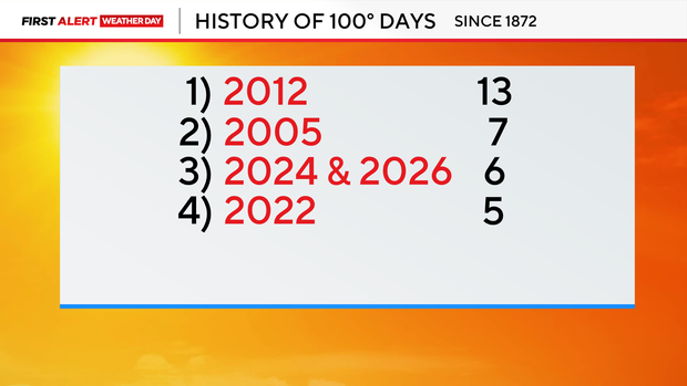
Denver International Airport reached 100 degrees on Saturday, marking the sixth day this year with temperatures at or above 100 degrees in Denver.
That ties 2024 for the number of 100-degree days recorded in a year. However, Denver's all-time record is much higher. In 2012, Denver recorded 13 days with temperatures reaching 100 degrees or hotter, the most on record.
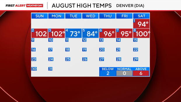
It has been a hot start to the month of August. In the last week, we have hit the triple digits three times.
Sunday is a First Alert Weather Day as the heat continues.
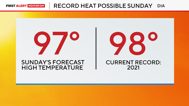
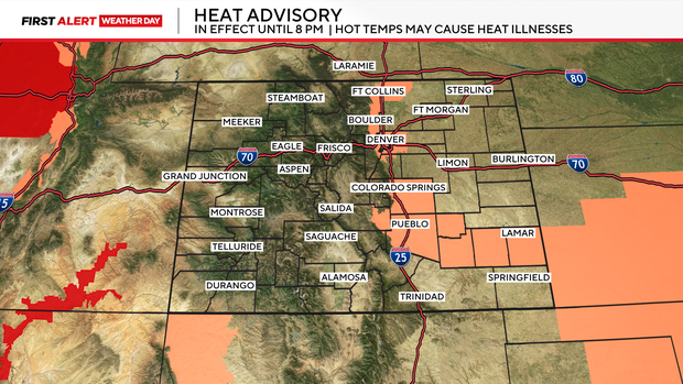
A Heat Advisory is in effect for the northern I-25 Corridor and Denver metro through 8 p.m. Sunday.
While temperatures will be the main concern Sunday, a few showers and isolated thunderstorms will develop during the afternoon. These storms are not expected to produce much rain, but they could produce strong, gusty winds. Wind gusts of 30 to 45 mph will be common near showers, with isolated gusts up to 55 mph possible.
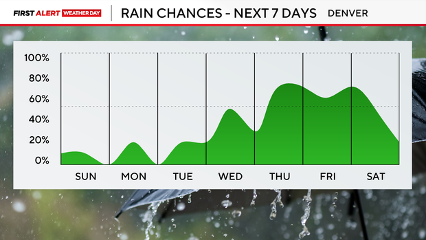
The heat doesn't immediately break. Monday and Tuesday will remain very warm, with temperatures again reaching the mid to upper 90s across the Denver metro area. Temperatures will begin to cool Wednesday, with highs dropping into the lower 90s. The biggest cooldown arrives Thursday and continues into next weekend.
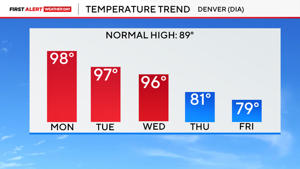
Forecast highs will trend into the 70s and 80s in many locations, while the return of monsoon moisture brings more widespread chances for showers and thunderstorms. Some storms could produce heavy rainfall that could lead to flooding in some areas.