Bitter cold and dangerous windchills continue Thursday with snowfall accumulating through the night
More snow is on the way after record-breaking cold in Denver. The snow won't have an impact this morning, but the cold will.
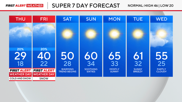
By this afternoon we will stay below freezing with highs in the mid to upper 20s. Many metro neighborhoods up into northern Colorado and to the northeast are seeing single-digit or subzero windchill Thursday morning. Cold weather advisories will remain in place until 11 a.m. with windchill as low as -30 degrees.
Thursday and Friday are First Alert Weather Days due to the bitter cold and biting wind chills Thursday morning. Another snowstorm will arrive by Thursday afternoon, carrying through the evening commute. We're likely to see the greatest impact Friday morning due to measurable snow during the morning commute.
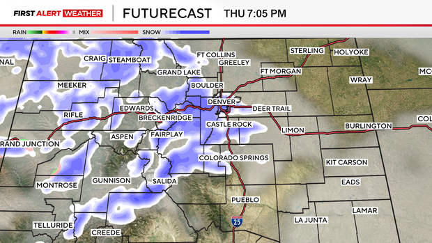
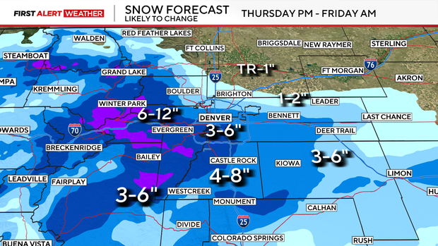
By the evening commute, there will be around 1" accumulation in the Denver metro area, but we have the potential to see 3" to 6" of snow across the area over the next day. Some isolated areas may pick up as much as 7" or 8" of snow.
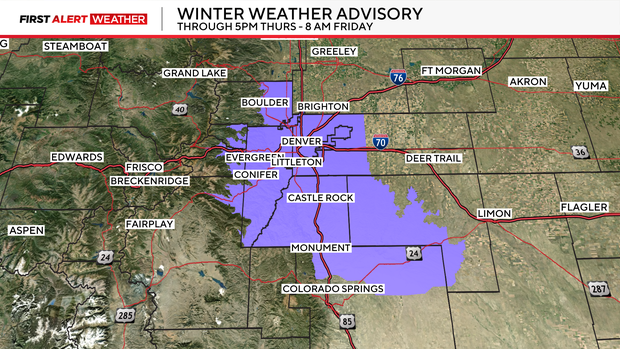
As snow moves into the area this evening, winter weather advisories will be in place starting at 5 p.m. Thursday until 8 a.m. Friday.
Light snowfall will continue throughout the High Country through Thursday.
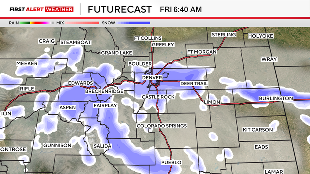
The snow should taper off Friday after the morning commute into the afternoon.