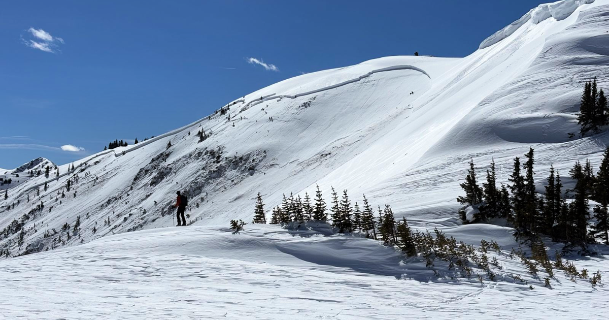
Colorado avalanche danger remains high; warnings continue as more snow moves in

A dangerous stretch continues in Colorado's high country as avalanche conditions remain critical following days of heavy snow and powerful winds.
According to the Colorado Avalanche Information Center, avalanche danger is rated high (4 of 5) across many mountain zones. Avalanche warnings remain in effect for multiple areas through Friday.
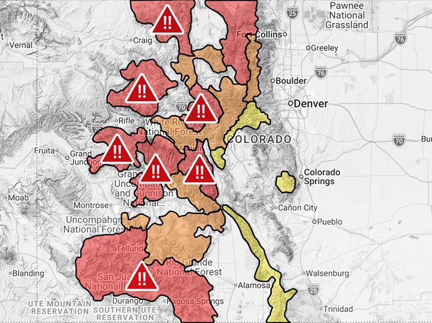
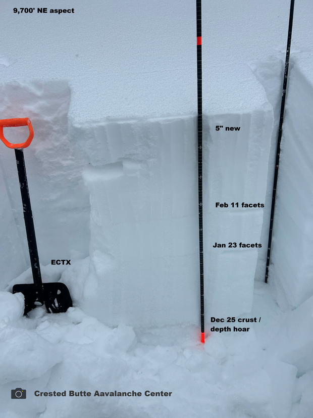
Forecasters say both human-triggered and natural avalanches are likely. This week's storms added significant snowfall on top of what experts describe as an unusually weak snowpack. Strong winds have further loaded slopes, creating widespread instability.
The danger is expected to remain elevated heading into the weekend. With high danger, backcountry travel in avalanche terrain is strongly discouraged.
Forecasters advise avoiding:
All steep slopes
Areas beneath steep slopes
Avalanche runout zones
Instead, recreationists should stick to:
Simple terrain
Low-angle slopes under 30 degrees
Areas with no steep terrain overhead
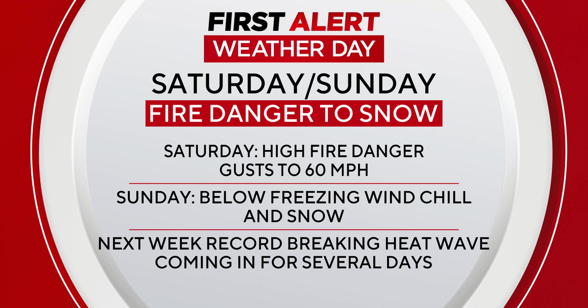
Another round of snow is expected Thursday night into Friday, especially favoring Colorado's southern and central Mountains. That additional snowfall will add more weight -- or "loading" -- to an already unstable snowpack, potentially prolonging or worsening dangerous conditions.
"We are really worried about an accident this weekend," said Brain Lazar with the Colorado Avalanche Information Center. "We do want to caution people that you can enjoy the snow, but you're really going to need to stick to conservative terrain choices because of how tender it is going to be."
Anyone planning to head into the mountains should check the latest forecast and avalanche warnings before leaving and be prepared to change plans.