Mild again on Monday in Chicago, but cold snap coming later in the week


CHICAGO (CBS) — After another mild day Monday, an arctic blast targets Chicago.
The coldest timeframe will be Thursday morning with wind chills of -5 to -15.
In a sooner timeframe, spotty drizzle is possible Sunday night as moisture heads our way from the Gulf of Mexico. The center of the storm will stay far south of the Chicago area, so only drizzle is expected—especially into Northwest Indiana and south of the Kankakee River Valley.
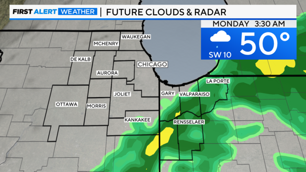
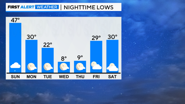
The low for Sunday night is 47.
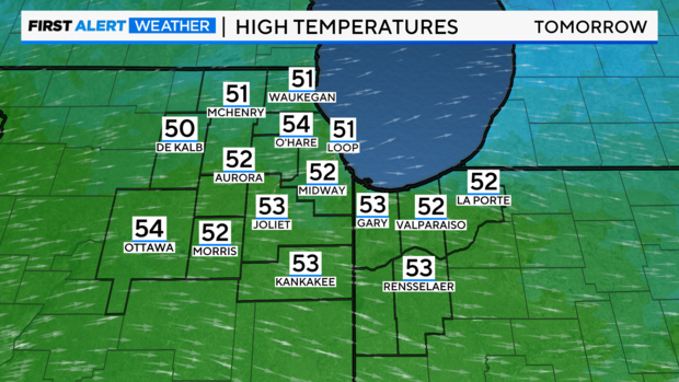
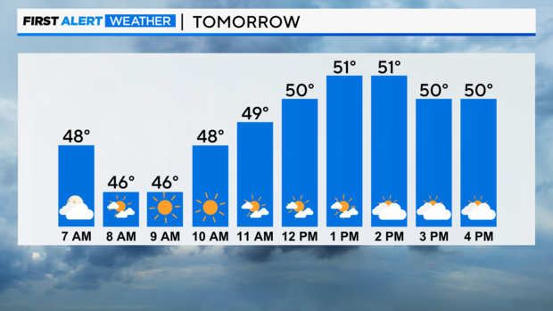
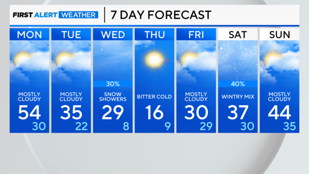
Temperatures will rise to the 50s again on Monday. The high for Monday is 54, up against a normal high of 39.
But then, the arctic front passes in the evening. This will open the door for chilly changes.
On Tuesday, it will be mostly cloudy with falling temperatures and highs in the mid-30s.
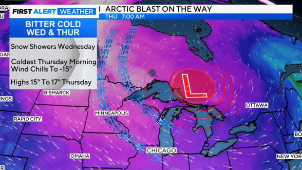
Wednesday and Thursday will be bitter-cold with high winds. Wind-whipped snow showers may be around on Wednesday. Then the core of the coldest air moves in for Thursday morning. This lobe of the Polar Vortex from northwest Canada will drive southeastward pulling the brutally cold air mass overhead. This is quite rare for the first half of December.
This arctic cold snap will be short-lived, as temperatures moderate by the weekend.