Much warmer in the week to come, but with rain


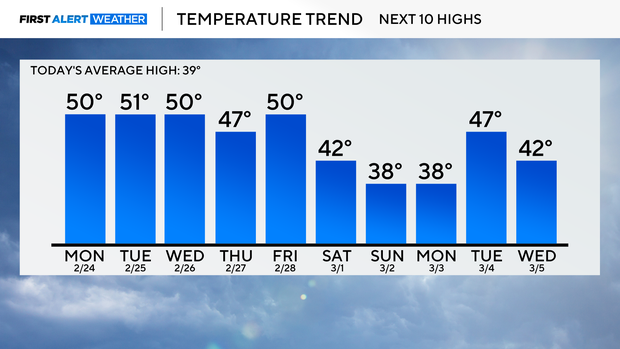
Temperatures will be much warmer this week, with widespread 40s and 50s expected.
With these mild temperatures, expect the snowpack to continue to melt away.
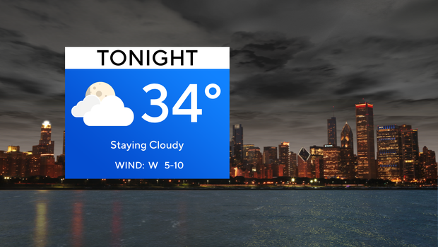
Overnight lows Sunday into Monday will drop into the lower 30s staying under a cloudy sky.
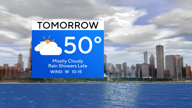
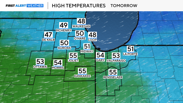
On Monday, temperatures will rebound during the day with highs reaching the lower 50s south of I-88. North of I-88, temperatures will be in the upper 40s.
Weather patterns start to shift Monday evening, as sporadic rain showers will march through. The rain shower activity is expected to last until early Tuesday.
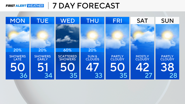
On Tuesday afternoon, we will get a slight break from the rain before more rain returns Tuesday night and throughout the day Wednesday. In total, we could receive about .25" to .75" of rain accumulation. This will definitely get rid of any of the leftover snow.
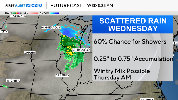
However, on the backside of that system, a little wintry mix will be possible, but no winter weather accumulations are expected.
Temperatures remain in the 40s and 50s through Saturday and by next Sunday temperatures get a reality check with highs in the upper 40s.
Forecast at a glance
Monday: High of 50. Mostly cloudy
Monday night: Rain showers arrive. Low of 36.