Snowy, windy, and cold Sunday ahead for Chicago; dangerous cold to start the work week

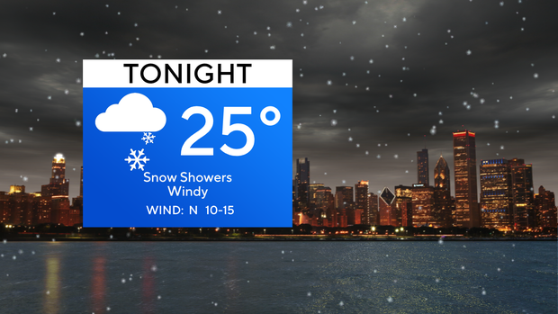
CHICAGO (CBS) -- Occasional snow showers will continue to move through the Chicago area Saturday night as temperatures hover in the middle 20s.
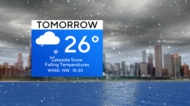
Winds will start to pick up and turn out of the northwest on Sunday, gusting near 30 mph, which will create lake-effect snow showers throughout the day.
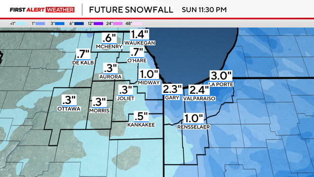
The heaviest lakeside snow plumes will favor northwest Indiana. Amounts could reach 1 to 3 inches, with La Porte county being under a winter weather advisory until 6 p.m. Sunday.
As the winds ease up, the snow will wind down, but temperatures will plummet. Temperatures will fall throughout the day Sunday, reaching the lower 20s by the afternoon. Then overnight lows will dip below zero, but the wind chills will reach -15 to -25.
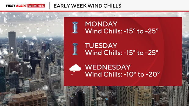
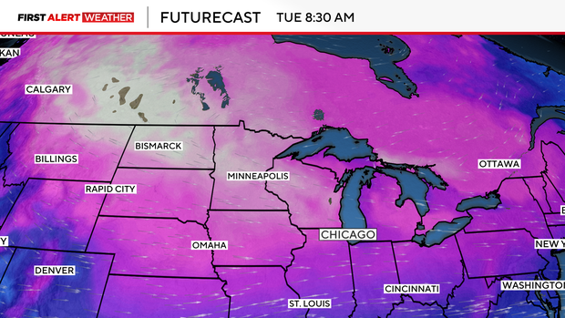
The cold air lasts throughout the beginning of the work week; including Monday, Tuesday, and Wednesday.
Monday and Tuesday will be the coldest days, with dangerously cold wind chill readings in the -15 to -25 degree range, so weather alerts have been posted for those days to urge everyone to limit activity outside as it will be extremely cold.
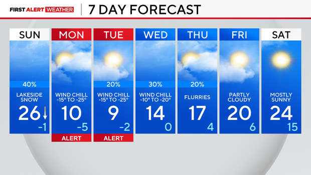
Temperatures stay below average through at least next weekend.
Forecast at a glance
TONIGHT: Snow showers, cloudy. Low of 25.
TOMORROW: Lakeside snow showers. Falling temps, through the 20s during the day. Windy.
TOMORROW NIGHT: Snow showers taper off. Cold air returns. Low of -1, feeling like -15 to -25.