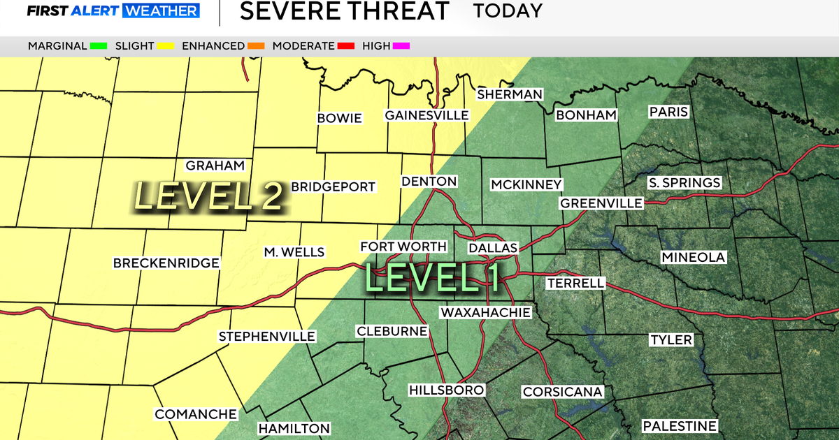
Isolated strong storms overnight, severe threat late Friday in Chicago


An isolated strong storm may wander into our area overnight Thursday into Friday, producing gusty winds and small hail.
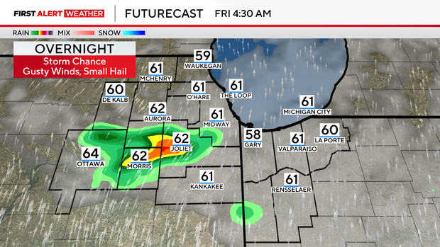
The storm chance Thursday night is mainly north of I-88. But most will remain dry, mild and windy as south winds prime the atmosphere for Friday's storm threat.
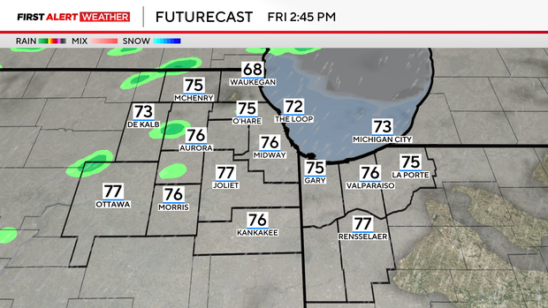
Friday afternoon will bring the warmest temperatures of the year so far with highs in the 80s up to the lakeshore.
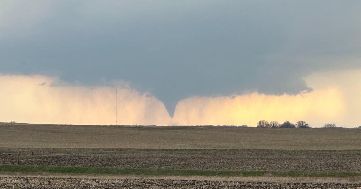
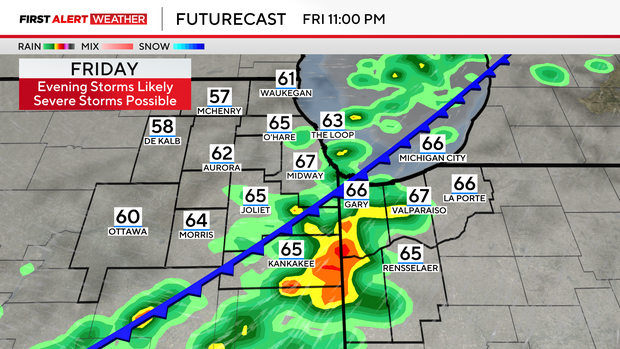
A cold front crashes into that heat and moisture late Friday evening, potentially firing up severe storms capable of hail, wind damage and an isolated tornado.

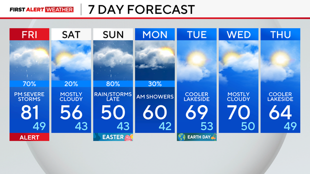
Cloudy skies and cooler weather are expected Saturday with rain showers generally remaining south of Chicago.
Easter Sunday starts dry, but rain and thunderstorms are likely again late in the day.
Forecast at a glance
Thursday night: An isolated storm, otherwise mild and windy. Low: 59
Friday: Very warm. Evening thunderstorms likely, some of which may be severe. High: 81
Saturday: Cloudy and cooler with scattered showers. High: 56