Tornado touchdowns reported in Kankakee, Northwest Indiana


Lates Updates: Coverage of the deadly tornadoes in Northwest Indiana and Kankakee, Illinois has moved here.
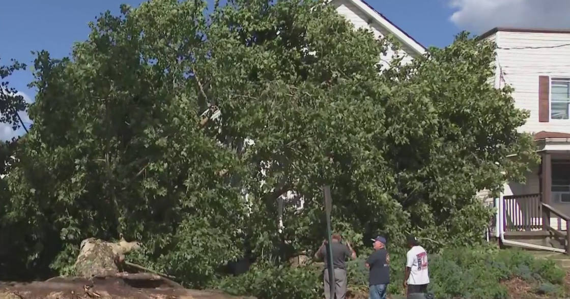
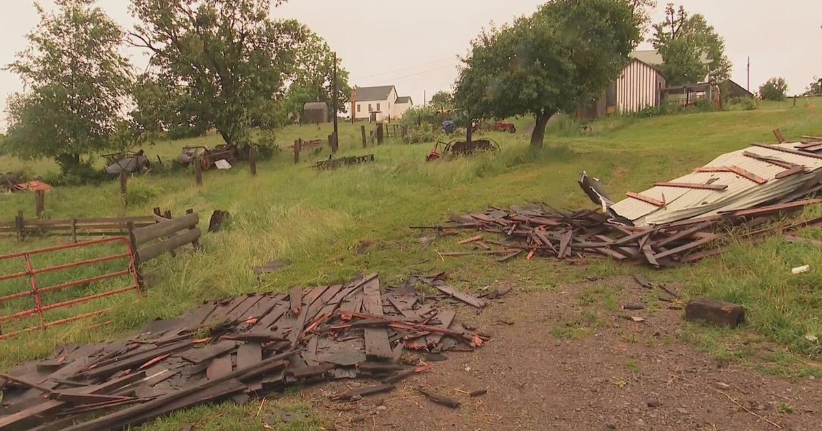
Emergency crews in Kankakee, Illinois, said they are assessing damage after a tornado touched down on Tuesday afternoon amid an outbreak of severe weather. The National Weather Service said the stovepipe tornado was spotted near the Kankakee Airport and moving toward Aroma Park, Illinois, and then on to Momence.
A tornado touchdown has also been reported at the Kankakee County Fairgrounds.
CBS News Chicago meteorologist Kylee Miller is in Kankakee County and said she can see significant damage in the area where the touchdown happened, including to homes and downed power lines.
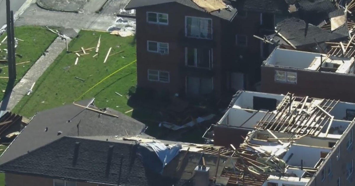
Confirmed tornadoes have also been reported over parts of northwest Indiana. Emergency crews there are advising residents to stay put and not to go out and assess damages themselves.
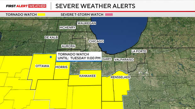
There are currently no active tornadoes, severe thunderstorms, flash flood warnings, or severe thunderstorm watches in effect within the viewing area. However, a Tornado Watch is in effect for La Porte County until 1 a.m.
A Flood Watch remains in effect for Cook, DuPage, Will, Grundy, Kane, Kankakee, Kendall, and La Salle counties in Illinois and Lake and Porter counties in Indiana until 3 a.m. Wednesday.
The severe weather barreled into downtown Chicago shortly before 6:30 p.m., with a typical thunderstorm quickly giving way to a downpour and then an onslaught of hail.
Large hail has also been reported in the southwest suburbs, with hail as large as 5.2 inches in Kankakee, which Meteorologist David Yeomans said might be a record for Illinois. Ping pong ball-sized hail has also been reported in Romeoville and tennis ball-sized hail near Pontiac, Illinois. There are also reports of golf ball-sized hail in Bolingbrook.
Storm chances will gradually decrease after midnight; the most concerning window for severe storms and tornadoes is Tuesday evening.
This overall severe weather risk is as high as we've seen in several years, said CBS News Chicago Chief Meteorologist Albert Ramon. It is vital that you have multiple ways to receive warnings and be ready to act quickly if a warning is issued.
In anticipation of the severe weather, the Manteno Police Department posted on its social media that two storm shelters will be open for residents who do not have basements where they can seek shelter, St. Joseph Catholic Church at 207 S. Main St. and Manteno Church of the Nazarene at 698 N. Locust St. Police said anyone going to St. Joseph should go in through the south lower doors that go straight to the basement, while at Nazarene residents should enter through the main doors and turn right to get to the basement. No animals are allowed at either shelter.
What are the main severe weather threats on Tuesday?
In areas along and south of I-80, storms could produce damaging winds, large hail, and tornadoes. Farther north, storms could still develop, but would be more likely to produce hail and gusty winds rather than tornadoes, due to the cooler and more stable air near the lake.
In addition to the tornado threat, storms may also produce very large hail — potentially as large as tennis balls — along with damaging wind gusts up to 70 miles per hour.
Heavy rain is also a concern, especially Tuesday night, as slow-moving storms could repeatedly move over some areas and potentially cause localized flooding and flash flooding.
The entire Chicago area is at a high risk for flooding, a medium to high risk for wind damage, and a high risk for tornadoes and hail through 1 a.m. Wednesday.
What is the tornado risk?
Areas along and south of I-80 and in Northwest Indiana are at a level four, or moderate, threat of severe storms Tuesday, and have the greatest risk to see tornadoes, though the entire area, including the city, has an enhanced chance of severe weather today. There is also a risk of long-tracked tornadoes.
What to do if there's a tornado warning
If a tornado warning is issued for your area, you should take shelter in the lowest level of your home or a basement if possible. If it's not possible to get to a basement, or you don't have one, take shelter in an interior room away from windows, like a bathroom, closet, or hallway. If time allows, be sure you bring your pets with you.
If you are outside, seek shelter inside a sturdy building immediately; sheds, storage facilities, and mobile homes are not considered safe by the National Weather Service.
If you're in your car, you should drive to the closest shelter immediately and take cover. If you can't get to a safe shelter, either get down in your car and cover your head or abandon your car and seek shelter in a low-lying area like a ditch or ravine, the NWS advises.
If you can, bring a flashlight, water, and your phone and charger into your safe room with you. If you have access to a radio, also bring the radio so you can stay informed of weather alerts, changes, and when the warning has been cleared.
What is the difference between a tornado watch and a tornado warning?
A tornado watch means there are weather conditions that could lead to the formation of severe storms and tornadoes. If a tornado watch is issued for your area, the NWS advises you to prepare for the event of a tornado warning, getting together supplies and determining where the safest place in your home is for you to take shelter.
A tornado warning means a tornado has been sighted or indicated by weather radar, and there is imminent danger to life and property. If a tornado warning is issued for your area, you should take shelter and safety precautions immediately.
Tornado watches are typically issued for large areas that are potentially at risk, while tornado warnings are issued for much smaller areas, around the size of a city or a small county, that may be impacted by a tornado identified by radar or a trained tornado spotter.
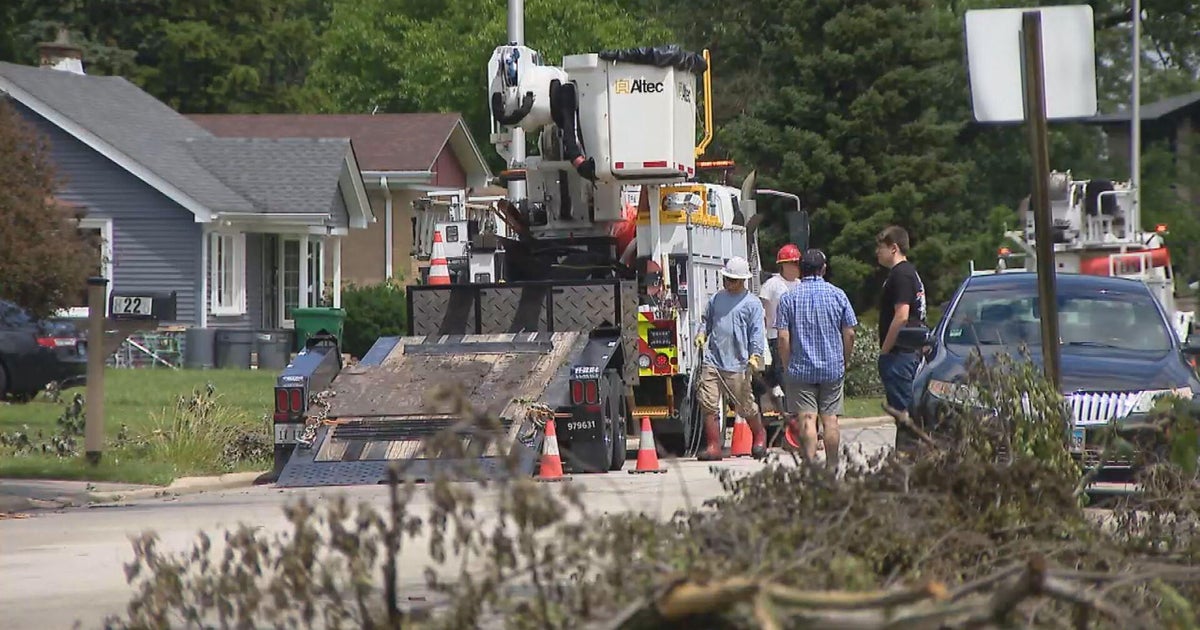
ComEd prepares for possible outages
ComEd advised that it is preparing ahead of time for potential power outages during the storms.
"As forecasted severe thunderstorms roll through our service territory this afternoon and tonight, we are taking additional steps to ensure we can restore impacted customers as safely and swiftly as possible," ComEd executive vice president and chief operating officer David Perez said in a news release. "All available crews are committed to working around the clock to restore outages and keep customers safe."
ComEd said in the event of a storm-related outage, its first priority is to restore power to critical facilities such as police and fire stations, nursing homes, and hospitals. Afterward, repairs will be made to restore power to the greatest number of customers.
ComEd said if a power line comes down, an immediate call to ComEd is warranted to 1-800-EDISON1 (1-800-334-7661), or 1-800-95-LUCES (1-800-955-8237) for Spanish language. Approaching downed power lines is never a good idea.
Meanwhile, if ComEd workers are fixing a power outage, people should not go up to them and ask about restoration times. They may be busy working on live electrical equipment, and approaching their work zones may be dangerous.
ComEd urges customers to contact them immediately in the event of a power outage. Customers can text OUT to 26633 (COMED) to report an outage, or call 1-800-EDISON1 (1-800-334-7661), or 1-800-95-LUCES (1-800-955-8237) for Spanish language, or go through ComEd.com/report.