Chicago Weather Alert: Slick conditions everywhere

CHICAGO (CBS) -- A Winter Storm Warning is in effect until 9:00 p.m. for Lake (IL) and McHenry County.
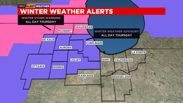
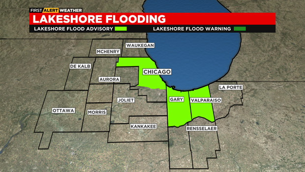
Also, a Winter Weather Advisory is in effect until 9:00 p.m. for Cook County, including the City of Chicago, and the western suburbs and a Lakeshore Flood Advisory is in effect until 3:00 a.m. Friday for Cook, Lake (IN) and Porter County.
According to CBS 2 Chief Meteorologist Albert Ramon, snow continues through the mid-evening for areas near the Illinois/Wisconsin state line. Hazardous travel is likely in this area due to snow accumulations of four to six inches.

For Chicago, a rain and sleet mix will transition over to snow late this afternoon into the evening. Some heavy bursts of snow will be possible early this evening thanks to lake enhancement.

Slippery travel is likely in the city and western suburbs this evening. Snowfall accumulations could be as high as two to four inches, with lighter amounts south of I-88. A strong northeast wind will create some lakeshore flooding in Cook County, along with Lake and Porter County in Northwest Indiana.
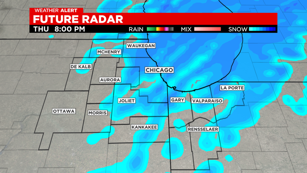
Lake effect snow is likely tonight in parts of northwest Indiana, but most of the area will be mainly dry after midnight.
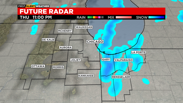
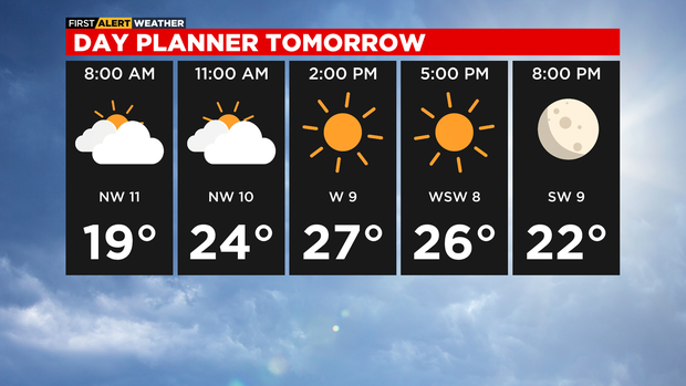
Very cold Friday morning with lows in the upper teen, but wind chills in the single digits. Clearing skies, breezy and cold for Friday afternoon with highs in the mid to upper 20s. A breezy southwest wind will warm temperatures back up to the 40s this weekend.
TONIGHT: Evening snow likely, then cloudy overnight. Lake effect snow overnight for northwest Indiana. Low 19°, wind chills in the single digits.
FRIDAY: Clearing skies, breezy and colder. High 27°
SATURDAY: Partly cloudy and breezy. High 42°