Chicago First Alert Weather: A Little Warmer Before Rain And Snow Arrive
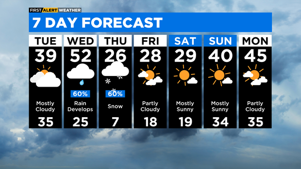
CHICAGO (CBS) -- It'll be partly cloudy and chilly on Monday night with lows in the upper teens and low 20s.
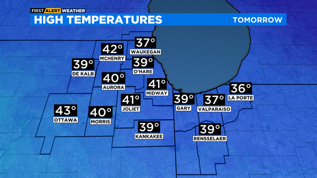
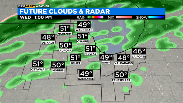
According to CBS 2 Chief Meteorologist Albert Ramon, expect it to be breezy and not as cold Tuesday with highs near 40 degrees. A strong south wind will boost temperatures into the low to mid 40s for Wednesday morning, then low 50s in the afternoon.
Wednesday will be the warmest day so far this year and the warmest temperatures since Christmas Day. Rain chances increase in the afternoon on Wednesday, then showers will be likely Wednesday evening.
A combination of the warm temperatures and rain chances may increase the flood threat along area rivers late this week. Rain transitions to sleet and freezing rain for early Thursday morning. Some ice accumulation is possible. Snow chances increase through the day on Thursday with accumulation possible.
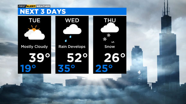
TONIGHT: Partly cloudy. Low 19°.
TUESDAY: Mostly cloudy and breezy. High 39°.
WEDNESDAY: Rain chances increase in the afternoon, showers likely in the evening. Windy and mild. High 52°.