Chicago area gets break from wintry mix until weekend


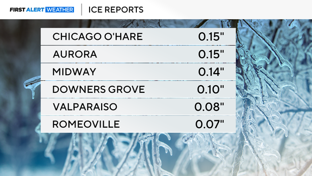
CHICAGO (CBS) — After an icy morning, with ice accumulation slightly over 0.1 inch in many places, conditions cleared and turned windy late Thursday.
Wind gusts Thursday evening were expected to be as high as 50 mph along the North Shore as a weather system moves to the north of the Chicago area.
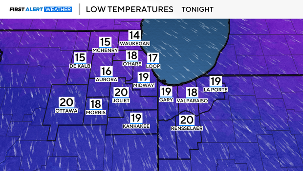
Conditions will be breezy and cold overnight with lows in the teens and wind chills between 5 and 10 degrees.
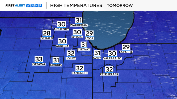
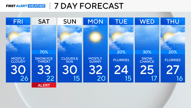
Friday will be mostly cloudy and colder, with highs in the low 30s.
The next weather maker arrives Saturday, with increasing chances for snow and freezing rain. The best chance for accumulating ice will be for areas south of Chicago, with a few inches of accumulating snow possible across the rest of the area.
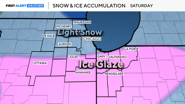
Travel could be impacted, especially where freezing rain occurs.
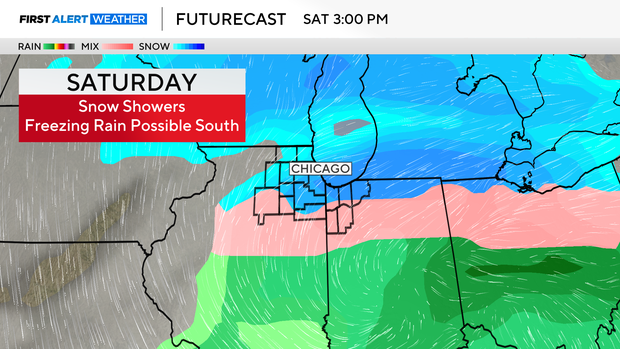
There is still some uncertainty in the data on the intensity and exact location of the snow and ice line, so stay connected with CBS News Chicago for the latest updates.
It will be colder next week with highs around 30 degrees Sunday and Monday, then 20s for midweek with some snow chances.
Forecast at a glance
TONIGHT: Partly cloudy, breezy. Single-digit wind chills with a high of 18.
FRIDAY: Clouds and sunshine. Colder with a low of 30.