Looking Back on a Monster Storm
Find Eric Fisher on Twitter and Facebook
Reporting on Cape Cod and talking to people in Boston was like communicating with alternate universes on Wednesday. My wife called and said 'it's pretty windy here.' To which of course I replied 'this is the craziest storm I've been in this winter.' Not many miles, very big difference! That of course was the forecast, as was the fact that the majority of this ocean monster would stay too far to our east for widespread major impact. But in the weather community, this was the most fascinating thing going on planet Earth (indeed the strongest storm on Earth at the time) regardless of hit or miss. I've put together a few images here that were eye-catching (pun intended) and will try to explain a couple things that viewers asked about during the storm.
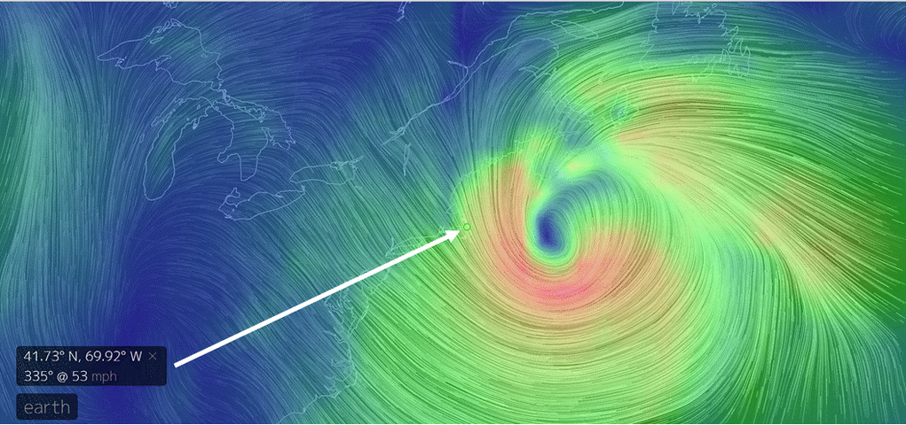
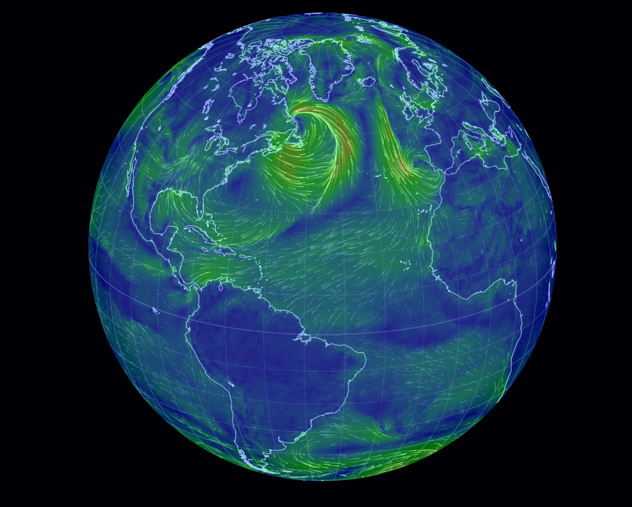
Source: http://earth.nullschool.net - a great site to bookmark!
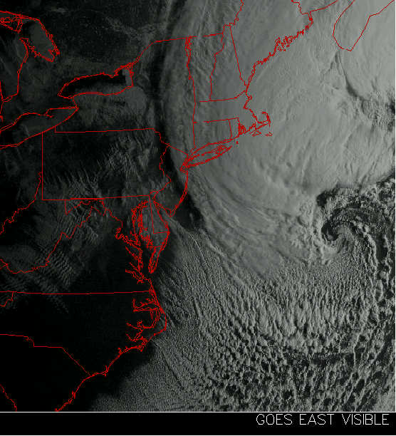
This was the view once the sun came up over the storm, via Wright-Weather.com. That dense area of gray off to the NW side is where the serious snow rates were. You can imagine what we'd have been talking about if it was moved 150 miles west! You also can see the 'eye' feature that was just starting to develop at this point at the storm's center.
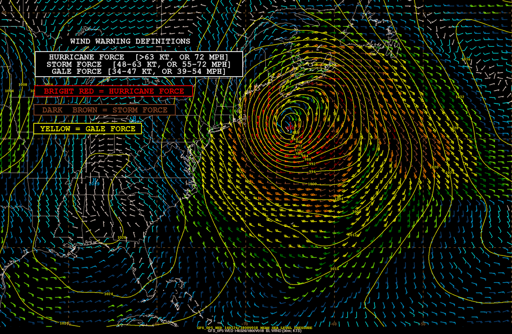
This image was posted by @NWSOPC (National Weather Service Ocean Prediction Center) - showing short-term model guidance and its forecast for a 954mb low, with gale force winds (>34mph) spanning nearly 1400nm from 74W° to 44W. We hadn't seen a storm with a wind field this large in our part of the world since Hurricane Sandy.
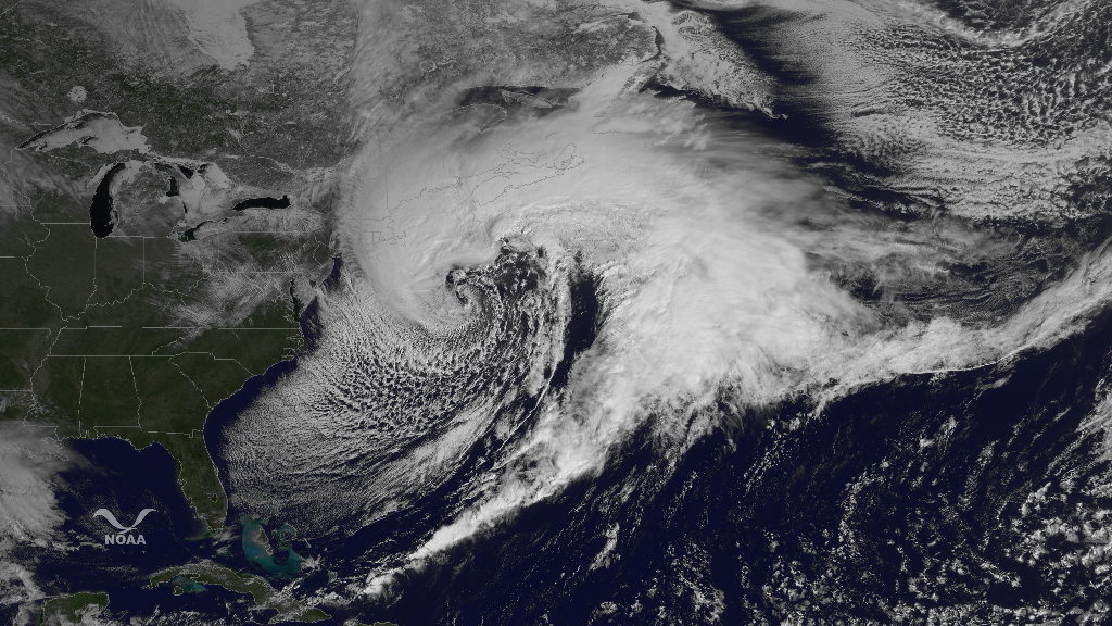
The spectacular wide view of the storm, via @NOAASatellites. Puts it all into perspective, showing the tight curl as the storm was undergoing 'warm seclusion' - where a pool of warm air wraps all the way into the center. It happens when you have explosive development of an extratropical cyclone, and the air is drawn all the way into the center where it lives in the quiet well of a mild/light wind environment. The associated cold front extends all the way down to Haiti, while the northern side of the comma-head reaches into Canada. You can see that it easily dwarfs the entire eastern U.S. with its size.
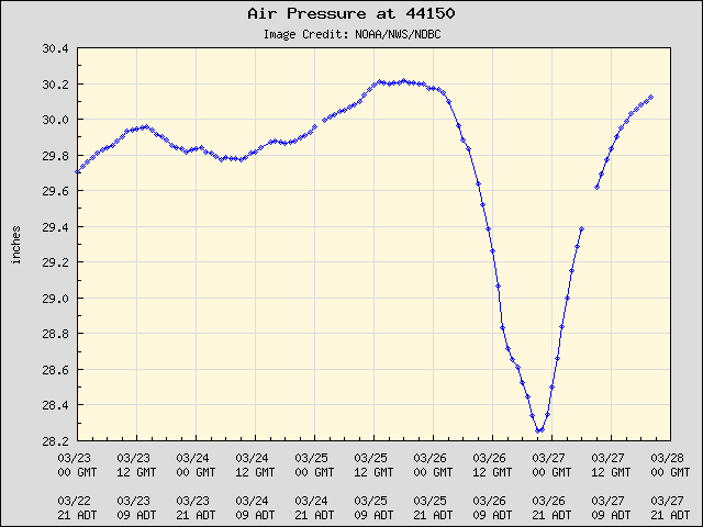
Buoy 44150 south of Nova Scotia showed a sudden drop and rise in pressure more associated with the passing of a hurricane!
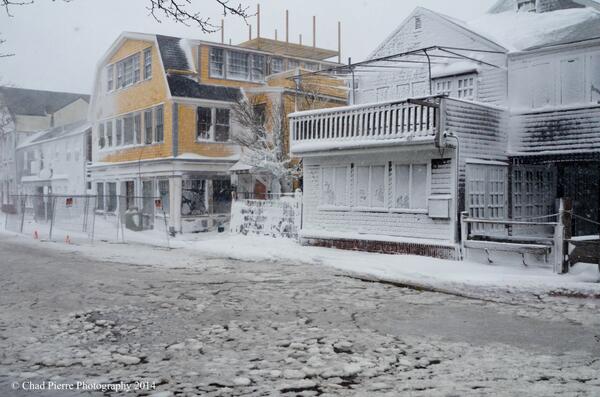
@chad_pierre took this photo of flooding in Harbor Square. The strong northerly winds pushed a storm surge into the low-lying areas of downtown Nantucket. You can also see how the horizontal snow blasted the sides of homes and businesses.
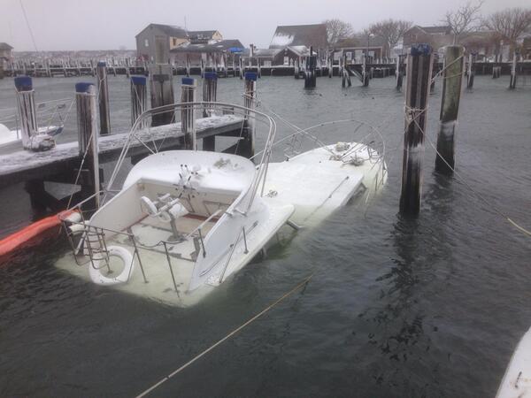
Casualty of the storm...a boat taken down by the rough waters of Nantucket Harbor. Photo courtesy @xploreNantucket
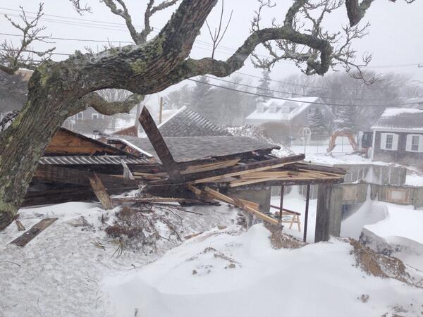
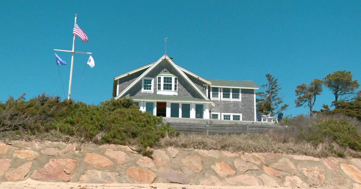
This was right down the street from our live location in Chatham, on Shore Road. It was a house that had stood for more than 200 years, and was undergoing renovation. The persistent strong winds forced part of the home to collapse. Photo is courtesy @JMichaelsNews
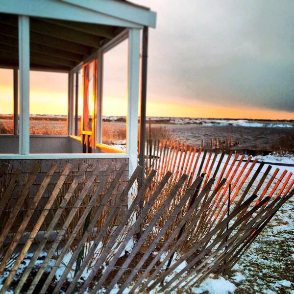
By the end of the day, the sun had returned! Kristen Kellogg captured this beauty after the passing of the storm.
Notables here in Massachusetts:
Nantucket hit an official peak gust of 82mph during the storm. They're no strangers to the wind, but this was exceptional. It was the highest gust recorded by the ASOS unit since it started to send data in 1998! The National Weather Service believes it was likely the strongest gust there since at least the 1993 Superstorm, if not Hurricane Bob in 1991.
In terms of snowfall, I honestly think the reports aren't indicative of what we actually saw (and no I'm not just angling to make it seem bigger!). It snowed, and snowed, and snowed. I know, I was standing in it :-) But even after a solid 10 hours of snow, there were still many bare spots on the ground. There were also 3' piles. On Nantucket, snow drifts topped 5'. How much actually fell? I have no idea. But it's clear that anyone going out there to measure and trying to do so accurately (commendable!) was having a tough time. The constant 40-65mph gusts, and in the case of Nantucket 80+ gusts, made it impossible. Where's the snow? Stuck in the woods somewhere. Piled up in some drifts. Blown out to sea. But the final numbers probably don't tell the full story. I'd be amazed if 9-12" didn't fall in the Chatham area, and 12"+ fell on Nantucket. Looking at the radar bands and actually seeing it for myself, I'd wager that's what it would look like if it was a standard storm with lighter winds and a more uniform snow pack.
Blizzard? You bet! It was the 2nd confirmed blizzard of the season for the area, and we picked our live location well. Chatham endured 7 straight hours of blizzard conditions, while many other locations saw 6 straight hours. It should be noted that a 'blizzard' has nothing to do with actual snow totals - it's all about visibility and wind speeds. To that end, Plymouth nearly verified blizzard criteria without much actual snowfall. You can read the full report from the NWS on who reached the criteria and for how long.
This was the strongest storm in our neighborhood in over 20 years, and if it had indeed traveled just a smidge farther west it would have dumped 1-3' of snow, brought widespread 70mph+ gusts across eastern New England down toward NYC, and shut down the region. No doubt in my mind it would have been on par with the Blizzard of '78 or other historic storms in our checkered past. While fun to witness, that level of storm is also very destructive and costly - so even us weather geeks are pleased that this mainly was a miss.
Canada - Taking a Direct Hit
If you think it was pretty wild on Nantucket on Wednesday, talk to some folks around Nova Scotia and New Brunswick. Nearly 2' of snow fell, frequent gusts over 100mph were reported, significant wave heights hit 29', and the central pressure of the storm finally bottomed out around 955mb (approximately the equivalent of a Category 3 hurricane). The Bay of Fundy reported a peak gust of 129mph - ridiculous! On land, Wreckhouse, Newfoundland recorded a gust of 115mph (and yes, it's named after its destructive winds from fierce storms). All in all, an incredible beast of a weather system.
Even today, the storm is the biggest game in town across a wide swath of the planet!
Why Does Cold Water Kill Hurricanes But Not Nor'easters?
Good question! Whenever we're tracking a tropical system, we talk about it weakening when it hits colder waters. So why doesn't cold Atlantic water put an end to nor'easters? The reason is that they are produced by different mechanisms. A storm like we just saw is 'cold core' and a tropical system is 'warm core.'
A nor'easter thrives when arctic air collides with relatively mild air over the ocean. These tight contrasts of cold and warm are called baroclinic zones. If you throw in some upper-level support, these clashes of air masses produce a storm. This particular storm had outstanding upper level support, in the form of a 'coupled jet'. Basically, you had an area between the left-exit of the subtropical jet and the right entrance of the polar jet where air was rapidly diverging aloft. Diverging essentially means 'heading away'. Air was rapidly exiting the top of the troposphere as air rapidly rushed to fill the void and rise at the surface. Voila! A rapidly deepening low pressure center at the surface.
Another fact to help this storm thrive was the depth of cold air (well below average) and the fact that SSTs off the East Coast are above average. An even larger contrast in temperature is good for storm business. As air rises from the ocean, and condenses. The act of condensation releases energy, which we call 'latent heat of condensation.' The heat is 'hidden' in a way until this phase change occurs. This is part of the story for a nor'easter, but is a bigger factor for hurricanes. Most of the temperature factor for a nor'easter is based on *horizontal* temperature contrasts.
Hurricanes feast on warm tropical waters and persistently rising air. They also can't survive wind shear, because their livelihoods depend on the regeneration of thunderstorms. Wind shear blows the tops off these storms and ruins the organization. Cold air at the ocean shuts down this process, because all of the sudden you have a layer of colder air near the surface than the air above it. That stops the air from being buoyant, and it stops rising. If it doesn't rise, you lose your clouds and storms. Goodbye hurricane.
