Snow, rain, wind and possible power outages in mid-week storm coming to Massachusetts
A storm headed for the Boston area this week will bring rain, wind and possibly heavy snow to parts of Massachusetts. Here's the latest forecast from the WBZ NEXT Weather Team.
BOSTON - With the potential for flooding rain, accumulating snow, and damaging winds all in the forecast, the WBZ-TV Weather Team has issued a NEXT Weather Alert.
When will the storm arrive?
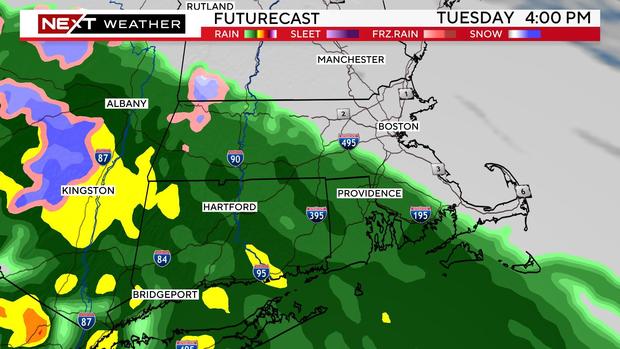
An initial wave of low pressure will pass by on Tuesday, think of it as an appetizer. Clouds will thicken Tuesday and some rain will push up from Connecticut in the afternoon and evening. It will be generally light to moderate stretching from western Massachusetts through southern Worcester County and into Rhode Island and southeastern Massachusetts. North of the Pike in places like Middlesex and Essex counties, we don't expect much, if any, rain, perhaps just a few sprinkles.
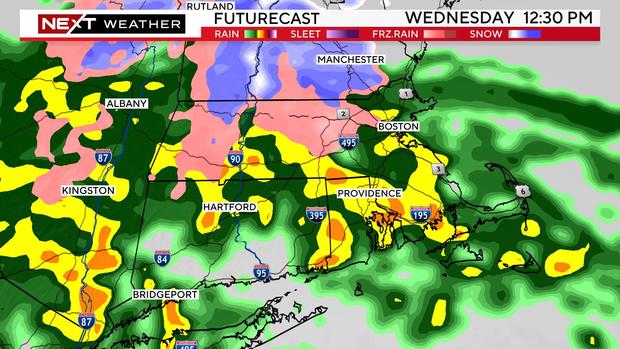
The main course arrives on Wednesday. After a light start in the morning, the intensity of the precipitation will increase by midday and afternoon.
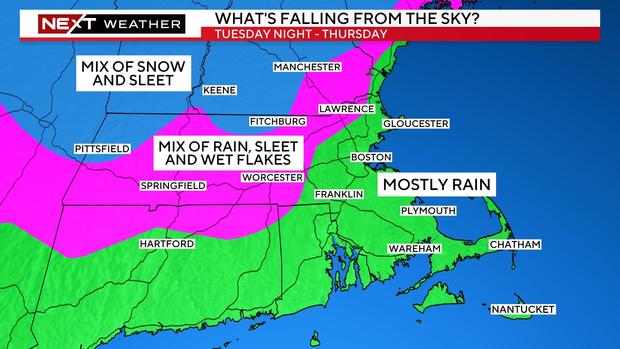
It should be mainly rain during the day on Wednesday in eastern Massachusetts and south of the Pike. North and west of 495, we will see some sleet or a few wet flakes mixing in at times. Not expecting any impactful wintry weather during the daylight hours.
During Wednesday night, conditions will be slightly more favorable for some sleet and snow accumulation north and west of Route 495.
As with most springtime storms, elevation will play a key role. The higher up you live, the better the chance of seeing some wintry weather. There are several towns in northern Worcester County with elevations between 500 and 1,000 feet. This is where we are most concerned for several inches of sleet and snow. With temperatures remaining near or slightly above freezing, the snow will be like paste, weighing down on lines and limbs.
The precipitation will become spottier by Thursday morning. We expect that the center of the storm will pass near or over parts of southern New England. This will force the heavier sleet and snow well northward into New Hampshire, Vermont and Maine.
How much snow in Massachusetts, NH?
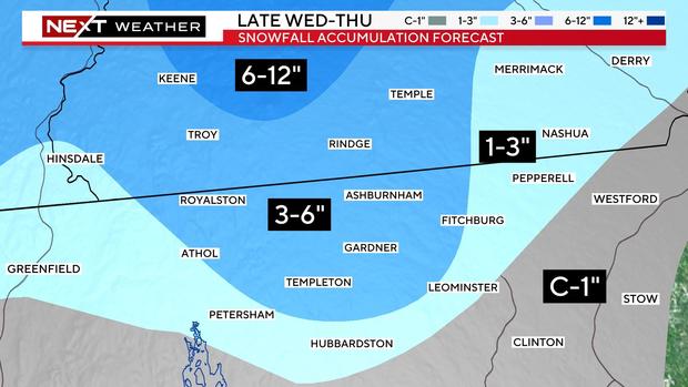
Again, this is mainly an elevation-based snowstorm. The higher elevations of northern Worcester County and southwest New Hampshire are at much higher risk of snow/sleet accumulation.
In elevations close to 1,000 feet, we could see as much as 3-to-6" of pasty, wet snow. Thinking of towns like Ashby and Ashburnham.
Come down in elevation closer to 500 feet and there may be 1-to-3" of heavy slop. The 1-3" contour also extends eastward through parts of Hillsboro and Rockingham counties in New Hampshire.
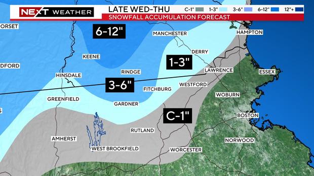
Closer to 495, we expect some scattered areas with a coating to an inch. This would be the case in towns like Worcester, Marlboro, Westford, and Lawrence.
The snowmap is particularly difficult to draw as amounts will vary from town to town depending on elevation.
Here's a closer look.
Strong wind gusts
The strongest winds will be located along the immediate coastline and in particular, over Cape Cod and the Islands. We could see east-northeast gusts between 45 and 55 mph in these areas.
As the center of the storm comes up over our area Thursday, the winds will shift from east to north-northeast by the afternoon and evening.
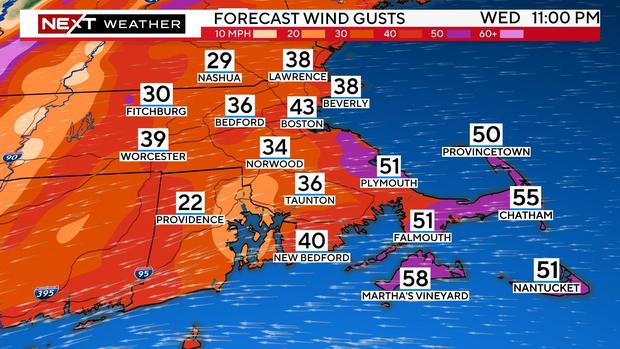
The strongest winds will also shift from Cape Cod northward towards Cape Ann and up through the New Hampshire and Maine Coastlines.
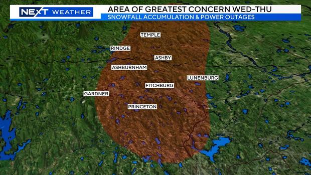
Risk of power outages
There is a risk of some outages in the areas where the heavy, wet snow accumulates. Again, the highest risk being in the highest elevations of central and western Massachusetts.
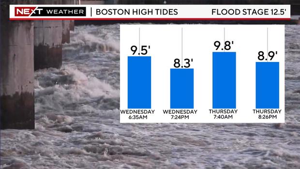
Minor coastal flooding
Tides are astronomically low this week so, thankfully, we will avoid a worst-case scenario. The Thursday morning high tide (between 7 and 8 a.m.) could still produce some minor to moderate coastal flooding, particularly from the South Shore through the North Shore of Massachusetts and also portions of coastal New Hampshire and Maine.
Storm slow to depart
The storm will be very slow to depart later this week. It is likely that clouds and scattered pop-up showers will linger on Friday and Saturday.
There is some hope of a dry Sunday with a bit more sunshine.


