WEATHER BLOG: Thursday
Plenty of clouds have gathered across the Northeast and in the mid-Atlantic states, and rain showers are showing up on the regional radar mosaic, too.
While this rain has had a history of being extremely light, it should still occur in many places east of the Appalachians (and north of the Mason-Dixon Line) early this morning. Rainfall totals last evening in places like Pittsburgh and Altoona, PA were in the 0.01" - 0.03" range -- which is similar to what cities located near I-95 will pick up before 6 a.m. today. Clouds should start to break for some sunshine today, probably after 8 or 9 a.m.
As of this writing, the only dense fog patches that have lowered the visibility to less than 2 miles was located in the western Panhandle of Maryland and in the eastern Panhandle of West Virginia -- this could become more widespread after light occurs, especially across the southern Tier of Pennsylvania, central Maryland and in Delaware, but it won't last very long. With a wind primarily out of the south this afternoon, temperatures will peak near 60.
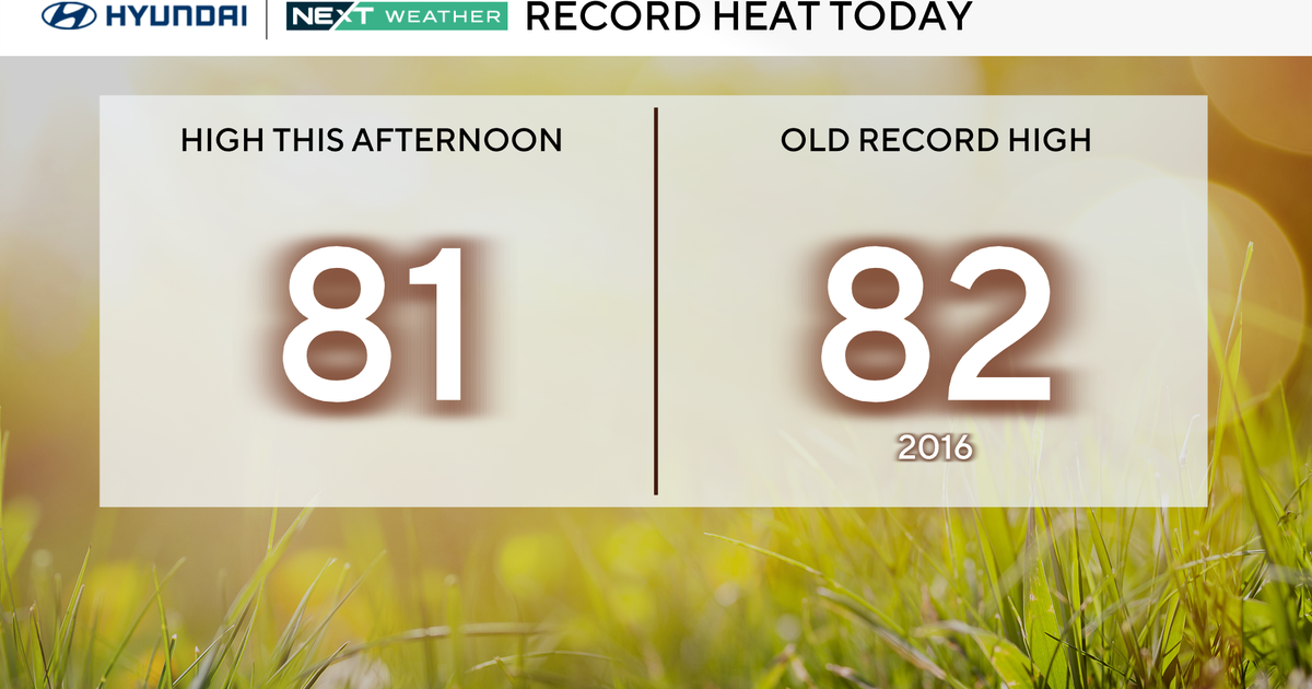
Today will only be 'just the beginning' of a very mild four or five-day period, at just plain 'warm for mid-December'.