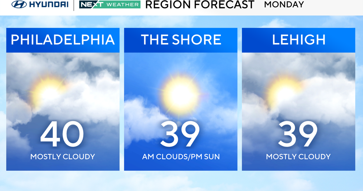
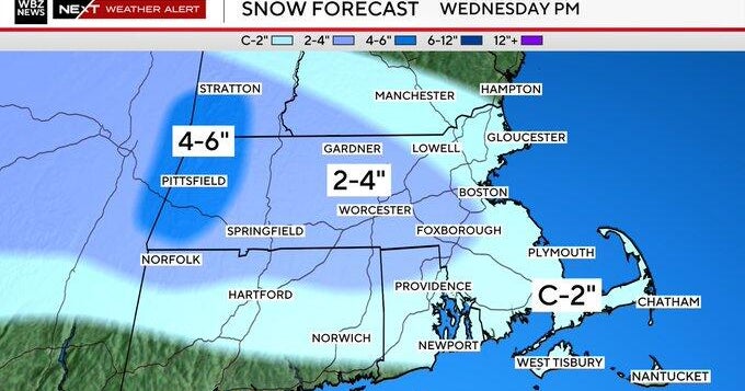
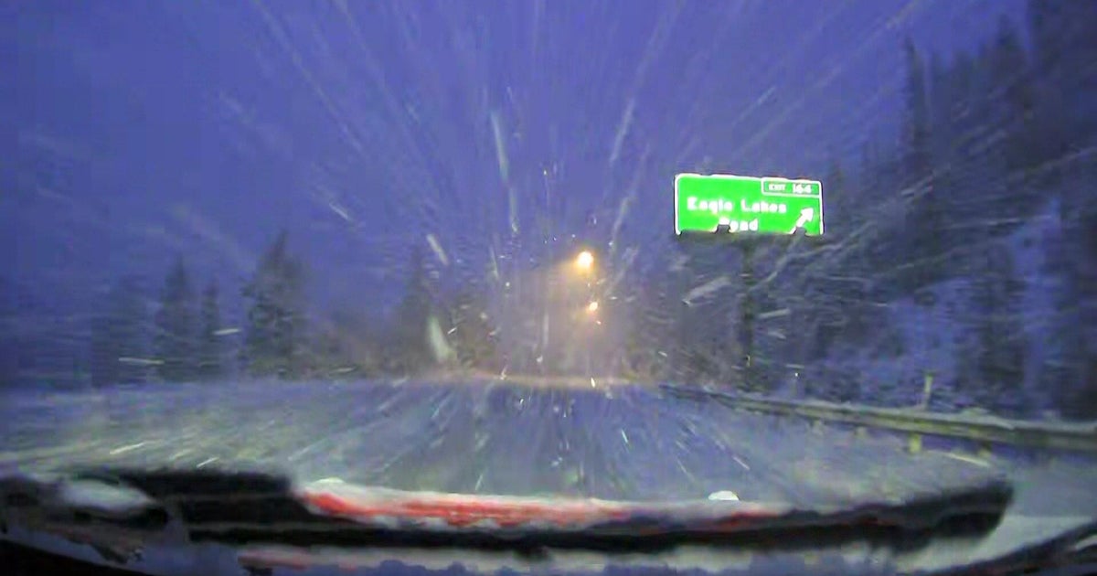
WEATHER BLOG: More Snow Coming
After starting Wednesday with some sunshine, clouds will quickly roll in as an arctic front approaches. By Wednesday afternoon & evening, a few snow showers will be possible. Between 5-9pm a snow squall may roll through briefly reducing visibilities on the road during rush hour. Around a coating to 1" of snow accumulation will be possible tomorrow afternoon and evening as the arctic front moves through. Behind the front is another exceptionally cold air mass that will be in place Wednesday night through Friday. This weekend is looking very messy with the chance for snow on Saturday transitioning to a rain by Sunday. We'll be fine-tuning the details for this weekend over the next few days.
Track weather using our CBSBaltimore Weather App!