WEATHER BLOG: Milder Temps
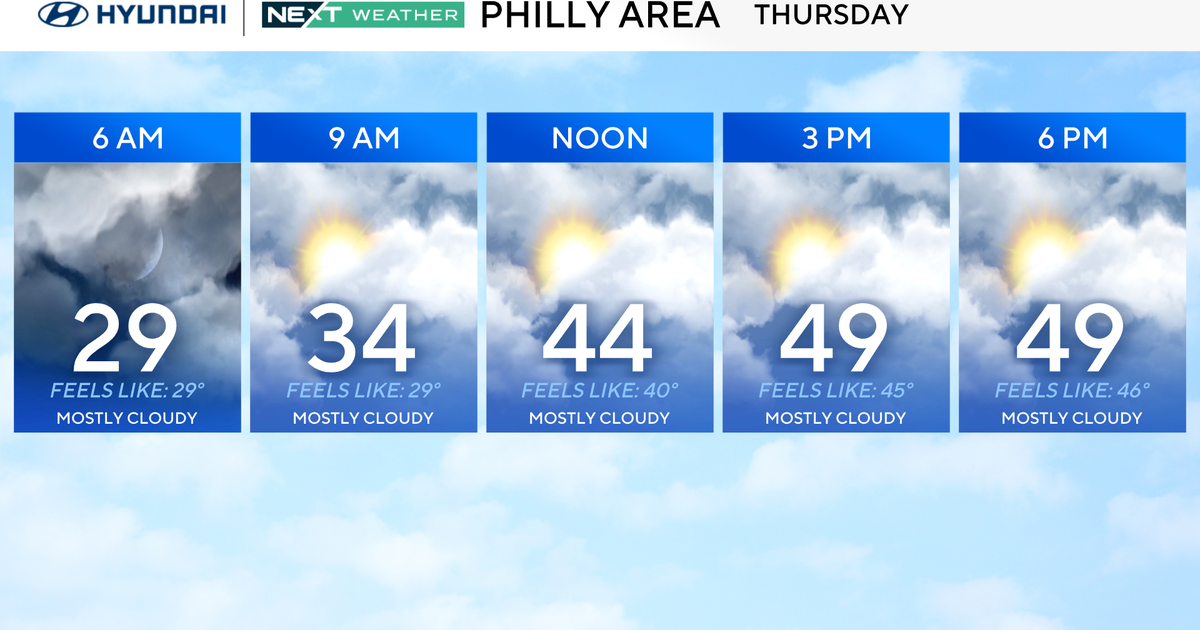
The upper low currently centered nearly directly overhead will slowly drift south-southeastward away from the region today and finally move off the mid-Atlantic coast tonight. As this happens, we remain rather cloudy this morning with enough instability to generate some showers. A few breaks of sun are more likely this afternoon as the ULL slowly drifts away and the shower chances, while not zero, will certainly wane after 2-4 PM. With some breaks of sun, we will certainly see milder temperatures than recent days as well. We finally get into a definite break in the clouds and showers this evening and first part of tonight with a little shortwave upper ridging moving across the area but then clouds and showers roll back in late tonight out ahead of the next upper trough and associated surface front crossing the region late tonight/tomorrow morning.
It then turns out partly sunny and quite breezy behind the front tomorrow for Mother's Day with a small chance of a lingering AM shower to our east with the front. So, we do stick with a small 20 POP for showers tomorrow early AM though most of the day is dry. A boundary stalled to our south eventually returns northward through next week so we get back into the warm sector and it will be quite unsettled with numerous shower and t-storm chances along with a good deal of clouds around.