BLOG: Winter Is Here...For Now
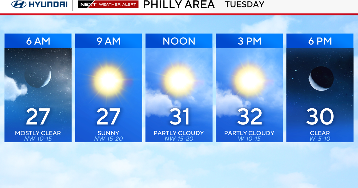
A cold end to the weekend as the cold upper-level trough which blasted into the region late on Friday lingers for another day. Temperatures will once again be below average, but with a good bit of sunshine and less wind as a surface high settles over Pennsylvania. This high will sink southeastward overnight with winds shifting to the south during the day Monday, and this wind shift will promote milder weather to start the upcoming work week.
A warm front will move through Monday night as weak ridging replaces the trough with a shortwave disturbance set to move across the Great Lakes area. Rain will accompany this feature, and in some areas to the northwest the precipitation may actually begin as a brief period of freezing rain and sleet. With high pressure located well to the east the cold air will not be able to hang in there very long, so any icing will be short-lived. Warmer air on Tuesday will push temperatures to around 50, ensuring liquid precipitation. At this point the rain isn't expected to be overly heavy, but several hours of steady rainfall seems a decent bet. A cold front will cross the area Tuesday night bringing us back to average for
Wednesday and Thursday. Warmer weather to follow to end the week with a more zonal flow setting up, allowing Pacific air to flood eastward.
GO RAVENS!!!!